more stats
43.7 miles
Distance
3,143 ft
Climb
-2,813 ft
Descent
06:03:56
Avg time
329 ft
Altitude change
2,300 ft
Altitude min
3,728 ft
Altitude max
2,502 ft
Altitude start
2,831 ft
Altitude end
0.1%
Grade
-21%
Grade max
45.7%
Grade min
23 miles
Distance climb
16 miles
Distance down
4 miles
Distance flat
06:03:56
Avg time

Acheron Road Details

  • Activities
    • Mountain Bike
    • Gravel Bike
    • Adaptive Bike
    • Hike
    • Trail Running
  • Riding Area
  • AKA
    Molesworth Station
  • Difficulty Rating
  • Local Popularity
    40 in Mountain Biking [+]
    • 5 in Trail Running
    • 5 in Hiking
  • Hiking SAC Scale
    T1 Hiking
  • Trail Type
    Dirt/Gravel Road
  • Bike Type
    XC, Gravel, Adaptive MTB
  • Direction
    Both Directions
  • Climb Difficulty
    Green
  • Physical Rating
    Extreme
  • Trail Visibility
    Always easy to follow
  • Season
    Summer 7 am – 7 pm
  • Dogs Allowed
    Yes
  • eBike Allowed
  • TTFs on Trail
    Bridge, Rock Garden
  • Ride in Rain
    Yes
  • Land Owner

During the summer season, the Acheron Road is open 7 am – 7 pm from Labour weekend Saturday to Easter Monday or the second Sunday in April (whichever is the later date), but may be closed without warning due to weather conditions or fire danger. The Acheron Road status can be checked 24 hours a day by contacting DOC Wairau / Renwick Office (03) 572 9100 or online at www.doc.govt.nz (type Molesworth in the search bar).

Keep to roads and marked routes. These are high‑altitude routes where weather conditions can change rapidly. Always carry wind‑ and water‑proof clothing.

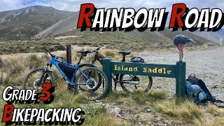
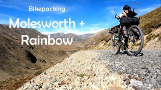
The distance from Blenheim to Hanmer via the Acheron Road is 207 km. Open dates are the same as for motorists. Outside the open season mountain bikers must apply for a permit from Wairau/Renwick Office.

Along the Awatere Road, toilet facilities are provided at the Marlborough District Council’s Blairich Recreation Reserve
(37 km from Blenheim/161 km from Hanmer) and Hodder Bridge Picnic Area (76 km from Blenheim/132 km from Hanmer).

Allow a full day to cycle the 59 km section through Molesworth, camping a night at the Molesworth Cob Cottage before setting out the next morning or — if you are beginning your journey in Hanmer — by the Acheron Accommodation House, 27 km from the township ($ 6.00 per night per adult (age 18+) and $3.00 per night per child (age 5–17)). These are the only sites along the Acheron Road where camping is permitted.

Local Trail Association
Traditionally Indigenous Territory

Recent Activity on Trail

Past Week
  • 0 rides
  •  
6 Months
  • 1 rides
  • 158.0 km avg distance
All
  • 4 rides
  • Last: Jun 9, 2026
c1c2c3c4
January
February
March
April
May
June
July
August
September
October
November
December
update trails status or condition

Acheron Road Trail Reports

statusdatedescription
Apr 3, 2021 @ 6:10pm
Apr 3, 2021
more »
Status:
on Apr 3, 2021
Very Dry
no votes yet
Your vote: 0

view (125)
close
3D
Trail Conditions
  • Unknown
  • Snow Groomed
  • Snow Packed
  • Snow Covered
  • Snow Cover Partial
  • Freeze/thaw Cycle
  • Icy
  • Prevalent Mud
  • Wet
  • Variable
  • Ideal
  • Dry
  • Very Dry
Trail Flow (Ridden Direction)
Trailforks scans users ridelogs to determine the most popular direction each trail is ridden. A good flowing trail network will have most trails flowing in a single direction according to their intension.
The colour categories are based on what percentage of riders are riding a trail in its intended direction.
  • > 96%
  • > 90%
  • > 80%
  • > 70%
  • > 50%
  • < 50%
  • bi-directional trail
  • no data
Trail Last Ridden
Trailforks scans ridelogs to determine the last time a trail was ridden.
  • < 2 days
  • < 1 week
  • < 2 weeks
  • < 1 month
  • < 6 months
  • > 6 months
Trail Ridden Direction
The intended direction a trail should be ridden.
  • Downhill Only
  • Downhill Primary
  • Both Directions
  • Uphill Primary
  • Uphill Only
  • One Direction
Contribute Details
Colors indicate trail is missing specified detail.
  • Description
  • Photos
  • Description & Photos
  • Videos
Trail Popularity ?
Trailforks scans ridelogs to determine which trails are ridden the most in the last 9 months. Trails are compared with nearby trails in the same city region with a possible 25 colour shades. Think of this as a heatmap, more rides = more kinetic energy = warmer colors.
  • most popular
  • popular
  • less popular
  • not popular
ATV/ORV/OHV Filter
Max Vehicle Width
inches
US Cell Coverage
Legend
cell carrier legend

Radar Time
Activity Recordings
Trailforks uses anonymized public activity data. ?
Activity Recordings
Trailforks uses anonymized public activity data. ?
Personal Heatmap
Activity Types
all / none
Options
2
Date range month
Winter Trails
Warning A routing network for winter maps does not exist. Selecting trails using the winter trails layer has been disabled.
Missing Trails
Most Popular
Least Popular
Trails are colored based on popularity. The more popular a trail is, the more red. Less popular trails trend towards green.
Jump Magnitude Heatmap
Heatmap of where riders jump on trails. Zoom in to see individual jumps, click circles to view jump details.
BC Backroad Status

Service Road Atlas is a free to use, community-driven service for viewing and creating reports on the numerous back-country service roads around B.C. and Alberta.

map legend
Slope Aspect
Direction the slope faces
Flat N NE E SE S SW W NW
Trails Deemphasized
Trails are shown in grey.
disable
Only show trails with no bike usage.
Enable
Suggested Layers
Based on selected activity type

    Save the current map location and zoom level as your default home location whenever this page is loaded.

    Save
        Directions to acheron-road trailhead (-42.462840, 172.889560)

        Photos

        No photos have been added for Acheron Road yet, add a photo.

        Videos

        2 more »
        4K Rainbow Road ASMR New Zealand Bikepacking
        22:28 | 168 | Feb 6, 2024 , Hanmer Springs
        Molesworth and Rainbow - Marlborough and...
        15:30 | 408 | Jan 3, 2021 , Hanmer Springs

        Reviews / Comments

        No reviews yet, be the first to write a review or ask a question.
        Use trail reports to comment on trail conditions.


        We hope you've been enjoying Trailforks!

        Create a FREE account to view trail comments and much more.

        • By YogiNZ & contributors
        • #32235 - 3,410 views

        Frequently Asked Questions About Acheron Road

        Where is Acheron Road located?
        Acheron Road is located in St James Conservation Area, Hanmer Springs, New Zealand. It is part of the St James Conservation Area trail network. The trailhead is located at coordinates -42.46284, 172.88956.
        What is the elevation gain for Acheron Road?
        Acheron Road has 958 m of elevation gain. The trail has 858 m of elevation descent. The elevation ranges from 701 m to 1,136 m.
        Is Acheron Road a point to point trail?
        Acheron Road is not a point to point trail. The direction is Both Directions. The trail type is dirt/gravel road.
        How long is Acheron Road?
        Acheron Road is 70.3 km long. The trail type is dirt/gravel road.

        Hit the Trail

        Open in App

        Get this trail on your phone instantly.
        open trail in app

        Download Trail

        Save to wishlist, Garmin & download.
        save the trail

        Find Related Routes

        Find routes and users activities that include this trail.
        find routes for this trail

        You must enter a description before submitting.