more stats
1.3 miles
Distance
23 ft
Climb
-679 ft
Descent
00:07:27
Avg time
-658 ft
Altitude change
517 ft
Altitude min
1,176 ft
Altitude max
1,176 ft
Altitude start
518 ft
Altitude end
-9.8%
Grade
-49%
Grade max
18.7%
Grade min
344 ft
Distance climb
1 mile
Distance down
200 ft
Distance flat
00:07:27
Avg time

Ahwingna Details

  • Activities
    • Mountain Bike
    • Gravel Bike
    • Adaptive Bike
    • Hike
    • Trail Running
  • Riding Area
    Turnbull Canyon
    Whittier, California
  • Difficulty Rating
  • Voted Difficulty
    Double Black Diamond (1 vote)
  • Local Popularity
    50 in Mountain Biking [+]
    • 65 in Trail Running
    • 100 in Hiking
  • Global Ranking
    #114793 in Mountain Biking [+]
    • #59219 in Trail Running
    • #10651 in Hiking
  • Trail Type
    Doubletrack
  • Bike Type
    AM, XC, Adaptive MTB, Gravel
  • Climb Difficulty
    Blue
  • Physical Rating
    Moderate
  • Dogs Allowed
    Yes

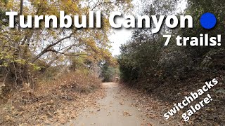
Fairly steep climb but not impossible. Take the right at the fork by the trees at the top to drop into the native oak trail or continue straight to head directly to the Turnbull canyon side of the mountain.

Access Info

Lots of parking across the street from the trailhead.

Local Trail Association
Traditionally Indigenous Territory

Recent Activity on Trail

Past Week
  • 0 rides
  •  
6 Months
  • 5 rides
  • 14 miles avg distance
All
  • 36 rides
  • Last: Mar 28, 2026
c1c2c3c4
January
February
March
April
May
June
July
August
September
October
November
December
update trails status or condition

Ahwingna Trail Reports

statusdatedescription
Feb 5, 2022 @ 6:53pm
Feb 5, 2022
Filled in all the ruts yesterday perfect condition
Sep 26, 2021 @ 11:02am
Sep 26, 2021
Big Ruts from past rainfall and dry cracked dirt
Jan 5, 2018 @ 10:55am
Jan 5, 2018
more »
Status:
on Feb 5, 2022
Ideal
Avg: 3.61 (2 votes)
Your vote: 0

view (439)
close
3D
Trail Conditions
  • Unknown
  • Snow Groomed
  • Snow Packed
  • Snow Covered
  • Snow Cover Partial
  • Freeze/thaw Cycle
  • Icy
  • Prevalent Mud
  • Wet
  • Variable
  • Ideal
  • Dry
  • Very Dry
Trail Flow (Ridden Direction)
Trailforks scans users ridelogs to determine the most popular direction each trail is ridden. A good flowing trail network will have most trails flowing in a single direction according to their intension.
The colour categories are based on what percentage of riders are riding a trail in its intended direction.
  • > 96%
  • > 90%
  • > 80%
  • > 70%
  • > 50%
  • < 50%
  • bi-directional trail
  • no data
Trail Last Ridden
Trailforks scans ridelogs to determine the last time a trail was ridden.
  • < 2 days
  • < 1 week
  • < 2 weeks
  • < 1 month
  • < 6 months
  • > 6 months
Trail Ridden Direction
The intended direction a trail should be ridden.
  • Downhill Only
  • Downhill Primary
  • Both Directions
  • Uphill Primary
  • Uphill Only
  • One Direction
Contribute Details
Colors indicate trail is missing specified detail.
  • Description
  • Photos
  • Description & Photos
  • Videos
Trail Popularity ?
Trailforks scans ridelogs to determine which trails are ridden the most in the last 9 months. Trails are compared with nearby trails in the same city region with a possible 25 colour shades. Think of this as a heatmap, more rides = more kinetic energy = warmer colors.
  • most popular
  • popular
  • less popular
  • not popular
ATV/ORV/OHV Filter
Max Vehicle Width
inches
US Cell Coverage
Legend
cell carrier legend

Radar Time
Activity Recordings
Trailforks uses anonymized public activity data. ?
Activity Recordings
Trailforks uses anonymized public activity data. ?
Personal Heatmap
Activity Types
all / none
Options
2
Date range month
Winter Trails
Warning A routing network for winter maps does not exist. Selecting trails using the winter trails layer has been disabled.
Missing Trails
Most Popular
Least Popular
Trails are colored based on popularity. The more popular a trail is, the more red. Less popular trails trend towards green.
Jump Magnitude Heatmap
Heatmap of where riders jump on trails. Zoom in to see individual jumps, click circles to view jump details.
BC Backroad Status

Service Road Atlas is a free to use, community-driven service for viewing and creating reports on the numerous back-country service roads around B.C. and Alberta.

map legend
Slope Aspect
Direction the slope faces
Flat N NE E SE S SW W NW
Trails Deemphasized
Trails are shown in grey.
disable
Only show trails with no bike usage.
Enable
Suggested Layers
Based on selected activity type

    Save the current map location and zoom level as your default home location whenever this page is loaded.

    Save
        Directions to ahwingna trailhead (34.001790, -118.008890)

        Photos

        No photos have been added for Ahwingna yet, add a photo.

        Videos

        1 more »
        Ahwingna
        46:50 | 76 | Dec 13, 2024 , Whittier

        1 Review & Comments


        We hope you've been enjoying Trailforks!

        Create a FREE account to view trail comments and much more.

        • By derkderkallTF Pro & contributors
        • #98564 - 1,805 views

        Frequently Asked Questions About Ahwingna

        Where is Ahwingna located?
        Ahwingna is located in Turnbull Canyon, Whittier, California, United States. It is part of the Turnbull Canyon trail network. The trailhead is located at coordinates 34.00179, -118.00889.
        How hard is Ahwingna?
        Ahwingna is rated as Blue difficulty. The physical rating is Moderate. The average grade is 9.8%. The climb difficulty is rated Blue.
        What is the elevation gain for Ahwingna?
        Ahwingna has 23 ft of elevation gain. The trail has 679 ft of elevation descent. The elevation ranges from 517 ft to 1,176 ft.
        How long is Ahwingna?
        Ahwingna is 1.3 miles long. The trail type is doubletrack.

        Hit the Trail

        Open in App

        Get this trail on your phone instantly.
        open trail in app

        Download Trail

        Save to wishlist, Garmin & download.
        save the trail

        Find Related Routes

        Find routes and users activities that include this trail.
        find routes for this trail

        You must enter a description before submitting.