more stats
2,703 ft
Distance
17 ft
Climb
-236 ft
Descent
00:07:51
Avg time
-221 ft
Altitude change
911 ft
Altitude min
1,132 ft
Altitude max
1,132 ft
Altitude start
912 ft
Altitude end
-8.2%
Grade
-32.6%
Grade max
9.7%
Grade min
351 ft
Distance climb
1,942 ft
Distance down
410 ft
Distance flat
00:07:51
Avg time

Airplane Mode Details

  • Activities
    • Mountain Bike
    • E-Bike
  • Riding Area
    Lava Flow
    Squamish, British Columbia
  • Ref Number
    REC258510
  • AKA
    The OneUp Trail
  • Difficulty Rating
  • Voted Difficulty
    Double Black Diamond (1 vote)
  • Local Popularity
    85 in Mountain Biking [+]
    • 90 in E-Biking
  • Global Ranking
    #407 in Mountain Biking [+]
    • #1887 in E-Biking
  • Trail Type
    Singletrack
  • Direction
    Downhill Only
    Popular Direction Shown
  • Trail Visibility
    Always easy to follow
  • Dogs Allowed
    Yes
  • eBike Allowed
    Yes up to Class 1
  • TTFs on Trail
    Berm, Bridge, Drop, Jump, Gap Jump, Ladder Bridge

Built with approval from Recreation Sites and Trails BC via the Section 57 application program

"We should build a jump trail" -heard in the OneUp HQ, Sept 2017 following a lunch ride devoid of jumps.

This trail was applied for and built by the team at OneUp Components, with help from many other community volunteers from 2018-2022

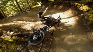
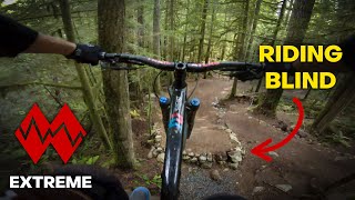
Using the pumptrack style of rollers rather than sharp lips and landing, the trail can be learned progressively. Riders have the option to roll everything on the main line, never leaving the ground. There are well-marked optional 'expert unlimited' gaps and drops on either side of the main flow of the trail.

***Enjoy and expect this trail to be temporarily closed (by a draw bridge at the start of the trail) during rain events of 20mm / 24h or more. It will remain closed for up to 48h after or when maintenance is required.

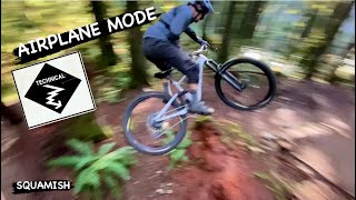
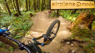
AIRPLANE MODE - REC258510 - JUNE 2022

Access Info

Expect this trail to be temporarily closed (by a draw bridge at the start of the trail) during rain events of 20mm / 24h or more. It will remain closed for up to 48h after or when maintenance is required.

Disclaimer

no cell phone service anywhere on or near trail

Trail Supporters
Local Trail Association
Traditionally Indigenous Territory

Recent Activity on Trail

Past Week
  • 6 rides
  • 16.6 km average
6 Months
  • 72 rides
  • 18.5 km avg distance
All
  • 789 rides
  • Last: Jun 15, 2026
c1c2c3c4
January
February
March
April
May
June
July
August
September
October
November
December
update trails status or condition

Airplane Mode Trail Reports

Status:
on Apr 24, 2026
Ideal
Avg: 4.52 (21 votes)
Your vote: 0

view (4,734)
close
3D
Trail Conditions
  • Unknown
  • Snow Groomed
  • Snow Packed
  • Snow Covered
  • Snow Cover Partial
  • Freeze/thaw Cycle
  • Icy
  • Prevalent Mud
  • Wet
  • Variable
  • Ideal
  • Dry
  • Very Dry
Trail Flow (Ridden Direction)
Trailforks scans users ridelogs to determine the most popular direction each trail is ridden. A good flowing trail network will have most trails flowing in a single direction according to their intension.
The colour categories are based on what percentage of riders are riding a trail in its intended direction.
  • > 96%
  • > 90%
  • > 80%
  • > 70%
  • > 50%
  • < 50%
  • bi-directional trail
  • no data
Trail Last Ridden
Trailforks scans ridelogs to determine the last time a trail was ridden.
  • < 2 days
  • < 1 week
  • < 2 weeks
  • < 1 month
  • < 6 months
  • > 6 months
Trail Ridden Direction
The intended direction a trail should be ridden.
  • Downhill Only
  • Downhill Primary
  • Both Directions
  • Uphill Primary
  • Uphill Only
  • One Direction
Contribute Details
Colors indicate trail is missing specified detail.
  • Description
  • Photos
  • Description & Photos
  • Videos
Trail Popularity ?
Trailforks scans ridelogs to determine which trails are ridden the most in the last 9 months. Trails are compared with nearby trails in the same city region with a possible 25 colour shades. Think of this as a heatmap, more rides = more kinetic energy = warmer colors.
  • most popular
  • popular
  • less popular
  • not popular
ATV/ORV/OHV Filter
Max Vehicle Width
inches
US Cell Coverage
Legend
cell carrier legend

Radar Time
Activity Recordings
Trailforks uses anonymized public activity data. ?
Activity Recordings
Trailforks uses anonymized public activity data. ?
Personal Heatmap
Activity Types
all / none
Options
2
Date range month
Winter Trails
Warning A routing network for winter maps does not exist. Selecting trails using the winter trails layer has been disabled.
Missing Trails
Most Popular
Least Popular
Trails are colored based on popularity. The more popular a trail is, the more red. Less popular trails trend towards green.
Jump Magnitude Heatmap
Heatmap of where riders jump on trails. Zoom in to see individual jumps, click circles to view jump details.
BC Backroad Status

Service Road Atlas is a free to use, community-driven service for viewing and creating reports on the numerous back-country service roads around B.C. and Alberta.

map legend
Slope Aspect
Direction the slope faces
Flat N NE E SE S SW W NW
Trails Deemphasized
Trails are shown in grey.
disable
Only show trails with no bike usage.
Enable
Suggested Layers
Based on selected activity type

    Save the current map location and zoom level as your default home location whenever this page is loaded.

    Save
        Directions to airplane-mode trailhead (49.734930, -123.056030)

        Photos

        94 more »
        881 |
        Jun 6, 2022 @ 4:42pm
        Jun 6, 2022
        648 |
        Jun 6, 2022 @ 4:21pm
        Jun 6, 2022
        133 |
        Feb 18, 2026 @ 2:51pm
        Feb 18, 2026
        167 |
        Feb 18, 2026 @ 1:49pm
        Feb 18, 2026

        Videos

        12 more »
        youtuber SQUAMISH, BC | masszívkrú gopro raw
        9:51 | 1187 | Oct 18, 2022 , Squamish
        youtuber AIRPLANE MODE | Black trail | Squamish -...
        3:00 | 274 | Dec 31, 2023 , Squamish
        youtuber Airplane Mode | A Jump Trail Built by OneUp...
        2:32 | 830 | Jun 29, 2023 , Squamish
        youtuber They call it 'Airplane Mode' Because of all...
        5:34 | 934 | Oct 24, 2022 , Squamish

        Routes with this trail

        6 miles 1,661 ft 7
        Legacy Climb > Ring Creek Access Road > Doubletrack > Climb Trail > > Lower Ditch Pig >...
        2 miles 69 ft 2
        > > > > Ring Creek Rip >
        7 miles 1,471 ft 9
        Legacy Climb > > Airplane Mode > Unrelated Dead Guys > Somewhere over there > Green Spider

        14 Reviews & Comments


        We hope you've been enjoying Trailforks!

        Create a FREE account to view trail comments and much more.

        • By canadakaTF Pro Trailforks & contributors
        • #531935 - 12,665 views

        Frequently Asked Questions About Airplane Mode

        Where is Airplane Mode located?
        Airplane Mode is located in Lava Flow, Squamish, British Columbia, Canada. It is part of the Lava Flow trail network. The trailhead is located at coordinates 49.73493, -123.05603.
        How hard is Airplane Mode?
        Airplane Mode is rated as Black Diamond difficulty. The average grade is 8.2%.
        What is the elevation gain for Airplane Mode?
        Airplane Mode has 17 ft of elevation gain. The trail has 236 ft of elevation descent. The elevation ranges from 911 ft to 1,132 ft.
        Is Airplane Mode a point to point trail?
        Yes, Airplane Mode is a point to point trail. The direction is Downhill Only. The trail type is singletrack.

        Hit the Trail

        Open in App

        Get this trail on your phone instantly.
        open trail in app

        Download Trail

        Save to wishlist, Garmin & download.
        save the trail

        Find Related Routes

        Find routes and users activities that include this trail.
        find routes for this trail

        You must enter a description before submitting.