more stats
1.2 miles
Distance
-1,633 ft
Descent
00:57:14
Avg time
-1,633 ft
Altitude change
574 ft
Altitude min
2,207 ft
Altitude max
2,207 ft
Altitude start
574 ft
Altitude end
-25.5%
Grade
-73.2%
Grade max
-4.9%
Grade min
1 mile
Distance down
00:57:14
Avg time

Ale & Ale Details

  • Activities
    • Mountain Bike
    • E-Bike
  • Riding Area
    Finale Outdoor Region
    Finale Ligure
  • AKA
    Rebel Yell
  • Difficulty Rating
  • Voted Difficulty
    Black Diamond (1 vote)
  • Local Popularity
    5 in Mountain Biking [+]
    • 5 in E-Biking
  • Global Ranking
    #113269 in Mountain Biking [+]
    • #99688 in E-Biking
  • Trail Type
    Singletrack
  • Bike Type
    DH, AM
  • Direction
    Downhill Only
    Popular Direction Shown
  • Physical Rating
    Extreme
  • Trail Visibility
    Always easy to follow
  • Alpine Trail
    Yes
  • Dogs Allowed
    Yes
  • eBike Allowed
    Yes up to Class 1
  • TTFs on Trail
    Berm, Drop, Pump Track, Rock Face, Rock Garden
  • Land Owner
    Finale Outdoor Region

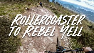
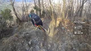
Steep and technical downhill track feeling trail. Nice and flowy singletrack at the top that drops into steep rolls with catch banks to control your speed. Take a right at the fire road, then left and right almost straight away.

Access Info

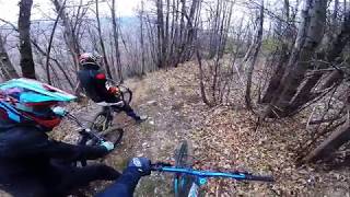
Peel off the Roller Coaster to the left.

Local Trail Association

Recent Activity on Trail

Past Week
  • 0 rides
  •  
6 Months
  • 1 rides
  • 11 miles avg distance
All
  • 20 rides
  • Last: Dec 30, 2025
c1c2c3c4
January
February
March
April
May
June
July
August
September
October
November
December
update trails status or condition

Ale & Ale Trail Reports

statusdatedescription
Dec 30, 2025 @ 6:11pm (Europe/Rome)
Dec 30, 2025
An advice to adventure bikers who would like to explore all trails in a Din area. Do not try this trail. Absolute disaster. A trap without an...
Apr 27, 2025 @ 12:10am
Apr 27, 2025
not mantained, fallen trees and dirt
Oct 7, 2024 @ 12:57am
Oct 7, 2024
this trail appers to have been deleted.
May 3, 2024 @ 11:56am
May 3, 2024
Great trail but unfortunately a lot of fallen trees along the way. Also a lot of loose stones, leaves and heavily overgrown.
Dec 16, 2023 @ 11:28pm
Dec 16, 2023
A lot of leaves and the trees are a pain in the ass to go through
more »
Status:
on Dec 30, 2025
Avg: 3.87 (18 votes)
Your vote: 0

view (321)
close
3D
Trail Conditions
  • Unknown
  • Snow Groomed
  • Snow Packed
  • Snow Covered
  • Snow Cover Partial
  • Freeze/thaw Cycle
  • Icy
  • Prevalent Mud
  • Wet
  • Variable
  • Ideal
  • Dry
  • Very Dry
Trail Flow (Ridden Direction)
Trailforks scans users ridelogs to determine the most popular direction each trail is ridden. A good flowing trail network will have most trails flowing in a single direction according to their intension.
The colour categories are based on what percentage of riders are riding a trail in its intended direction.
  • > 96%
  • > 90%
  • > 80%
  • > 70%
  • > 50%
  • < 50%
  • bi-directional trail
  • no data
Trail Last Ridden
Trailforks scans ridelogs to determine the last time a trail was ridden.
  • < 2 days
  • < 1 week
  • < 2 weeks
  • < 1 month
  • < 6 months
  • > 6 months
Trail Ridden Direction
The intended direction a trail should be ridden.
  • Downhill Only
  • Downhill Primary
  • Both Directions
  • Uphill Primary
  • Uphill Only
  • One Direction
Contribute Details
Colors indicate trail is missing specified detail.
  • Description
  • Photos
  • Description & Photos
  • Videos
Trail Popularity ?
Trailforks scans ridelogs to determine which trails are ridden the most in the last 9 months. Trails are compared with nearby trails in the same city region with a possible 25 colour shades. Think of this as a heatmap, more rides = more kinetic energy = warmer colors.
  • most popular
  • popular
  • less popular
  • not popular
ATV/ORV/OHV Filter
Max Vehicle Width
inches
US Cell Coverage
Legend
cell carrier legend

Radar Time
Activity Recordings
Trailforks uses anonymized public activity data. ?
Activity Recordings
Trailforks uses anonymized public activity data. ?
Personal Heatmap
Activity Types
all / none
Options
2
Date range month
Winter Trails
Warning A routing network for winter maps does not exist. Selecting trails using the winter trails layer has been disabled.
Missing Trails
Most Popular
Least Popular
Trails are colored based on popularity. The more popular a trail is, the more red. Less popular trails trend towards green.
Jump Magnitude Heatmap
Heatmap of where riders jump on trails. Zoom in to see individual jumps, click circles to view jump details.
BC Backroad Status

Service Road Atlas is a free to use, community-driven service for viewing and creating reports on the numerous back-country service roads around B.C. and Alberta.

map legend
Slope Aspect
Direction the slope faces
Flat N NE E SE S SW W NW
Trails Deemphasized
Trails are shown in grey.
disable
Only show trails with no bike usage.
Enable
Suggested Layers
Based on selected activity type

    Save the current map location and zoom level as your default home location whenever this page is loaded.

    Save
        Directions to ale--ale trailhead (44.207170, 8.255950)

        Photos

        6 more »
        76 |
        Nov 28, 2023 @ 10:06am
        Nov 28, 2023
        84 |
        Nov 28, 2023 @ 10:08am
        Nov 28, 2023
        63 |
        Nov 28, 2023 @ 10:08am
        Nov 28, 2023
        196 |
        Apr 23, 2018 @ 4:50am
        Apr 23, 2018

        Videos

        5 more »
        youtuber Rollercoaster to Rebel Yell - Finale Ligure
        15:35 | 957 | Oct 2, 2019 , Finale Ligure
        Finale Ligure Bike | Rebel Yell (Black) | 2019
        9:08 | 1180 | May 3, 2019 , Finale Ligure
        REBEL YELL FINALE LIGURE PÁŤA MOURAS RICHARD...
        11:27 | 416 | Apr 24, 2019 , Finale Ligure
        Rebel Yell - Finale Ligure | LINES
        9:16 | 1108 | Mar 4, 2018 , Finale Ligure

        10 Reviews & Comments


        We hope you've been enjoying Trailforks!

        Create a FREE account to view trail comments and much more.

        • By void & contributors
        • #54113 - 7,593 views

        Frequently Asked Questions About Ale & Ale

        Where is Ale & Ale located?
        Ale & Ale is located in Finale Outdoor Region, Finale Ligure, Italy. It is part of the Finale Outdoor Region trail network. The trailhead is located at coordinates 44.20717, 8.25595.
        How hard is Ale & Ale?
        Ale & Ale is rated as Black difficulty. The physical rating is Extreme. The average grade is 25.5%.
        What is the elevation gain for Ale & Ale?
        The trail has 498 m of elevation descent. The elevation ranges from 175 m to 673 m.
        Is Ale & Ale a point to point trail?
        Yes, Ale & Ale is a point to point trail. The direction is Downhill Only. The trail type is singletrack.

        Hit the Trail

        Open in App

        Get this trail on your phone instantly.
        open trail in app

        Download Trail

        Save to wishlist, Garmin & download.
        save the trail

        Find Related Routes

        Find routes and users activities that include this trail.
        find routes for this trail

        You must enter a description before submitting.