more stats
3,652 ft
Distance
36 ft
Climb
-373 ft
Descent
00:03:53
Avg time
-336 ft
Altitude change
979 ft
Altitude min
1,348 ft
Altitude max
1,316 ft
Altitude start
981 ft
Altitude end
-9.2%
Grade
-48.4%
Grade max
16.4%
Grade min
453 ft
Distance climb
2,920 ft
Distance down
276 ft
Distance flat
00:03:53
Avg time

Alias Trail Details

  • Activities
    • Mountain Bike
    • E-Bike
  • Riding Area
  • Difficulty Rating
  • Voted Difficulty
    Black Diamond (1 vote)
  • Local Popularity
    65 in Mountain Biking [+]
    • 60 in E-Biking
  • Global Ranking
    #1933 in Mountain Biking [+]
    • #55431 in E-Biking
  • Trail Type
    Singletrack
  • Bike Type
    DH, AM
  • Direction
    Downhill Only
    Popular Direction Shown
  • Climb Difficulty
    Blue
  • Physical Rating
    Moderate
  • Trail Visibility
    Always easy to follow
  • Season
    Feb - Nov
  • Dogs Allowed
    Yes
  • eBike Allowed
    Yes up to Class 1
  • TTFs on Trail
    Bridge, Drop, Jump, Roller Coaster
  • Year Opened
    2021

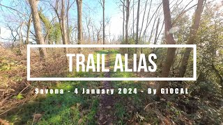
Nuova apertura di AliasTrail, primo tratto di un sentiero già esistente. Rivalutazione del vecchio sentiero per ora solo per la parte iniziale, con nuova segnaletica.
Partendo dalla base del Forte Ciuto, il sentiero si presenta ricco di sponde e drop e divertentissimo per tutti i livelli tecnici. Una volta giunti alla strada bianca proveniente da via Canaiella, è possibile scendere tramite quest'ultima, oppure risalire tramite strada sterrata 36 (vedi openstreetmap) nei pressi del Passo Paolino Ovest.
Posta e commenta con #koncaverderideexperience #kazzutrail, seguici su @koncaverdesv.

Access Info

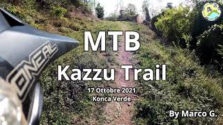
Salire da via N.S. Del Monte, fino al sentiero "Ingresso Ciuto Express". Prendere quest'ultimo, salire in cima alla collina e seguire le indicazioni per "Kazzu Trail". ( l'ingresso è lo stesso del ciuto express trail )

Disclaimer

Alcuni bivi minori potrebbero non essere segnalati.

Trail Supporters
  • past supporters

Local Trail Association

Recent Activity on Trail

Past Week
  • 0 rides
  •  
6 Months
  • 5 rides
  • 14 miles avg distance
All
  • 64 rides
  • Last: May 24, 2026
c1c2c3c4
January
February
March
April
May
June
July
August
September
October
November
December
update trails status or condition

Alias Trail Trail Reports

statusdatedescription
May 4, 2026 @ 8:17am (Europe/Rome)
May 3, 2026
Si riesce a fare tutto stando in sella, ma sembra in stato di abbandono, fondo molto sporco e molto scavato, a tratti rovinato dai cinghiali
Apr 16, 2026 @ 8:45am (Europe/Rome)
Apr 15, 2026
Buono, si ritorna sulla strada per fare Gustin
Feb 22, 2026 @ 9:54am (Europe/Rome)
Feb 22, 2026
sentiero chiuso
Jan 31, 2026 @ 8:40am (Europe/Monaco)
Jan 30, 2026
Tutto ok
Jan 29, 2026 @ 8:57am (Europe/Rome)
Jan 28, 2026
Poca vegetazione, qlc rovo... si passa, uscito poi su asfalto
more »
Status:
on May 4, 2026
Dry
Avg: 4.49 (8 votes)
Your vote: 0

view (712)
close
3D
Trail Conditions
  • Unknown
  • Snow Groomed
  • Snow Packed
  • Snow Covered
  • Snow Cover Partial
  • Freeze/thaw Cycle
  • Icy
  • Prevalent Mud
  • Wet
  • Variable
  • Ideal
  • Dry
  • Very Dry
Trail Flow (Ridden Direction)
Trailforks scans users ridelogs to determine the most popular direction each trail is ridden. A good flowing trail network will have most trails flowing in a single direction according to their intension.
The colour categories are based on what percentage of riders are riding a trail in its intended direction.
  • > 96%
  • > 90%
  • > 80%
  • > 70%
  • > 50%
  • < 50%
  • bi-directional trail
  • no data
Trail Last Ridden
Trailforks scans ridelogs to determine the last time a trail was ridden.
  • < 2 days
  • < 1 week
  • < 2 weeks
  • < 1 month
  • < 6 months
  • > 6 months
Trail Ridden Direction
The intended direction a trail should be ridden.
  • Downhill Only
  • Downhill Primary
  • Both Directions
  • Uphill Primary
  • Uphill Only
  • One Direction
Contribute Details
Colors indicate trail is missing specified detail.
  • Description
  • Photos
  • Description & Photos
  • Videos
Trail Popularity ?
Trailforks scans ridelogs to determine which trails are ridden the most in the last 9 months. Trails are compared with nearby trails in the same city region with a possible 25 colour shades. Think of this as a heatmap, more rides = more kinetic energy = warmer colors.
  • most popular
  • popular
  • less popular
  • not popular
ATV/ORV/OHV Filter
Max Vehicle Width
inches
US Cell Coverage
Legend
cell carrier legend

Radar Time
Activity Recordings
Trailforks uses anonymized public activity data. ?
Activity Recordings
Trailforks uses anonymized public activity data. ?
Personal Heatmap
Activity Types
all / none
Options
2
Date range month
Winter Trails
Warning A routing network for winter maps does not exist. Selecting trails using the winter trails layer has been disabled.
Missing Trails
Most Popular
Least Popular
Trails are colored based on popularity. The more popular a trail is, the more red. Less popular trails trend towards green.
Jump Magnitude Heatmap
Heatmap of where riders jump on trails. Zoom in to see individual jumps, click circles to view jump details.
BC Backroad Status

Service Road Atlas is a free to use, community-driven service for viewing and creating reports on the numerous back-country service roads around B.C. and Alberta.

map legend
Slope Aspect
Direction the slope faces
Flat N NE E SE S SW W NW
Trails Deemphasized
Trails are shown in grey.
disable
Only show trails with no bike usage.
Enable
Suggested Layers
Based on selected activity type

    Save the current map location and zoom level as your default home location whenever this page is loaded.

    Save
        Directions to alias-trail trailhead (44.314920, 8.418710)

        Photos

        10 more »
        109 |
        Mar 16, 2021 @ 4:35am
        Mar 16, 2021
        117 |
        Mar 16, 2021 @ 4:35am
        Mar 16, 2021
        96 |
        Mar 14, 2021 @ 7:39am
        Mar 14, 2021
        95 |
        Mar 14, 2021 @ 7:38am
        Mar 14, 2021

        Videos

        4 more »
        Savona eMTBing - Trail Alias (Kazzu)
        4:05 | 88 | Jan 4, 2024 , Savona
        MTB Kazzu Trail Konca Verde (SV)
        6:15 | 154 | Jan 26, 2022 , Savona
        Kazzu Trail con caduta finale
        9:18 | 157 | Mar 20, 2021 , Savona
        0:15 | 79 | Mar 14, 2021 , Savona

        Routes with this trail

        12 miles 3,742 ft 11 Point to Point
        Giro carino che unisce i sentieri Kazzu Trail, e Fontanassa Trail. Si parte dallo stadio Bacigalupo,...

        8 Reviews & Comments


        We hope you've been enjoying Trailforks!

        Create a FREE account to view trail comments and much more.

        • By Pietro2 & contributors
        • #416264 - 2,112 views

        Frequently Asked Questions About Alias Trail

        Where is Alias Trail located?
        Alias Trail is located in KoncaVerde Ride Experience, Savona, Italy. It is part of the KoncaVerde Ride Experience trail network. The trailhead is located at coordinates 44.31492, 8.41871.
        How hard is Alias Trail?
        Alias Trail is rated as Blue difficulty. The physical rating is Moderate. The average grade is 9.2%. The climb difficulty is rated Blue.
        What is the elevation gain for Alias Trail?
        Alias Trail has 36 ft of elevation gain. The trail has 373 ft of elevation descent. The elevation ranges from 979 ft to 1,348 ft.
        Is Alias Trail a point to point trail?
        Yes, Alias Trail is a point to point trail. The direction is Downhill Only. The trail type is singletrack.

        Hit the Trail

        Open in App

        Get this trail on your phone instantly.
        open trail in app

        Download Trail

        Save to wishlist, Garmin & download.
        save the trail

        Find Related Routes

        Find routes and users activities that include this trail.
        find routes for this trail

        You must enter a description before submitting.