more stats
3,612 ft
Distance
2 ft
Climb
-351 ft
Descent
00:10:16
Avg time
-349 ft
Altitude change
2,106 ft
Altitude min
2,455 ft
Altitude max
2,455 ft
Altitude start
2,106 ft
Altitude end
-9.7%
Grade
-31%
Grade max
9.1%
Grade min
108 ft
Distance climb
3,091 ft
Distance down
413 ft
Distance flat
00:10:16
Avg time

A-Line Details

  • Activities
    • Mountain Bike
  • Riding Area
  • Difficulty Rating
  • Voted Difficulty
    Red (2 votes)
  • Local Popularity
    75 in Mountain Biking
  • Global Ranking
    #100856 in Mountain Biking
  • Trail Type
    Machine Groomed
  • Bike Type
    DH, AM
  • Direction
    Downhill Only
    Popular Direction Shown
  • Physical Rating
    Moderate
  • TTFs on Trail
    Berm, Bridge, Drop, Jump, Gap Jump

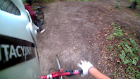
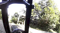
Trasa trudna, posiada liczne przeszkody, takie jak skocznie typu stolik, step up lub step down w wielkościach od 3 m do 9 m, dropy drewniane o wysokościach od 1 m do 3 m i ostre zakręty z bandami. Możliwe występowanie szybkiej, śliskiej nawierzchni. Rekomendowany rower z przynajmniej jednym amortyzatorem i obowiązkowo dwoma hamulcami. Obowiązkowe kask full face i ochraniacze.

Bike Park

Recent Activity on Trail

Past Week
  • 2 rides
  • 6 miles average
6 Months
  • 2 rides
  • 6 miles avg distance
All
  • 33 rides
  • Last: Jun 14, 2026
c1c2c3c4
January
February
March
April
May
June
July
August
September
October
November
December
Status:
on Jun 13, 2026
Variable
Avg: 4.13 (1 votes)
Your vote: 0

view (1,167)
close
3D
Trail Conditions
  • Unknown
  • Snow Groomed
  • Snow Packed
  • Snow Covered
  • Snow Cover Partial
  • Freeze/thaw Cycle
  • Icy
  • Prevalent Mud
  • Wet
  • Variable
  • Ideal
  • Dry
  • Very Dry
Trail Flow (Ridden Direction)
Trailforks scans users ridelogs to determine the most popular direction each trail is ridden. A good flowing trail network will have most trails flowing in a single direction according to their intension.
The colour categories are based on what percentage of riders are riding a trail in its intended direction.
  • > 96%
  • > 90%
  • > 80%
  • > 70%
  • > 50%
  • < 50%
  • bi-directional trail
  • no data
Trail Last Ridden
Trailforks scans ridelogs to determine the last time a trail was ridden.
  • < 2 days
  • < 1 week
  • < 2 weeks
  • < 1 month
  • < 6 months
  • > 6 months
Trail Ridden Direction
The intended direction a trail should be ridden.
  • Downhill Only
  • Downhill Primary
  • Both Directions
  • Uphill Primary
  • Uphill Only
  • One Direction
Contribute Details
Colors indicate trail is missing specified detail.
  • Description
  • Photos
  • Description & Photos
  • Videos
Trail Popularity ?
Trailforks scans ridelogs to determine which trails are ridden the most in the last 9 months. Trails are compared with nearby trails in the same city region with a possible 25 colour shades. Think of this as a heatmap, more rides = more kinetic energy = warmer colors.
  • most popular
  • popular
  • less popular
  • not popular
ATV/ORV/OHV Filter
Max Vehicle Width
inches
US Cell Coverage
Legend
cell carrier legend

Radar Time
Activity Recordings
Trailforks uses anonymized public activity data. ?
Activity Recordings
Trailforks uses anonymized public activity data. ?
Personal Heatmap
Activity Types
all / none
Options
2
Date range month
Winter Trails
Warning A routing network for winter maps does not exist. Selecting trails using the winter trails layer has been disabled.
Missing Trails
Most Popular
Least Popular
Trails are colored based on popularity. The more popular a trail is, the more red. Less popular trails trend towards green.
Jump Magnitude Heatmap
Heatmap of where riders jump on trails. Zoom in to see individual jumps, click circles to view jump details.
BC Backroad Status

Service Road Atlas is a free to use, community-driven service for viewing and creating reports on the numerous back-country service roads around B.C. and Alberta.

map legend
Slope Aspect
Direction the slope faces
Flat N NE E SE S SW W NW
Trails Deemphasized
Trails are shown in grey.
disable
Only show trails with no bike usage.
Enable
Suggested Layers
Based on selected activity type

    Save the current map location and zoom level as your default home location whenever this page is loaded.

    Save
        Directions to aline-60920 trailhead (49.456440, 20.318940)

        Photos

        78 more »
        296 |
        May 29, 2018 @ 2:05pm
        May 29, 2018
        100 |
        Aug 18, 2020 @ 1:44pm
        Aug 18, 2020
        102 |
        Oct 27, 2018 @ 1:49pm
        Oct 27, 2018
        97 |
        Oct 27, 2018 @ 1:49pm
        Oct 27, 2018

        Videos

        66 more »
        JoyRide Bikepark Kluszkowce A-line
        2:19 | 667 | Jun 17, 2019 , Czorsztyn
        Nowa 'trasa'
        0:27 | 180 | Sep 2, 2013 , Czorsztyn
        Stozek A-line ride
        5:48 | 185 | Aug 19, 2013 , Czorsztyn
        Lot przez prawą hopę na a-line
        0:13 | 255 | Sep 15, 2013 , Czorsztyn

        1 Review & Comments


        We hope you've been enjoying Trailforks!

        Create a FREE account to view trail comments and much more.

        • By Bazylio & contributors
        • #60920 - 1,996 views

        Frequently Asked Questions About A-Line

        Where is A-Line located?
        A-Line is located in Joy Ride Bike Park Kluszkowce, Czorsztyn, Poland. It is part of the Joy Ride Bike Park Kluszkowce trail network. The trailhead is located at coordinates 49.45644, 20.31894.
        How hard is A-Line?
        A-Line is rated as Black difficulty. The physical rating is Moderate. The average grade is 9.7%.
        What is the elevation gain for A-Line?
        A-Line has 1 m of elevation gain. The trail has 107 m of elevation descent. The elevation ranges from 642 m to 748 m.
        Is A-Line a point to point trail?
        Yes, A-Line is a point to point trail. The direction is Downhill Only. The trail type is machine groomed.

        Hit the Trail

        Open in App

        Get this trail on your phone instantly.
        open trail in app

        Download Trail

        Save to wishlist, Garmin & download.
        save the trail

        Find Related Routes

        Find routes and users activities that include this trail.
        find routes for this trail

        You must enter a description before submitting.