more stats
3,363 ft
Distance
318 ft
Climb
-20 ft
Descent
00:42:05
Avg time
298 ft
Altitude change
788 ft
Altitude min
1,087 ft
Altitude max
788 ft
Altitude start
1,086 ft
Altitude end
8.9%
Grade
-7.8%
Grade max
37.1%
Grade min
2,457 ft
Distance climb
604 ft
Distance down
302 ft
Distance flat
00:42:05
Avg time

Alta Via Details

  • Activities
    • Hike
    • Mountain Bike
    • Trail Running
  • Riding Area
    Northshore
    North Bay, Ontario
  • Difficulty Rating
  • Local Popularity
    5 in Mountain Biking [+]
    • 40 in Trail Running
    • 60 in Hiking
  • Global Ranking
    #156202 in Mountain Biking [+]
    • #121782 in Trail Running
    • #117685 in Hiking
  • Hiking SAC Scale
    T3 Demanding Mountain Hiking
  • Trail Type
    Singletrack
  • Bike Type
    DH, AM
  • Direction
    Downhill Only
  • Climb Difficulty
    Double Black Diamond
  • Physical Rating
    Moderate
  • Dogs Allowed
    Yes
  • TTFs on Trail
    Rock Face, Rock Garden

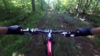
The Alta Via Trail brings you up over the waters of Four Mile Bay and Trout Lake. On a clear day you can see as far as Callandar Bay Lake Nipissing and the Manitou Islands Lake Nipissing. It is well worth the hike This is a hiking/running/snowshoeing trail - please note that biking is not intended on this trail, unless the rider is extremely skilled.

Disclaimer

Extremely challenging trail for Mountain Biking. This trail is primarily a hiking/running trail. Use with caution.

Local Trail Association

Recent Activity on Trail

Past Week
  • 0 rides
  •  
6 Months
  • 0 rides
  •  
All
  • 5 rides
  • Last: Apr 24, 2024
c1c2c3c4
January
February
March
April
May
June
July
August
September
October
November
December
update trails status or condition

Alta Via Trail Reports

statusdatedescription
Apr 19, 2021 @ 7:31am
Apr 19, 2021
more »
Status:
on Apr 19, 2021
Ideal
Avg: 4.13 (1 votes)
Your vote: 0

view (41)
close
3D
Trail Conditions
  • Unknown
  • Snow Groomed
  • Snow Packed
  • Snow Covered
  • Snow Cover Partial
  • Freeze/thaw Cycle
  • Icy
  • Prevalent Mud
  • Wet
  • Variable
  • Ideal
  • Dry
  • Very Dry
Trail Flow (Ridden Direction)
Trailforks scans users ridelogs to determine the most popular direction each trail is ridden. A good flowing trail network will have most trails flowing in a single direction according to their intension.
The colour categories are based on what percentage of riders are riding a trail in its intended direction.
  • > 96%
  • > 90%
  • > 80%
  • > 70%
  • > 50%
  • < 50%
  • bi-directional trail
  • no data
Trail Last Ridden
Trailforks scans ridelogs to determine the last time a trail was ridden.
  • < 2 days
  • < 1 week
  • < 2 weeks
  • < 1 month
  • < 6 months
  • > 6 months
Trail Ridden Direction
The intended direction a trail should be ridden.
  • Downhill Only
  • Downhill Primary
  • Both Directions
  • Uphill Primary
  • Uphill Only
  • One Direction
Contribute Details
Colors indicate trail is missing specified detail.
  • Description
  • Photos
  • Description & Photos
  • Videos
Trail Popularity ?
Trailforks scans ridelogs to determine which trails are ridden the most in the last 9 months. Trails are compared with nearby trails in the same city region with a possible 25 colour shades. Think of this as a heatmap, more rides = more kinetic energy = warmer colors.
  • most popular
  • popular
  • less popular
  • not popular
ATV/ORV/OHV Filter
Max Vehicle Width
inches
US Cell Coverage
Legend
cell carrier legend

Radar Time
Activity Recordings
Trailforks uses anonymized public activity data. ?
Activity Recordings
Trailforks uses anonymized public activity data. ?
Personal Heatmap
Activity Types
all / none
Options
2
Date range month
Winter Trails
Warning A routing network for winter maps does not exist. Selecting trails using the winter trails layer has been disabled.
Missing Trails
Most Popular
Least Popular
Trails are colored based on popularity. The more popular a trail is, the more red. Less popular trails trend towards green.
Jump Magnitude Heatmap
Heatmap of where riders jump on trails. Zoom in to see individual jumps, click circles to view jump details.
BC Backroad Status

Service Road Atlas is a free to use, community-driven service for viewing and creating reports on the numerous back-country service roads around B.C. and Alberta.

map legend
Slope Aspect
Direction the slope faces
Flat N NE E SE S SW W NW
Trails Deemphasized
Trails are shown in grey.
disable
Only show trails with no bike usage.
Enable
Suggested Layers
Based on selected activity type

    Save the current map location and zoom level as your default home location whenever this page is loaded.

    Save
        Directions to alta-via trailhead (46.330800, -79.278230)

        Photos

        3 more »
        171 |
        Apr 30, 2020 @ 5:29am
        Apr 30, 2020
        71 |
        Feb 2, 2021 @ 11:45am
        Feb 2, 2021
        66 |
        Feb 2, 2021 @ 11:44am
        Feb 2, 2021

        Videos

        1 more »
        looking for alta via the wrong way then alta...
        44:14 | 54 | Sep 10, 2024 , North Bay

        Reviews / Comments

        No reviews yet, be the first to write a review or ask a question.
        Use trail reports to comment on trail conditions.


        We hope you've been enjoying Trailforks!

        Create a FREE account to view trail comments and much more.

        • By northbaymtbTF Pro NBMBA & contributors
        • #280236 - 1,391 views

        Frequently Asked Questions About Alta Via

        Where is Alta Via located?
        Alta Via is located in Northshore, North Bay, Ontario, Canada. It is part of the Northshore trail network. The trailhead is located at coordinates 46.3308, -79.27823.
        How hard is Alta Via?
        Alta Via is rated as Double Black Diamond difficulty. The physical rating is Moderate. The average grade is 8.9%. The climb difficulty is rated Double Black Diamond.
        What is the elevation gain for Alta Via?
        Alta Via has 318 ft of elevation gain. The trail has 20 ft of elevation descent. The elevation ranges from 788 ft to 1,087 ft.
        Is Alta Via a point to point trail?
        Yes, Alta Via is a point to point trail. The direction is Downhill Only. The trail type is singletrack.

        Hit the Trail

        Open in App

        Get this trail on your phone instantly.
        open trail in app

        Download Trail

        Save to wishlist, Garmin & download.
        save the trail

        Find Related Routes

        Find routes and users activities that include this trail.
        find routes for this trail

        You must enter a description before submitting.