more stats
3,783 ft
Distance
77 ft
Climb
-71 ft
Descent
00:06:42
Avg time
4 ft
Altitude change
4,641 ft
Altitude min
4,682 ft
Altitude max
4,674 ft
Altitude start
4,678 ft
Altitude end
0.1%
Grade
-19.7%
Grade max
14.6%
Grade min
1,325 ft
Distance climb
1,391 ft
Distance down
1,047 ft
Distance flat
00:06:42
Avg time

Andante Details

  • Activities
    • Mountain Bike
    • Horse
    • Hike
    • Trail Running
  • Riding Area
    Thunder Mountain
    Sedona, Arizona
  • Difficulty Rating
  • Voted Difficulty
    Blue (2 votes)
  • Local Popularity
    80 in Mountain Biking [+]
    • 90 in Trail Running
    • 95 in Hiking
    • 5 in Horseback
  • Global Ranking
    #42661 in Mountain Biking [+]
    • #50025 in Trail Running
    • #23546 in Hiking
  • Trail Type
    Singletrack
  • Bike Type
    XC
  • Direction
    Both Directions
  • Climb Difficulty
    Green
  • Physical Rating
    Moderate
  • Dogs Allowed
    Yes
  • eBike Allowed
  • Ride in Rain
    Yes
  • Land Owner
    USFS

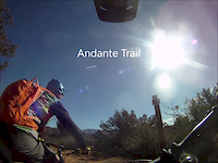
Intermediate 80% and beginner 20%, .62 mile MTB trail which is a bi-directional singletrack that is a twisty trail with an up and down component. The trail tread is mostly packed dirt that holds up well during prolonged wet periods There is no preferred direction and the trail is a great connector between the Thunder Mountain trail to the west and the Thunder Mt trail to the east.

Access Info

Trail is best accessed from the Andante trailhead. It serves as a connector trail between the Thunder Mt.trail which is an advanced trail not easily ridden by lesser skilled riders.

Trail Supporters

  • USFS
    Land Manager
Local Trail Association

Recent Activity on Trail

Past Week
  • 1 rides
  • 15 miles average
6 Months
  • 95 rides
  • 18 miles avg distance
All
  • 601 rides
  • Last: Jun 13, 2026
c1c2c3c4
January
February
March
April
May
June
July
August
September
October
November
December
Status:
on Apr 19, 2026
Dry
Avg: 3.46 (9 votes)
Your vote: 0

view (3,982)
close
3D
Trail Conditions
  • Unknown
  • Snow Groomed
  • Snow Packed
  • Snow Covered
  • Snow Cover Partial
  • Freeze/thaw Cycle
  • Icy
  • Prevalent Mud
  • Wet
  • Variable
  • Ideal
  • Dry
  • Very Dry
Trail Flow (Ridden Direction)
Trailforks scans users ridelogs to determine the most popular direction each trail is ridden. A good flowing trail network will have most trails flowing in a single direction according to their intension.
The colour categories are based on what percentage of riders are riding a trail in its intended direction.
  • > 96%
  • > 90%
  • > 80%
  • > 70%
  • > 50%
  • < 50%
  • bi-directional trail
  • no data
Trail Last Ridden
Trailforks scans ridelogs to determine the last time a trail was ridden.
  • < 2 days
  • < 1 week
  • < 2 weeks
  • < 1 month
  • < 6 months
  • > 6 months
Trail Ridden Direction
The intended direction a trail should be ridden.
  • Downhill Only
  • Downhill Primary
  • Both Directions
  • Uphill Primary
  • Uphill Only
  • One Direction
Contribute Details
Colors indicate trail is missing specified detail.
  • Description
  • Photos
  • Description & Photos
  • Videos
Trail Popularity ?
Trailforks scans ridelogs to determine which trails are ridden the most in the last 9 months. Trails are compared with nearby trails in the same city region with a possible 25 colour shades. Think of this as a heatmap, more rides = more kinetic energy = warmer colors.
  • most popular
  • popular
  • less popular
  • not popular
ATV/ORV/OHV Filter
Max Vehicle Width
inches
US Cell Coverage
Legend
cell carrier legend

Radar Time
Activity Recordings
Trailforks uses anonymized public activity data. ?
Activity Recordings
Trailforks uses anonymized public activity data. ?
Personal Heatmap
Activity Types
all / none
Options
2
Date range month
Winter Trails
Warning A routing network for winter maps does not exist. Selecting trails using the winter trails layer has been disabled.
Missing Trails
Most Popular
Least Popular
Trails are colored based on popularity. The more popular a trail is, the more red. Less popular trails trend towards green.
Jump Magnitude Heatmap
Heatmap of where riders jump on trails. Zoom in to see individual jumps, click circles to view jump details.
BC Backroad Status

Service Road Atlas is a free to use, community-driven service for viewing and creating reports on the numerous back-country service roads around B.C. and Alberta.

map legend
Slope Aspect
Direction the slope faces
Flat N NE E SE S SW W NW
Trails Deemphasized
Trails are shown in grey.
disable
Only show trails with no bike usage.
Enable
Suggested Layers
Based on selected activity type

    Save the current map location and zoom level as your default home location whenever this page is loaded.

    Save
        Directions to andante trailhead (34.877680, -111.809250)

        Photos

        No photos have been added for Andante yet, add a photo.

        Videos

        2 more »
        Sedona MTB // Teacup Trail // GETTING LOST PART II
        3:13 | 352 | Jun 11, 2020 , Sedona
        Andante Trail 2-8-17
        3:53 | 306 | Feb 8, 2017 , Sedona

        Routes with this trail

        5.0 53 miles 5,619 ft 24
        This is for the AES BFL for the year 2021
        5.0 4 miles 622 ft 2 Loop
        3.0 10 miles 1,044 ft 6 Loop
        A long loop that will test your endurance and technical skill, this loop will feel more like 15 miles than...

        1 Review & Comments


        We hope you've been enjoying Trailforks!

        Create a FREE account to view trail comments and much more.

        • By toddTF Pro Trailforks & contributors
        • #14569 - 4,540 views

        Frequently Asked Questions About Andante

        Where is Andante located?
        Andante is located in Thunder Mountain, Sedona, Arizona, United States. It is part of the Thunder Mountain trail network. The trailhead is located at coordinates 34.87768, -111.80925.
        How hard is Andante?
        Andante is rated as Blue difficulty. The physical rating is Moderate. The average grade is 0.1%. The climb difficulty is rated Green.
        What is the elevation gain for Andante?
        Andante has 77 ft of elevation gain. The trail has 71 ft of elevation descent. The elevation ranges from 4,641 ft to 4,682 ft.
        Is Andante a point to point trail?
        Andante is not a point to point trail. The direction is Both Directions. The trail type is singletrack.

        Hit the Trail

        Open in App

        Get this trail on your phone instantly.
        open trail in app

        Download Trail

        Save to wishlist, Garmin & download.
        save the trail

        Find Related Routes

        Find routes and users activities that include this trail.
        find routes for this trail

        You must enter a description before submitting.