


Open in App
Get this trail on your phone instantly.

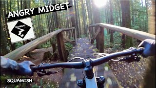
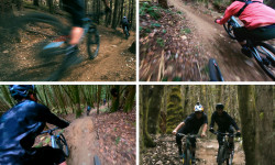
Intermediate trail that flows and winds on a loamy tread through the forest passing over half nelson. No big features here, just the occasional ladders crossing drainages and the ever-present root challenges
Accessed by riding up Ring Creek road and continuing past Half Nelson.
| c1 | c2 | c3 | c4 |
|---|---|---|---|
January | February | March | April |
May | June | July | August |
September | October | November | December |

Service Road Atlas is a free to use, community-driven service for viewing and creating reports on the numerous back-country service roads around B.C. and Alberta.
Save the current map location and zoom level as your default home location whenever this page is loaded.
Save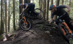
 Bridge Ladder Bridge
We hope you've been enjoying Trailforks!
Create a FREE account to view trail comments and much more.
You must enter a description before submitting.

