more stats
1,942 ft
Distance
-397 ft
Descent
00:02:51
Avg time
-397 ft
Altitude change
932 ft
Altitude min
1,329 ft
Altitude max
1,329 ft
Altitude start
932 ft
Altitude end
-20.4%
Grade
-45.9%
Grade max
-6.9%
Grade min
1,942 ft
Distance down
00:02:51
Avg time

Angry Sheep Details

  • Activities
    • Mountain Bike
    • E-Bike
    • Winter Fat Bike
  • Riding Area
    Traquair Trails
    Innerleithen
  • Difficulty Rating
  • Voted Difficulty
    Black (1 vote)
  • Local Popularity
    100 in Mountain Biking [+]
    • 100 in E-Biking
  • Global Ranking
    #295 in Mountain Biking [+]
    • #1850 in E-Biking
  • Trail Type
    Singletrack
  • Bike Type
    DH, AM, XC, DJ, Fat
  • Direction
    One Direction
    Popular Direction Shown
  • Climb Difficulty
    Blue
  • Physical Rating
    Moderate
  • Dogs Allowed
    Yes
  • eBike Allowed
    Yes up to Class 1
  • TTFs on Trail
    Berm, Drop
  • Year Opened
    2016

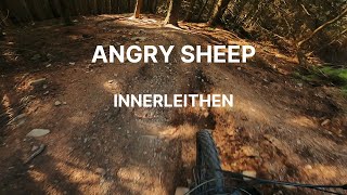
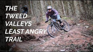
Hand made, natural flowy trail without too many steep or overly techy sections. Easily one of the most fun trails in the Tweed Valley.

For some reason riders have been trying to put shortcuts in, straightening out the amazing flowy corners - not cool.

Access Info

Just down the road from where the uplift buses turn. Two trails run side by side, Angry Sheep is the one to the left (the other is Green Wing).

This trail is unsanctioned.

Disclaimer

For some reason riders have been trying to put shortcuts in, straightening out the amazing flowy corners - not cool.

Recent Activity on Trail

Past Week
  • 5 rides
  • 38.3 km average
6 Months
  • 73 rides
  • 28.7 km avg distance
All
  • 675 rides
  • Last: Jun 17, 2026
c1c2c3c4
January
February
March
April
May
June
July
August
September
October
November
December
Status:
on May 26, 2026
Dry
Avg: 4.7 (30 votes)
Your vote: 0

view (14,945)
close
3D
Trail Conditions
  • Unknown
  • Snow Groomed
  • Snow Packed
  • Snow Covered
  • Snow Cover Partial
  • Freeze/thaw Cycle
  • Icy
  • Prevalent Mud
  • Wet
  • Variable
  • Ideal
  • Dry
  • Very Dry
Trail Flow (Ridden Direction)
Trailforks scans users ridelogs to determine the most popular direction each trail is ridden. A good flowing trail network will have most trails flowing in a single direction according to their intension.
The colour categories are based on what percentage of riders are riding a trail in its intended direction.
  • > 96%
  • > 90%
  • > 80%
  • > 70%
  • > 50%
  • < 50%
  • bi-directional trail
  • no data
Trail Last Ridden
Trailforks scans ridelogs to determine the last time a trail was ridden.
  • < 2 days
  • < 1 week
  • < 2 weeks
  • < 1 month
  • < 6 months
  • > 6 months
Trail Ridden Direction
The intended direction a trail should be ridden.
  • Downhill Only
  • Downhill Primary
  • Both Directions
  • Uphill Primary
  • Uphill Only
  • One Direction
Contribute Details
Colors indicate trail is missing specified detail.
  • Description
  • Photos
  • Description & Photos
  • Videos
Trail Popularity ?
Trailforks scans ridelogs to determine which trails are ridden the most in the last 9 months. Trails are compared with nearby trails in the same city region with a possible 25 colour shades. Think of this as a heatmap, more rides = more kinetic energy = warmer colors.
  • most popular
  • popular
  • less popular
  • not popular
ATV/ORV/OHV Filter
Max Vehicle Width
inches
US Cell Coverage
Legend
cell carrier legend

Radar Time
Activity Recordings
Trailforks uses anonymized public activity data. ?
Activity Recordings
Trailforks uses anonymized public activity data. ?
Personal Heatmap
Activity Types
all / none
Options
2
Date range month
Winter Trails
Warning A routing network for winter maps does not exist. Selecting trails using the winter trails layer has been disabled.
Missing Trails
Most Popular
Least Popular
Trails are colored based on popularity. The more popular a trail is, the more red. Less popular trails trend towards green.
Jump Magnitude Heatmap
Heatmap of where riders jump on trails. Zoom in to see individual jumps, click circles to view jump details.
BC Backroad Status

Service Road Atlas is a free to use, community-driven service for viewing and creating reports on the numerous back-country service roads around B.C. and Alberta.

map legend
Slope Aspect
Direction the slope faces
Flat N NE E SE S SW W NW
Trails Deemphasized
Trails are shown in grey.
disable
Only show trails with no bike usage.
Enable
Suggested Layers
Based on selected activity type

    Save the current map location and zoom level as your default home location whenever this page is loaded.

    Save
        Directions to angry-sheep trailhead (55.611390, -3.033240)

        Photos

        8 more »
        303 |
        Jul 11, 2021 @ 2:46pm
        Jul 11, 2021
        190 |
        Jul 11, 2021 @ 2:46pm
        Jul 11, 2021
        187 |
        May 29, 2021 @ 2:36am
        May 29, 2021
        300 |
        Jul 26, 2019 @ 3:33am
        Jul 26, 2019

        Videos

        11 more »
        youtuber How fast can I ride?! Innerleithen MTB Trails...
        13:07 | 457 | Aug 26, 2020 , Innerleithen
        Innerleithen mtb Red xc loop: 2024
        16:14 | 253 | Jul 5, 2024 , Innerleithen
        Angry Sheep Innerleithen PoV
        0:43 | 441 | May 17, 2023 , Innerleithen
        Angry Sheep, Innerleithen's best beginner...
        2:34 | 458 | May 2, 2022 , Innerleithen

        Routes with this trail

        4.0 50 miles 10,325 ft 41
        Featuring the best trails of the tweed valley in one epic loop
        1.0 12 miles 2,434 ft 12 Loop
        Classic XC route with few changes after storm damage
        12 miles 3,687 ft 17
        Tracks used for testing of Norco Fluid VLT eMTB

        3 Reviews & Comments


        We hope you've been enjoying Trailforks!

        Create a FREE account to view trail comments and much more.

        • #77650 - 13,117 views

        Frequently Asked Questions About Angry Sheep

        Where is Angry Sheep located?
        Angry Sheep is located in Traquair Trails, Innerleithen, United Kingdom. It is part of the Traquair Trails trail network. The trailhead is located at coordinates 55.61139, -3.03324.
        How hard is Angry Sheep?
        Angry Sheep is rated as Red difficulty. The physical rating is Moderate. The average grade is 20.4%. The climb difficulty is rated Blue.
        What is the elevation gain for Angry Sheep?
        The trail has 397 ft of elevation descent. The elevation ranges from 932 ft to 1,329 ft.
        Is Angry Sheep a point to point trail?
        Yes, Angry Sheep is a point to point trail. The direction is One Direction. The trail type is singletrack.

        Hit the Trail

        Open in App

        Get this trail on your phone instantly.
        open trail in app

        Download Trail

        Save to wishlist, Garmin & download.
        save the trail

        Find Related Routes

        Find routes and users activities that include this trail.
        find routes for this trail

        You must enter a description before submitting.