more stats
732 ft
Distance
-88 ft
Descent
00:01:10
Avg time
-88 ft
Altitude change
375 ft
Altitude min
463 ft
Altitude max
463 ft
Altitude start
374 ft
Altitude end
-12%
Grade
-28.1%
Grade max
-3%
Grade min
732 ft
Distance down
00:01:10
Avg time

Armadillo Details

  • Activities
    • Mountain Bike
    • E-Bike
  • Riding Area
    Haughmond Hill
    Shrewsbury
  • Difficulty Rating
  • Local Popularity
    40 in Mountain Biking [+]
    • 70 in E-Biking
  • Global Ranking
    #117926 in Mountain Biking [+]
    • #62862 in E-Biking
  • Trail Type
    Singletrack
  • Bike Type
    DH, AM, XC
  • Direction
    Downhill Only
    Popular Direction Shown
  • Physical Rating
    Moderate
  • Trail Visibility
    Always easy to follow
  • Dogs Allowed
    Yes
  • eBike Allowed
    Yes up to Class 1
  • TTFs on Trail
    Berm, Drop

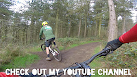
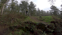
Straight down steep rocky chute to a right berm. Continue down passing an optional 'Double' on the left, then using left and right berms then traverse left across new trail traversing across and down between 2 large tree trunks. Finishes on bottom few feet of Wow and The Only Way Is Down trails. One of the better downhills and fairly even Red Grade, other than the start which is top end.

Local Trail Association

Recent Activity on Trail

Past Week
  • 0 rides
  •  
6 Months
  • 1 rides
  • 21 miles avg distance
All
  • 44 rides
  • Last: Mar 28, 2026
c1c2c3c4
January
February
March
April
May
June
July
August
September
October
November
December
update trails status or condition

Armadillo Trail Reports

statusdatedescription
Apr 9, 2026 @ 9:15pm (Europe/London)
Apr 9, 2026
Good trail clear until the last 30m where there are many large trees down. Have to carry bike over them.
Sep 24, 2021 @ 3:10am
Sep 24, 2021
Mar 31, 2021 @ 11:06am
Mar 31, 2021
reporter
Mar 20, 2021 @ 8:59am
Mar 20, 2021
reporter
Jul 9, 2020 @ 4:35am
Jul 9, 2020
Greasy and wet atm good fun but unpredictable
more »
Status:
on Apr 9, 2026
Dry
Avg: 4.13 (1 votes)
Your vote: 0

view (442)
close
3D
Trail Conditions
  • Unknown
  • Snow Groomed
  • Snow Packed
  • Snow Covered
  • Snow Cover Partial
  • Freeze/thaw Cycle
  • Icy
  • Prevalent Mud
  • Wet
  • Variable
  • Ideal
  • Dry
  • Very Dry
Trail Flow (Ridden Direction)
Trailforks scans users ridelogs to determine the most popular direction each trail is ridden. A good flowing trail network will have most trails flowing in a single direction according to their intension.
The colour categories are based on what percentage of riders are riding a trail in its intended direction.
  • > 96%
  • > 90%
  • > 80%
  • > 70%
  • > 50%
  • < 50%
  • bi-directional trail
  • no data
Trail Last Ridden
Trailforks scans ridelogs to determine the last time a trail was ridden.
  • < 2 days
  • < 1 week
  • < 2 weeks
  • < 1 month
  • < 6 months
  • > 6 months
Trail Ridden Direction
The intended direction a trail should be ridden.
  • Downhill Only
  • Downhill Primary
  • Both Directions
  • Uphill Primary
  • Uphill Only
  • One Direction
Contribute Details
Colors indicate trail is missing specified detail.
  • Description
  • Photos
  • Description & Photos
  • Videos
Trail Popularity ?
Trailforks scans ridelogs to determine which trails are ridden the most in the last 9 months. Trails are compared with nearby trails in the same city region with a possible 25 colour shades. Think of this as a heatmap, more rides = more kinetic energy = warmer colors.
  • most popular
  • popular
  • less popular
  • not popular
ATV/ORV/OHV Filter
Max Vehicle Width
inches
US Cell Coverage
Legend
cell carrier legend

Radar Time
Activity Recordings
Trailforks uses anonymized public activity data. ?
Activity Recordings
Trailforks uses anonymized public activity data. ?
Personal Heatmap
Activity Types
all / none
Options
2
Date range month
Winter Trails
Warning A routing network for winter maps does not exist. Selecting trails using the winter trails layer has been disabled.
Missing Trails
Most Popular
Least Popular
Trails are colored based on popularity. The more popular a trail is, the more red. Less popular trails trend towards green.
Jump Magnitude Heatmap
Heatmap of where riders jump on trails. Zoom in to see individual jumps, click circles to view jump details.
BC Backroad Status

Service Road Atlas is a free to use, community-driven service for viewing and creating reports on the numerous back-country service roads around B.C. and Alberta.

map legend
Slope Aspect
Direction the slope faces
Flat N NE E SE S SW W NW
Trails Deemphasized
Trails are shown in grey.
disable
Only show trails with no bike usage.
Enable
Suggested Layers
Based on selected activity type

    Save the current map location and zoom level as your default home location whenever this page is loaded.

    Save
        Directions to armadillo-101303 trailhead (52.715610, -2.676120)

        Photos

        6 more »
        56 |
        Jun 8, 2020 @ 2:43am
        Jun 8, 2020
        30 |
        Jun 7, 2020 @ 9:38am
        Jun 7, 2020
        25 |
        Jun 7, 2020 @ 9:38am
        Jun 7, 2020
        48 |
        Feb 24, 2020 @ 9:35am
        Feb 24, 2020

        Videos

        3 more »
        Haughmond Hill - Armadillo
        0:49 | 211 | Mar 23, 2020 , Shrewsbury
        Haughmond Hill Drop Fail
        0:12 | 246 | Mar 23, 2020 , Shrewsbury
        Is This The Way To Armadillo?
        0:47 | 167 | Dec 4, 2017 , Shrewsbury

        Reviews / Comments

        No reviews yet, be the first to write a review or ask a question.
        Use trail reports to comment on trail conditions.


        We hope you've been enjoying Trailforks!

        Create a FREE account to view trail comments and much more.

        • By CyclingclaireTF Pro HHTA & contributors
        • #101303 - 2,362 views

        Frequently Asked Questions About Armadillo

        Where is Armadillo located?
        Armadillo is located in Haughmond Hill, Shrewsbury, United Kingdom. It is part of the Haughmond Hill trail network. The trailhead is located at coordinates 52.71561, -2.67612.
        How hard is Armadillo?
        Armadillo is rated as Red difficulty. The physical rating is Moderate. The average grade is 12%.
        What is the elevation gain for Armadillo?
        The trail has 88 ft of elevation descent. The elevation ranges from 375 ft to 463 ft.
        Is Armadillo a point to point trail?
        Yes, Armadillo is a point to point trail. The direction is Downhill Only. The trail type is singletrack.

        Hit the Trail

        Open in App

        Get this trail on your phone instantly.
        open trail in app

        Download Trail

        Save to wishlist, Garmin & download.
        save the trail

        Find Related Routes

        Find routes and users activities that include this trail.
        find routes for this trail

        You must enter a description before submitting.