



Open in App
Get this trail on your phone instantly.

The Arnold Rim Trail is a non-motorized trail system designed for hikers, mountain bikers and equestrians. ART connects the many wonders of public lands along the Ebbetts Pass National Scenic Byway stretch of Hwy 4 to its communities, creating a high level of access for its residents and visitors.
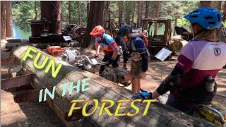
The northern terminus of the Arnold Rim Trail is at the Sierra Nevada Logging Museum in the community of White Pines. From the museum’s parking lot, look for the start of the trail across the adjacent gravel road. The first mile is paved and gently graded for wheelchair accessibility.
* Directions: From eastbound Highway 4 in Arnold, veer left onto Blagen Road just past the Chevron gas station. Follow Blagen Road for approximately one mile through the community of White Pines. Turn left on Dunbar Road, following signs for Hazel Fisher School and Logging Museum. Just past White Pines Lake, turn right at the giant pencil that marks the Logging Museum entrance. Please respect the signs demarcating parking spaces reserved for the Museum.

| c1 | c2 | c3 | c4 |
|---|---|---|---|
January | February | March | April |
May | June | July | August |
September | October | November | December |


Service Road Atlas is a free to use, community-driven service for viewing and creating reports on the numerous back-country service roads around B.C. and Alberta.
Save the current map location and zoom level as your default home location whenever this page is loaded.
SaveWe hope you've been enjoying Trailforks!
Create a FREE account to view trail comments and much more.
 & contributors
You must enter a description before submitting.

