more stats
4,213 ft
Distance
7 ft
Climb
-978 ft
Descent
00:22:50
Avg time
-971 ft
Altitude change
418 ft
Altitude min
1,389 ft
Altitude max
1,389 ft
Altitude start
418 ft
Altitude end
-23.046%
Grade
-43.607%
Grade max
12.733%
Grade min
96 ft
Distance climb
4,117 ft
Distance down
00:22:50
Avg time

Azbestoza Details

  • Activities
    • Mountain Bike
    • Hike
    • Trail Running
  • Riding Area
    Kozjak
    Split
  • Difficulty Rating
  • Global Ranking
    #126679 in Mountain Biking [+]
    • #130353 in Trail Running
    • #123426 in Hiking
  • Trail Type
    Singletrack
  • Bike Type
    DH
  • Direction
    Downhill Only
    Popular Direction Shown
  • Physical Rating
    Hard
  • Season
    Jan-Dec
  • Dogs Allowed
    Yes
  • eBike Allowed
  • TTFs on Trail
    Berm, Drop, Jump, Gap Jump, Rock Face, Rock Garden
  • Year Opened
    2012

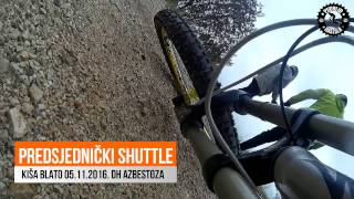
Azbestoza DH/FR trail was built and it is maintained by mtb klub KRŠ from Split.

Access Info

Driving from Split to west on the Kaštela highway, turn right in Sućurac by fire Department HQ building. Follow the road to the cemetery, behind which is a gravel parking lot. It is a meeting point. From parking, follow the fire road couple of km to the mountain house. Start is there

Disclaimer

Please contact maintainers at [email protected] before riding the trail for the first time.

Local Trail Association

Recent Activity on Trail

Past Week
  • 0 rides
  •  
6 Months
  • 0 rides
  •  
All
  • 1 rides
  •  
c1c2c3c4
January
February
March
April
May
June
July
August
September
October
November
December
update trails status or condition

Azbestoza Trail Reports

statusdatedescription
Jan 18, 2026 @ 4:04pm (Europe/Zagreb)
Jan 18, 2026
Upper third still closed. Lower 2 in mint condition. We did a lot of work last month so take care and if you see any big derbies or rocks on trail...
Nov 30, 2025 @ 10:22pm (Europe/Zagreb)
Nov 30, 2025
Jun 10, 2024 @ 6:11am
Jun 10, 2024
Jun 17, 2023 @ 12:52pm
Jun 17, 2023
Upper part closed due to reconstruction, the mid and lower parts are clear. Still needs a bit of trimming on the lower part.
Jul 24, 2022 @ 10:03am
Jul 24, 2022
In july almost no grip even on dry tires on the upper part, at the lower part little bit washed by the rain so prepair a good set of tires.
more »
Status:
on Jan 18, 2026
Ideal
Avg: 4.35 (5 votes)
Your vote: 0

view (0)
close
3D
Trail Conditions
  • Unknown
  • Snow Groomed
  • Snow Packed
  • Snow Covered
  • Snow Cover Partial
  • Freeze/thaw Cycle
  • Icy
  • Prevalent Mud
  • Wet
  • Variable
  • Ideal
  • Dry
  • Very Dry
Trail Flow (Ridden Direction)
Trailforks scans users ridelogs to determine the most popular direction each trail is ridden. A good flowing trail network will have most trails flowing in a single direction according to their intension.
The colour categories are based on what percentage of riders are riding a trail in its intended direction.
  • > 96%
  • > 90%
  • > 80%
  • > 70%
  • > 50%
  • < 50%
  • bi-directional trail
  • no data
Trail Last Ridden
Trailforks scans ridelogs to determine the last time a trail was ridden.
  • < 2 days
  • < 1 week
  • < 2 weeks
  • < 1 month
  • < 6 months
  • > 6 months
Trail Ridden Direction
The intended direction a trail should be ridden.
  • Downhill Only
  • Downhill Primary
  • Both Directions
  • Uphill Primary
  • Uphill Only
  • One Direction
Contribute Details
Colors indicate trail is missing specified detail.
  • Description
  • Photos
  • Description & Photos
  • Videos
Trail Popularity ?
Trailforks scans ridelogs to determine which trails are ridden the most in the last 9 months. Trails are compared with nearby trails in the same city region with a possible 25 colour shades. Think of this as a heatmap, more rides = more kinetic energy = warmer colors.
  • most popular
  • popular
  • less popular
  • not popular
ATV/ORV/OHV Filter
Max Vehicle Width
inches
US Cell Coverage
Legend
cell carrier legend

Radar Time
Activity Recordings
Trailforks uses anonymized public activity data. ?
Activity Recordings
Trailforks uses anonymized public activity data. ?
Personal Heatmap
Activity Types
all / none
Options
2
Date range month
Winter Trails
Warning A routing network for winter maps does not exist. Selecting trails using the winter trails layer has been disabled.
Missing Trails
Most Popular
Least Popular
Trails are colored based on popularity. The more popular a trail is, the more red. Less popular trails trend towards green.
Jump Magnitude Heatmap
Heatmap of where riders jump on trails. Zoom in to see individual jumps, click circles to view jump details.
BC Backroad Status

Service Road Atlas is a free to use, community-driven service for viewing and creating reports on the numerous back-country service roads around B.C. and Alberta.

map legend
Slope Aspect
Direction the slope faces
Flat N NE E SE S SW W NW
Trails Deemphasized
Trails are shown in grey.
disable
Only show trails with no bike usage.
Enable
Suggested Layers
Based on selected activity type

    Save the current map location and zoom level as your default home location whenever this page is loaded.

    Save
        Directions to azbestoza trailhead (43.567242, 16.424747)

        Photos

        61 more »
        316 |
        Mar 19, 2013 @ 11:40am
        Mar 19, 2013
        409 |
        Mar 19, 2013 @ 11:40am
        Mar 19, 2013
        361 |
        Mar 19, 2013 @ 11:40am
        Mar 19, 2013
        630 |
        Mar 19, 2013 @ 11:40am
        Mar 19, 2013

        Videos

        12 more »
        Rainzbestoza
        5:51 | 741 | Feb 23, 2018 , Split
        Azbestoza Easy Going
        575 | Sep 28, 2017 , Split
        Kišni Predsjednički Shuttle Azbestoza
        563 | Jan 21, 2017 , Split
        PiPiPi Azbestni Ručak
        476 | Jan 21, 2017 , Split

        4 Reviews & Comments


        We hope you've been enjoying Trailforks!

        Create a FREE account to view trail comments and much more.

        Nearby Trails

        • By tuberkulozis & contributors
        • #80573 - 4,771 views

        Frequently Asked Questions About Azbestoza

        Where is Azbestoza located?
        Azbestoza is located in Kozjak, Split, Croatia. It is part of the Kozjak trail network. The trailhead is located at coordinates 43.56724, 16.42475.
        How hard is Azbestoza?
        Azbestoza is rated as Black Diamond difficulty. The physical rating is Hard. The average grade is 23.046%.
        What is the elevation gain for Azbestoza?
        Azbestoza has 7 ft of elevation gain. The trail has 978 ft of elevation descent. The elevation ranges from 418 ft to 1,389 ft.
        Is Azbestoza a point to point trail?
        Yes, Azbestoza is a point to point trail. The direction is Downhill Only. The trail type is singletrack.

        Hit the Trail

        Open in App

        Get this trail on your phone instantly.
        open trail in app

        Download Trail

        Save to wishlist, Garmin & download.
        save the trail

        Find Related Routes

        Find routes and users activities that include this trail.
        find routes for this trail

        You must enter a description before submitting.