more stats
2,146 ft
Distance
00:03:22
Avg time
756 ft
Altitude min
756 ft
Altitude max
756 ft
Altitude start
755 ft
Altitude end
00:03:22
Avg time

Back 40 Details

  • Activities
    • Mountain Bike
    • Winter Fat Bike
    • Hike
    • Trail Running
  • Riding Area
    Bison Butte Recreational Trails
    Winnipeg, Manitoba
  • Difficulty Rating
  • Local Popularity
    100 in Mountain Biking [+]
    • 75 in Trail Running
    • 5 in Hiking
  • Global Ranking
    #51932 in Mountain Biking [+]
    • #54146 in Trail Running
    • #304272 in Hiking
  • Trail Type
    Singletrack
  • Bike Type
    AM, XC, Fat
  • Direction
    One Direction
    Popular Direction Shown
  • Physical Rating
    Moderate
  • Dogs Allowed
    Yes
  • TTFs on Trail
    Berm, Drop, Rock Garden

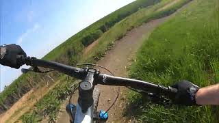
Starts with big S turn berms, singletrack to a steep rock roll down, rock garden, then singletrack finish with mild climb. Ride around option for roll down. "Back 40" is also a classic Manitoba MTB race near Morden MB, with the sweetest singletrack. Shout-out to the Back 40

Disclaimer

Helmets mandatory. Riders assume all risks.

Local Trail Association

Recent Activity on Trail

Past Week
  • 5 rides
  • 14 miles average
6 Months
  • 25 rides
  • 13 miles avg distance
All
  • 478 rides
  • Last: Jun 21, 2026
c1c2c3c4
January
February
March
April
May
June
July
August
September
October
November
December
update trails status or condition

Back 40 Trail Reports

Status:
on Jun 21, 2026
Ideal
Avg: 3.99 (3 votes)
Your vote: 0

view (8,272)
close
3D
Trail Conditions
  • Unknown
  • Snow Groomed
  • Snow Packed
  • Snow Covered
  • Snow Cover Partial
  • Freeze/thaw Cycle
  • Icy
  • Prevalent Mud
  • Wet
  • Variable
  • Ideal
  • Dry
  • Very Dry
Trail Flow (Ridden Direction)
Trailforks scans users ridelogs to determine the most popular direction each trail is ridden. A good flowing trail network will have most trails flowing in a single direction according to their intension.
The colour categories are based on what percentage of riders are riding a trail in its intended direction.
  • > 96%
  • > 90%
  • > 80%
  • > 70%
  • > 50%
  • < 50%
  • bi-directional trail
  • no data
Trail Last Ridden
Trailforks scans ridelogs to determine the last time a trail was ridden.
  • < 2 days
  • < 1 week
  • < 2 weeks
  • < 1 month
  • < 6 months
  • > 6 months
Trail Ridden Direction
The intended direction a trail should be ridden.
  • Downhill Only
  • Downhill Primary
  • Both Directions
  • Uphill Primary
  • Uphill Only
  • One Direction
Contribute Details
Colors indicate trail is missing specified detail.
  • Description
  • Photos
  • Description & Photos
  • Videos
Trail Popularity ?
Trailforks scans ridelogs to determine which trails are ridden the most in the last 9 months. Trails are compared with nearby trails in the same city region with a possible 25 colour shades. Think of this as a heatmap, more rides = more kinetic energy = warmer colors.
  • most popular
  • popular
  • less popular
  • not popular
ATV/ORV/OHV Filter
Max Vehicle Width
inches
US Cell Coverage
Legend
cell carrier legend

Radar Time
Activity Recordings
Trailforks uses anonymized public activity data. ?
Activity Recordings
Trailforks uses anonymized public activity data. ?
Personal Heatmap
Activity Types
all / none
Options
2
Date range month
Winter Trails
Warning A routing network for winter maps does not exist. Selecting trails using the winter trails layer has been disabled.
Missing Trails
Most Popular
Least Popular
Trails are colored based on popularity. The more popular a trail is, the more red. Less popular trails trend towards green.
Jump Magnitude Heatmap
Heatmap of where riders jump on trails. Zoom in to see individual jumps, click circles to view jump details.
BC Backroad Status

Service Road Atlas is a free to use, community-driven service for viewing and creating reports on the numerous back-country service roads around B.C. and Alberta.

map legend
Slope Aspect
Direction the slope faces
Flat N NE E SE S SW W NW
Trails Deemphasized
Trails are shown in grey.
disable
Only show trails with no bike usage.
Enable
Suggested Layers
Based on selected activity type

    Save the current map location and zoom level as your default home location whenever this page is loaded.

    Save
        Directions to back-40-126136 trailhead (49.833760, -97.217940)

        Photos

        2 more »
        127 |
        Jul 13, 2023 @ 12:40pm
        Jul 13, 2023
        115 |
        Jun 18, 2022 @ 5:17pm
        Jun 18, 2022

        Videos

        1 more »
        Quick ride at Bison Butte, Winnipeg Manitoba |...
        2:59 | 87 | Sep 10, 2024 , Winnipeg

        Routes with this trail

        2 miles 2 ft 2 Loop
        Winter Fat Biking loop when conditions are suitable, Machine groomed when required.
        1 mile 2 ft 12
        A fairly easy loop that bypasses the steep climbs and technical sections. Mostly single track, double...
        4.5 3 miles 5 ft 12 Race
        Although the overall rating is intermediate, there are a few significant Black Diamond challenges both...

        Reviews / Comments

        No reviews yet, be the first to write a review or ask a question.
        Use trail reports to comment on trail conditions.


        We hope you've been enjoying Trailforks!

        Create a FREE account to view trail comments and much more.

        • By crislabossiereTF Pro SWTA MTB MB & contributors
        • #126136 - 2,510 views

        Frequently Asked Questions About Back 40

        Where is Back 40 located?
        Back 40 is located in Bison Butte Recreational Trails, Winnipeg, Manitoba, Canada. It is part of the Bison Butte Recreational Trails trail network. The trailhead is located at coordinates 49.83376, -97.21794.
        How hard is Back 40?
        Back 40 is rated as Blue difficulty. The physical rating is Moderate.
        Is Back 40 a point to point trail?
        Yes, Back 40 is a point to point trail. The direction is One Direction. The trail type is singletrack.
        How long is Back 40?
        Back 40 is 2,146 ft long. The trail type is singletrack.

        Hit the Trail

        Open in App

        Get this trail on your phone instantly.
        open trail in app

        Download Trail

        Save to wishlist, Garmin & download.
        save the trail

        Find Related Routes

        Find routes and users activities that include this trail.
        find routes for this trail

        You must enter a description before submitting.