more stats
2,068 ft
Distance
108 ft
Climb
-137 ft
Descent
00:06:36
Avg time
-29 ft
Altitude change
307 ft
Altitude min
410 ft
Altitude max
344 ft
Altitude start
315 ft
Altitude end
-1.398%
Grade
-29.59%
Grade max
26.621%
Grade min
815 ft
Distance climb
1,254 ft
Distance down
00:06:36
Avg time

Bailout Details

  • Activities
    • Mountain Bike
    • Hike
    • Trail Running
  • Riding Area
  • Difficulty Rating
  • Voted Difficulty
    Advanced (1 vote)
  • Local Popularity
    65 in Mountain Biking [+]
    • 15 in Trail Running
    • 60 in Hiking
  • Global Ranking
    #65557 in Mountain Biking [+]
    • #129046 in Trail Running
    • #89344 in Hiking
  • Trail Type
    Singletrack
  • Bike Type
    AM, XC
  • Direction
    Both Directions
    Popular Direction Shown
  • Climb Difficulty
    Blue
  • Physical Rating
    Hard
  • Dogs Allowed
    Yes
  • eBike Allowed
    Yes up to Class 1
  • TTFs on Trail
    Bridge
  • Year Opened
    2014
  • Land Owner

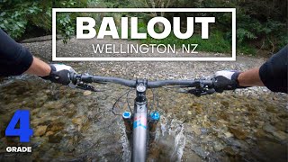
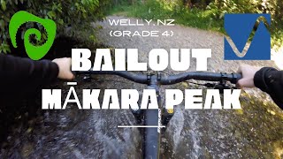
New exit out to South Karori Road from the bottom Leaping Lizard for those who don't want to have to climb back up into the park via Possum Bait Line. Makes Leaping Lizard a much more appealing prospect.

Built by the Makara Peak Supporters and several corporate work parties over 2014.

Access Info

From the bottom of Leaping Lizard and at the start of Possum Bait Line. Alternatively, you can grovel up it from South Karori Road. Look out for the bollard with the sign towards the end of the road. It crosses private property and close to a house so please respect the land owners.

Local Trail Association

Recent Activity on Trail

Past Week
  • 0 rides
  •  
6 Months
  • 22 rides
  • 11 miles avg distance
All
  • 224 rides
  • Last: Jun 7, 2026
c1c2c3c4
January
February
March
April
May
June
July
August
September
October
November
December
Status:
on Apr 4, 2026
Ideal
Avg: 3.84 (7 votes)
Your vote: 0

view (2,430)
close
3D
Trail Conditions
  • Unknown
  • Snow Groomed
  • Snow Packed
  • Snow Covered
  • Snow Cover Partial
  • Freeze/thaw Cycle
  • Icy
  • Prevalent Mud
  • Wet
  • Variable
  • Ideal
  • Dry
  • Very Dry
Trail Flow (Ridden Direction)
Trailforks scans users ridelogs to determine the most popular direction each trail is ridden. A good flowing trail network will have most trails flowing in a single direction according to their intension.
The colour categories are based on what percentage of riders are riding a trail in its intended direction.
  • > 96%
  • > 90%
  • > 80%
  • > 70%
  • > 50%
  • < 50%
  • bi-directional trail
  • no data
Trail Last Ridden
Trailforks scans ridelogs to determine the last time a trail was ridden.
  • < 2 days
  • < 1 week
  • < 2 weeks
  • < 1 month
  • < 6 months
  • > 6 months
Trail Ridden Direction
The intended direction a trail should be ridden.
  • Downhill Only
  • Downhill Primary
  • Both Directions
  • Uphill Primary
  • Uphill Only
  • One Direction
Contribute Details
Colors indicate trail is missing specified detail.
  • Description
  • Photos
  • Description & Photos
  • Videos
Trail Popularity ?
Trailforks scans ridelogs to determine which trails are ridden the most in the last 9 months. Trails are compared with nearby trails in the same city region with a possible 25 colour shades. Think of this as a heatmap, more rides = more kinetic energy = warmer colors.
  • most popular
  • popular
  • less popular
  • not popular
ATV/ORV/OHV Filter
Max Vehicle Width
inches
US Cell Coverage
Legend
cell carrier legend

Radar Time
Activity Recordings
Trailforks uses anonymized public activity data. ?
Activity Recordings
Trailforks uses anonymized public activity data. ?
Personal Heatmap
Activity Types
all / none
Options
2
Date range month
Winter Trails
Warning A routing network for winter maps does not exist. Selecting trails using the winter trails layer has been disabled.
Missing Trails
Most Popular
Least Popular
Trails are colored based on popularity. The more popular a trail is, the more red. Less popular trails trend towards green.
Jump Magnitude Heatmap
Heatmap of where riders jump on trails. Zoom in to see individual jumps, click circles to view jump details.
BC Backroad Status

Service Road Atlas is a free to use, community-driven service for viewing and creating reports on the numerous back-country service roads around B.C. and Alberta.

map legend
Slope Aspect
Direction the slope faces
Flat N NE E SE S SW W NW
Trails Deemphasized
Trails are shown in grey.
disable
Only show trails with no bike usage.
Enable
Suggested Layers
Based on selected activity type

    Save the current map location and zoom level as your default home location whenever this page is loaded.

    Save
        Directions to bailout trailhead (-41.303321, 174.706918)

        Photos

        No photos have been added for Bailout yet, add a photo.

        Videos

        5 more »
        youtuber BACK TO THE CARPARK - Bailout Mountain Bike...
        3:18 | 561 | Aug 28, 2020 , Wellington
        Bailout | Mākara Peak | Wellington, NZ |...
        4:10 | 198 | Nov 22, 2021 , Wellington
        Bailout Mountain Bike Trail (Grade 4 -...
        3:18 | 181 | Aug 28, 2020 , Wellington
        Leaping Lizard (Main) & Bailout Trails,...
        6:51 | 323 | Jun 28, 2019 , Wellington

        Routes with this trail

        5.0 6 miles 1,489 ft 16 Loop
        An Advanced grade loop taking you out to the wilds of Makara Peak. Harder than an Intermediate grade due...
        8 miles 1,688 ft 31 Loop Race
        Welcome to the final round of the PNP Spring MTB Series for 2018. This is the long loop for the event....

        2 Reviews & Comments


        We hope you've been enjoying Trailforks!

        Create a FREE account to view trail comments and much more.

        • By thearsenalofmegadeth & contributors
        • #22484 - 3,712 views

        Frequently Asked Questions About Bailout

        Where is Bailout located?
        Bailout is located in Mākara Peak Mountain Bike Park, Wellington, New Zealand. It is part of the Mākara Peak Mountain Bike Park trail network. The trailhead is located at coordinates -41.30332, 174.70692.
        How hard is Bailout?
        Bailout is rated as Advanced difficulty. The physical rating is Hard. The average grade is 1.398%. The climb difficulty is rated Blue.
        What is the elevation gain for Bailout?
        Bailout has 108 ft of elevation gain. The trail has 137 ft of elevation descent. The elevation ranges from 307 ft to 410 ft.
        Is Bailout a point to point trail?
        Bailout is not a point to point trail. The direction is Both Directions. The trail type is singletrack.

        Hit the Trail

        Open in App

        Get this trail on your phone instantly.
        open trail in app

        Download Trail

        Save to wishlist, Garmin & download.
        save the trail

        Find Related Routes

        Find routes and users activities that include this trail.
        find routes for this trail

        You must enter a description before submitting.