more stats
2.2 miles
Distance
243 ft
Climb
-239 ft
Descent
00:22:23
Avg time
5 ft
Altitude change
838 ft
Altitude min
922 ft
Altitude max
851 ft
Altitude start
856 ft
Altitude end
-28.1%
Grade max
18%
Grade min
4,508 ft
Distance climb
4,970 ft
Distance down
2,156 ft
Distance flat
00:22:23
Avg time

Balaton Details

  • Activities
    • Mountain Bike
    • Winter Fat Bike
  • Riding Area
  • Difficulty Rating
  • Local Popularity
    100 in Mountain Biking
  • Global Ranking
    #45389 in Mountain Biking
  • Trail Type
    Singletrack
  • Bike Type
    AM, XC, Fat
  • Direction
    One Direction
  • Climb Difficulty
    Blue
  • Physical Rating
    Moderate
  • Trail Visibility
    Sometimes hard to follow
  • Season
    All year
  • Year Opened
    2019

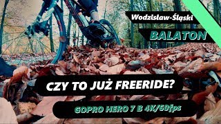
Krótka ścieżka pozostawiona po zawodach xc, bardzo męcząca, z powodu wielu podjazdów i zjazdów które wymagają umiejętności. Idealna na traningi. Uwaga, na zjazdach przy jeziorze przy większych prędkościach problematyczne może okazać się zmieszczenie na ścieżce Widziałem zawodników którzy lądowali w wodzie

------ENG-------

A short path left after xc competition, very tiring, due to many uphill and downhill runs that require skill. Perfect for tranings. Attention, when descending by the lake at higher speeds it may be problematic to fit on the path! I saw bikers who landed in the water!

Access Info

Najłatwiej będzie wystartować z asfaltowego pasu przed jeziorem, zaraz obok blaszaka z wypożyczalni pływającego plastiku trzeba skręcić w prawo, jadąc drogą dojazdową do jeziora.

This trail is unsanctioned.

Recent Activity on Trail

Past Week
  • 0 rides
  •  
6 Months
  • 0 rides
  •  
All
  • 2 rides
  • Last: Jul 12, 2025
c1c2c3c4
January
February
March
April
May
June
July
August
September
October
November
December
update trails status or condition

Balaton Trail Reports

Status:
on Dec 28, 2020
Prevalent Mud
Avg: 4.24 (2 votes)
Your vote: 0

view (91)
close
3D
Trail Conditions
  • Unknown
  • Snow Groomed
  • Snow Packed
  • Snow Covered
  • Snow Cover Partial
  • Freeze/thaw Cycle
  • Icy
  • Prevalent Mud
  • Wet
  • Variable
  • Ideal
  • Dry
  • Very Dry
Trail Flow (Ridden Direction)
Trailforks scans users ridelogs to determine the most popular direction each trail is ridden. A good flowing trail network will have most trails flowing in a single direction according to their intension.
The colour categories are based on what percentage of riders are riding a trail in its intended direction.
  • > 96%
  • > 90%
  • > 80%
  • > 70%
  • > 50%
  • < 50%
  • bi-directional trail
  • no data
Trail Last Ridden
Trailforks scans ridelogs to determine the last time a trail was ridden.
  • < 2 days
  • < 1 week
  • < 2 weeks
  • < 1 month
  • < 6 months
  • > 6 months
Trail Ridden Direction
The intended direction a trail should be ridden.
  • Downhill Only
  • Downhill Primary
  • Both Directions
  • Uphill Primary
  • Uphill Only
  • One Direction
Contribute Details
Colors indicate trail is missing specified detail.
  • Description
  • Photos
  • Description & Photos
  • Videos
Trail Popularity ?
Trailforks scans ridelogs to determine which trails are ridden the most in the last 9 months. Trails are compared with nearby trails in the same city region with a possible 25 colour shades. Think of this as a heatmap, more rides = more kinetic energy = warmer colors.
  • most popular
  • popular
  • less popular
  • not popular
ATV/ORV/OHV Filter
Max Vehicle Width
inches
US Cell Coverage
Legend
cell carrier legend

Radar Time
Activity Recordings
Trailforks uses anonymized public activity data. ?
Activity Recordings
Trailforks uses anonymized public activity data. ?
Personal Heatmap
Activity Types
all / none
Options
2
Date range month
Winter Trails
Warning A routing network for winter maps does not exist. Selecting trails using the winter trails layer has been disabled.
Missing Trails
Most Popular
Least Popular
Trails are colored based on popularity. The more popular a trail is, the more red. Less popular trails trend towards green.
Jump Magnitude Heatmap
Heatmap of where riders jump on trails. Zoom in to see individual jumps, click circles to view jump details.
BC Backroad Status

Service Road Atlas is a free to use, community-driven service for viewing and creating reports on the numerous back-country service roads around B.C. and Alberta.

map legend
Slope Aspect
Direction the slope faces
Flat N NE E SE S SW W NW
Trails Deemphasized
Trails are shown in grey.
disable
Only show trails with no bike usage.
Enable
Suggested Layers
Based on selected activity type

    Save the current map location and zoom level as your default home location whenever this page is loaded.

    Save
        Directions to balaton-232804 trailhead (50.001200, 18.493830)

        Photos

        2 more »
        160 |
        Nov 23, 2019 @ 11:45am
        Nov 23, 2019

        Videos

        1 more »
        Rowerowy Wodzisław-Śląski | Balaton |...
        10:45 | 365 | Nov 23, 2019 , Wodzisław Śląski

        Reviews / Comments

        No reviews yet, be the first to write a review or ask a question.
        Use trail reports to comment on trail conditions.


        We hope you've been enjoying Trailforks!

        Create a FREE account to view trail comments and much more.

        • #232804 - 1,003 views

        Frequently Asked Questions About Balaton

        Where is Balaton located?
        Balaton is located in Wodzisław Śląski, Poland. It is part of the Wodzisław Śląski trail network. The trailhead is located at coordinates 50.0012, 18.49383.
        How hard is Balaton?
        Balaton is rated as Blue difficulty. The physical rating is Moderate. The climb difficulty is rated Blue.
        What is the elevation gain for Balaton?
        Balaton has 74 m of elevation gain. The trail has 73 m of elevation descent. The elevation ranges from 255 m to 281 m.
        Is Balaton a point to point trail?
        Yes, Balaton is a point to point trail. The direction is One Direction. The trail type is singletrack.

        Hit the Trail

        Open in App

        Get this trail on your phone instantly.
        open trail in app

        Download Trail

        Save to wishlist, Garmin & download.
        save the trail

        Find Related Routes

        Find routes and users activities that include this trail.
        find routes for this trail

        You must enter a description before submitting.