more stats
808 ft
Distance
-41 ft
Descent
00:01:08
Avg time
-41 ft
Altitude change
334 ft
Altitude min
375 ft
Altitude max
375 ft
Altitude start
334 ft
Altitude end
-5.073%
Grade
-11.124%
Grade max
-2.449%
Grade min
797 ft
Distance down
11 ft
Distance flat
00:01:08
Avg time

Banker Details

  • Activities
    • Mountain Bike
    • E-Bike
    • Hike
    • Trail Running
  • Riding Area
  • Difficulty Rating
  • Local Popularity
    95 in Mountain Biking [+]
    • 90 in E-Biking
    • 90 in Trail Running
    • 75 in Hiking
  • Global Ranking
    #20289 in Mountain Biking [+]
    • #23921 in E-Biking
    • #34460 in Trail Running
    • #72149 in Hiking
  • Trail Type
    Singletrack
  • Bike Type
    DH, AM, XC, DJ
  • Direction
    Both Directions
  • Physical Rating
    Easy
  • Season
    All year
  • Dogs Allowed
    Yes
  • eBike Allowed
    Yes up to Class 1
  • TTFs on Trail
    Jump
  • Ride in Rain
    Yes
  • Land Owner

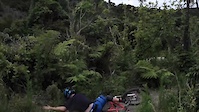
This is a fun easy trail full with banked turns and jumps. All obstacles can be either rolled over or by passed.

This is a great trail to practice skills or develop confidence.

All ages can ride it.

Access Info

Access is from the Wetland loop. If you are riding the loop clockwise the entrance to Banker is on the right next to the pump track.

Local Trail Association

Recent Activity on Trail

Past Week
  • 1 rides
  • 6 miles average
6 Months
  • 75 rides
  • 11 miles avg distance
All
  • 882 rides
  • Last: Jun 16, 2026
c1c2c3c4
January
February
March
April
May
June
July
August
September
October
November
December
Status:
on Oct 25, 2025
Ideal
Avg: 3.57 (6 votes)
Your vote: 0

view (12,307)
close
3D
Trail Conditions
  • Unknown
  • Snow Groomed
  • Snow Packed
  • Snow Covered
  • Snow Cover Partial
  • Freeze/thaw Cycle
  • Icy
  • Prevalent Mud
  • Wet
  • Variable
  • Ideal
  • Dry
  • Very Dry
Trail Flow (Ridden Direction)
Trailforks scans users ridelogs to determine the most popular direction each trail is ridden. A good flowing trail network will have most trails flowing in a single direction according to their intension.
The colour categories are based on what percentage of riders are riding a trail in its intended direction.
  • > 96%
  • > 90%
  • > 80%
  • > 70%
  • > 50%
  • < 50%
  • bi-directional trail
  • no data
Trail Last Ridden
Trailforks scans ridelogs to determine the last time a trail was ridden.
  • < 2 days
  • < 1 week
  • < 2 weeks
  • < 1 month
  • < 6 months
  • > 6 months
Trail Ridden Direction
The intended direction a trail should be ridden.
  • Downhill Only
  • Downhill Primary
  • Both Directions
  • Uphill Primary
  • Uphill Only
  • One Direction
Contribute Details
Colors indicate trail is missing specified detail.
  • Description
  • Photos
  • Description & Photos
  • Videos
Trail Popularity ?
Trailforks scans ridelogs to determine which trails are ridden the most in the last 9 months. Trails are compared with nearby trails in the same city region with a possible 25 colour shades. Think of this as a heatmap, more rides = more kinetic energy = warmer colors.
  • most popular
  • popular
  • less popular
  • not popular
ATV/ORV/OHV Filter
Max Vehicle Width
inches
US Cell Coverage
Legend
cell carrier legend

Radar Time
Activity Recordings
Trailforks uses anonymized public activity data. ?
Activity Recordings
Trailforks uses anonymized public activity data. ?
Personal Heatmap
Activity Types
all / none
Options
2
Date range month
Winter Trails
Warning A routing network for winter maps does not exist. Selecting trails using the winter trails layer has been disabled.
Missing Trails
Most Popular
Least Popular
Trails are colored based on popularity. The more popular a trail is, the more red. Less popular trails trend towards green.
Jump Magnitude Heatmap
Heatmap of where riders jump on trails. Zoom in to see individual jumps, click circles to view jump details.
BC Backroad Status

Service Road Atlas is a free to use, community-driven service for viewing and creating reports on the numerous back-country service roads around B.C. and Alberta.

map legend
Slope Aspect
Direction the slope faces
Flat N NE E SE S SW W NW
Trails Deemphasized
Trails are shown in grey.
disable
Only show trails with no bike usage.
Enable
Suggested Layers
Based on selected activity type

    Save the current map location and zoom level as your default home location whenever this page is loaded.

    Save
        Directions to banker trailhead (-41.247249, 174.925926)

        Photos

        1 more »
        448 |
        Nov 21, 2011 @ 8:11pm
        Nov 21, 2011

        Videos

        1 more »
        Banker Stump Jump Crash Fail
        0:08 | 187 | Apr 23, 2021 , Lower Hutt

        Routes with this trail

        8 miles 1,475 ft 7
        Walk / ride from Wainu MTB park to Te White Riser
        13 miles 2,803 ft 22 Loop
        Up from Te Whiti park, couple of freewheel loops of upper bike park then down snails up jungles and return...
        8 miles 2,075 ft 17
        Big tracks at Waiu for half a day.

        1 Review & Comments


        We hope you've been enjoying Trailforks!

        Create a FREE account to view trail comments and much more.

        • By nikholden & contributors
        • #17357 - 4,202 views

        Frequently Asked Questions About Banker

        Where is Banker located?
        Banker is located in Wainuiomata Trail Park (WTP), Lower Hutt, New Zealand. It is part of the Wainuiomata Trail Park (WTP) trail network. The trailhead is located at coordinates -41.24725, 174.92593.
        How hard is Banker?
        Banker is rated as Green difficulty. The physical rating is Easy. The average grade is 5.073%.
        What is the elevation gain for Banker?
        The trail has 41 ft of elevation descent. The elevation ranges from 334 ft to 375 ft.
        Is Banker a point to point trail?
        Banker is not a point to point trail. The direction is Both Directions. The trail type is singletrack.

        Hit the Trail

        Open in App

        Get this trail on your phone instantly.
        open trail in app

        Download Trail

        Save to wishlist, Garmin & download.
        save the trail

        Find Related Routes

        Find routes and users activities that include this trail.
        find routes for this trail

        You must enter a description before submitting.