more stats
4,729 ft
Distance
113 ft
Climb
-308 ft
Descent
00:10:28
Avg time
-195 ft
Altitude change
904 ft
Altitude min
1,128 ft
Altitude max
1,128 ft
Altitude start
933 ft
Altitude end
-4.128%
Grade
-20.189%
Grade max
14.361%
Grade min
1,557 ft
Distance climb
2,788 ft
Distance down
383 ft
Distance flat
00:10:28
Avg time

Barham Ridge Details

  • Activities
    • Mountain Bike
    • Horse
    • Hike
    • Trail Running
  • Riding Area
    Santiago Oaks
    Orange, California
  • Difficulty Rating
  • Voted Difficulty
    Green (2 votes)
  • Local Popularity
    85 in Mountain Biking [+]
    • 95 in Trail Running
    • 70 in Hiking
    • 5 in Horseback
  • Global Ranking
    #51894 in Mountain Biking [+]
    • #19507 in Trail Running
    • #81326 in Hiking
    • #1236 in Horseback
  • Trail Type
    Singletrack
  • Bike Type
    AM, XC
  • Direction
    Both Directions
    Popular Direction Shown
  • Climb Difficulty
    Blue
  • Physical Rating
    Moderate
  • Trail Visibility
    Always easy to follow
  • Season
    Year Round
  • Family Friendly
    Yes
  • Dogs Allowed
    Yes
  • eBike Allowed
  • TTFs on Trail
    Berm, Drop, Jump, Rock Face

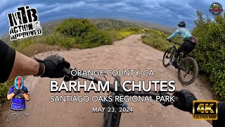
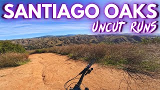
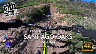
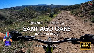
This trail travels along a ridge the connects the top Santiago Oaks to where the trails Chutes and Waterfall start. There are a few rock drops that have ride arounds. Traveling south to north is predominantly climbing, with uphill/downhill traffic occupying different parts of the trail. Traveling south from Deer/Coachwhip junction, the downhill route is through the singletrack that parallels and crosses the wider climbing road.

Access Info

From the south, the trail begins at the junction of both Goat and Chutes climbing routes. At the other end, this trail begins at the very top just below the flag on the north end.

Local Trail Association
Traditionally Indigenous Territory

Recent Activity on Trail

Past Week
  • 6 rides
  • 13 miles average
6 Months
  • 77 rides
  • 12 miles avg distance
All
  • 1,233 rides
  • Last: Jun 18, 2026
c1c2c3c4
January
February
March
April
May
June
July
August
September
October
November
December
Status:
on Oct 12, 2025
Dry
Avg: 4.09 (15 votes)
Your vote: 0

view (13,234)
close
3D
Trail Conditions
  • Unknown
  • Snow Groomed
  • Snow Packed
  • Snow Covered
  • Snow Cover Partial
  • Freeze/thaw Cycle
  • Icy
  • Prevalent Mud
  • Wet
  • Variable
  • Ideal
  • Dry
  • Very Dry
Trail Flow (Ridden Direction)
Trailforks scans users ridelogs to determine the most popular direction each trail is ridden. A good flowing trail network will have most trails flowing in a single direction according to their intension.
The colour categories are based on what percentage of riders are riding a trail in its intended direction.
  • > 96%
  • > 90%
  • > 80%
  • > 70%
  • > 50%
  • < 50%
  • bi-directional trail
  • no data
Trail Last Ridden
Trailforks scans ridelogs to determine the last time a trail was ridden.
  • < 2 days
  • < 1 week
  • < 2 weeks
  • < 1 month
  • < 6 months
  • > 6 months
Trail Ridden Direction
The intended direction a trail should be ridden.
  • Downhill Only
  • Downhill Primary
  • Both Directions
  • Uphill Primary
  • Uphill Only
  • One Direction
Contribute Details
Colors indicate trail is missing specified detail.
  • Description
  • Photos
  • Description & Photos
  • Videos
Trail Popularity ?
Trailforks scans ridelogs to determine which trails are ridden the most in the last 9 months. Trails are compared with nearby trails in the same city region with a possible 25 colour shades. Think of this as a heatmap, more rides = more kinetic energy = warmer colors.
  • most popular
  • popular
  • less popular
  • not popular
ATV/ORV/OHV Filter
Max Vehicle Width
inches
US Cell Coverage
Legend
cell carrier legend

Radar Time
Activity Recordings
Trailforks uses anonymized public activity data. ?
Activity Recordings
Trailforks uses anonymized public activity data. ?
Personal Heatmap
Activity Types
all / none
Options
2
Date range month
Winter Trails
Warning A routing network for winter maps does not exist. Selecting trails using the winter trails layer has been disabled.
Missing Trails
Most Popular
Least Popular
Trails are colored based on popularity. The more popular a trail is, the more red. Less popular trails trend towards green.
Jump Magnitude Heatmap
Heatmap of where riders jump on trails. Zoom in to see individual jumps, click circles to view jump details.
BC Backroad Status

Service Road Atlas is a free to use, community-driven service for viewing and creating reports on the numerous back-country service roads around B.C. and Alberta.

map legend
Slope Aspect
Direction the slope faces
Flat N NE E SE S SW W NW
Trails Deemphasized
Trails are shown in grey.
disable
Only show trails with no bike usage.
Enable
Suggested Layers
Based on selected activity type

    Save the current map location and zoom level as your default home location whenever this page is loaded.

    Save
        Directions to barham-ridge trailhead (33.826160, -117.754350)

        Photos

        13 more »
        119 |
        Feb 27, 2023 @ 11:08am
        Feb 27, 2023
        151 |
        Feb 24, 2023 @ 6:33pm
        Feb 24, 2023
        138 |
        Feb 24, 2023 @ 6:33pm
        Feb 24, 2023
        99 |
        Feb 25, 2022 @ 1:26am
        Feb 25, 2022

        Videos

        12 more »
        youtuber MTB Riding Chutes A Line At The Oaks, May 23,...
        5:36 | 174 | May 26, 2024 , Orange
        Would You Flourish or Flounder on My Home Trails?
        16:26 | 115 | Jan 31, 2024 , Orange
        youtuber MTB Riding Barham At The Oaks, January 22, 2023
        5:27 | 159 | Jan 23, 2023 , Orange
        youtuber MTB Riding Barham Ridge at Santiago Oaks,...
        3:13 | 154 | Feb 7, 2022 , Orange

        Routes with this trail

        5.0 6 miles 936 ft 6 Out & Back
        a great beginner intermediate route from the local content create mtb Alan, emtb is technically not...
        5.0 8 miles 1,232 ft 35 Loop
        Santiago Oaks is a well-known trail network located in Orange County. The park has multiple options for...
        5.0 8 miles 1,696 ft 11 Loop
        Route hitting most of the good stuff at Santiago Oaks, without waterfall.

        1 Review & Comments


        We hope you've been enjoying Trailforks!

        Create a FREE account to view trail comments and much more.

        • By Desertrat3511 & contributors
        • #7463 - 5,601 views

        Frequently Asked Questions About Barham Ridge

        Where is Barham Ridge located?
        Barham Ridge is located in Santiago Oaks, Orange, California, United States. It is part of the Santiago Oaks trail network. The trailhead is located at coordinates 33.82616, -117.75435.
        How hard is Barham Ridge?
        Barham Ridge is rated as Blue difficulty. The physical rating is Moderate. The average grade is 4.128%. The climb difficulty is rated Blue.
        What is the elevation gain for Barham Ridge?
        Barham Ridge has 113 ft of elevation gain. The trail has 308 ft of elevation descent. The elevation ranges from 904 ft to 1,128 ft.
        Is Barham Ridge a point to point trail?
        Barham Ridge is not a point to point trail. The direction is Both Directions. The trail type is singletrack.

        Hit the Trail

        Open in App

        Get this trail on your phone instantly.
        open trail in app

        Download Trail

        Save to wishlist, Garmin & download.
        save the trail

        Find Related Routes

        Find routes and users activities that include this trail.
        find routes for this trail

        You must enter a description before submitting.