more stats
1.4 miles
Distance
-1,136 ft
Descent
00:19:26
Avg time
-1,136 ft
Altitude change
523 ft
Altitude min
1,659 ft
Altitude max
1,659 ft
Altitude start
522 ft
Altitude end
-15.1%
Grade
-53.3%
Grade max
-1.8%
Grade min
1 mile
Distance down
00:19:26
Avg time

Bastardo Details

  • Activities
    • Mountain Bike
    • E-Bike
    • Hike
    • Trail Running
  • Riding Area
    Campocecina
    Carrara
  • Ref Number
    CAI365
  • Difficulty Rating
  • Voted Difficulty
    Proline (2 votes)
  • Local Popularity
    70 in Mountain Biking [+]
    • 75 in E-Biking
    • 95 in Trail Running
    • 5 in Hiking
  • Global Ranking
    #89507 in Mountain Biking [+]
    • #47994 in E-Biking
    • #135395 in Trail Running
    • #129221 in Hiking
  • Hiking SAC Scale
    T1 Hiking
  • Trail Type
    Singletrack
  • Bike Type
    DH, AM
  • Direction
    Downhill Primary
    Popular Direction Shown
  • Climb Difficulty
    Blue
  • Physical Rating
    Hard
  • Season
    all the year
  • Alpine Trail
    Yes
  • Dogs Allowed
    Yes
  • eBike Allowed
    Yes up to Class 1
  • TTFs on Trail
    Ladder Bridge, Rock Garden

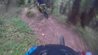
Sentiero di collegamento tra Castelpoggio e Casano di Ortonovo

Access Info

from the village of castelpoggio, sea side, at the base of the village. start is on the right after few meters from the start of via del soldato gravel road. or from ristorante mauro, above ortonovo village, take via del soldato till the end.

Recent Activity on Trail

Past Week
  • 0 rides
  •  
6 Months
  • 1 rides
  • 26.2 km avg distance
All
  • 11 rides
  • Last: Jun 14, 2026
c1c2c3c4
January
February
March
April
May
June
July
August
September
October
November
December
update trails status or condition

Bastardo Trail Reports

statusdatedescription
Apr 19, 2026 @ 4:01pm (Europe/Rome)
Apr 19, 2026
⚒️ Rimosse le piante cadute, passerelle sistemate, ponte finale nuovo e pulizia generale ⚒️
Apr 10, 2026 @ 8:49pm (Europe/Rome)
Apr 10, 2026
❌❌❌ 3 alberi in mezzo, ponte a metà rotto e i ponti finali non ci sono più!!!
Jun 22, 2025 @ 11:21am
Jun 22, 2025
Perfettamente percorribile
Jan 18, 2025 @ 8:59am
Jan 18, 2025
Jan 15, 2025 @ 10:00am
Jan 15, 2025
more »
Status:
on Apr 19, 2026
Ideal
Avg: 3.53 (7 votes)
Your vote: 0

view (265)
close
3D
Trail Conditions
  • Unknown
  • Snow Groomed
  • Snow Packed
  • Snow Covered
  • Snow Cover Partial
  • Freeze/thaw Cycle
  • Icy
  • Prevalent Mud
  • Wet
  • Variable
  • Ideal
  • Dry
  • Very Dry
Trail Flow (Ridden Direction)
Trailforks scans users ridelogs to determine the most popular direction each trail is ridden. A good flowing trail network will have most trails flowing in a single direction according to their intension.
The colour categories are based on what percentage of riders are riding a trail in its intended direction.
  • > 96%
  • > 90%
  • > 80%
  • > 70%
  • > 50%
  • < 50%
  • bi-directional trail
  • no data
Trail Last Ridden
Trailforks scans ridelogs to determine the last time a trail was ridden.
  • < 2 days
  • < 1 week
  • < 2 weeks
  • < 1 month
  • < 6 months
  • > 6 months
Trail Ridden Direction
The intended direction a trail should be ridden.
  • Downhill Only
  • Downhill Primary
  • Both Directions
  • Uphill Primary
  • Uphill Only
  • One Direction
Contribute Details
Colors indicate trail is missing specified detail.
  • Description
  • Photos
  • Description & Photos
  • Videos
Trail Popularity ?
Trailforks scans ridelogs to determine which trails are ridden the most in the last 9 months. Trails are compared with nearby trails in the same city region with a possible 25 colour shades. Think of this as a heatmap, more rides = more kinetic energy = warmer colors.
  • most popular
  • popular
  • less popular
  • not popular
ATV/ORV/OHV Filter
Max Vehicle Width
inches
US Cell Coverage
Legend
cell carrier legend

Radar Time
Activity Recordings
Trailforks uses anonymized public activity data. ?
Activity Recordings
Trailforks uses anonymized public activity data. ?
Personal Heatmap
Activity Types
all / none
Options
2
Date range month
Winter Trails
Warning A routing network for winter maps does not exist. Selecting trails using the winter trails layer has been disabled.
Missing Trails
Most Popular
Least Popular
Trails are colored based on popularity. The more popular a trail is, the more red. Less popular trails trend towards green.
Jump Magnitude Heatmap
Heatmap of where riders jump on trails. Zoom in to see individual jumps, click circles to view jump details.
BC Backroad Status

Service Road Atlas is a free to use, community-driven service for viewing and creating reports on the numerous back-country service roads around B.C. and Alberta.

map legend
Slope Aspect
Direction the slope faces
Flat N NE E SE S SW W NW
Trails Deemphasized
Trails are shown in grey.
disable
Only show trails with no bike usage.
Enable
Suggested Layers
Based on selected activity type

    Save the current map location and zoom level as your default home location whenever this page is loaded.

    Save
        Directions to bastardo trailhead (44.110100, 10.073240)

        Photos

        2 more »
        73 |
        Sep 4, 2025 @ 9:41am
        Sep 4, 2025
        101 |
        Feb 7, 2022 @ 11:34am
        Feb 7, 2022
        29 |
        Apr 19, 2026 @ 7:01am
        Apr 19, 2026

        Videos

        2 more »
        Le Nostre Strade - Il Bastardo
        13:27 | 288 | Oct 10, 2023 , Carrara
        Massa Carrara mtb trail Bastardo
        5:53 | 1038 | Apr 14, 2019 , Carrara

        1 Review & Comments


        We hope you've been enjoying Trailforks!

        Create a FREE account to view trail comments and much more.

        • By Valn1r & contributors
        • #92132 - 2,501 views

        Frequently Asked Questions About Bastardo

        Where is Bastardo located?
        Bastardo is located in Campocecina, Carrara, Italy. It is part of the Campocecina trail network. The trailhead is located at coordinates 44.1101, 10.07324.
        How hard is Bastardo?
        Bastardo is rated as Red difficulty. The physical rating is Hard. The average grade is 15.1%. The climb difficulty is rated Blue.
        What is the elevation gain for Bastardo?
        The trail has 346 m of elevation descent. The elevation ranges from 159 m to 506 m.
        Is Bastardo a point to point trail?
        Bastardo is not a point to point trail. The direction is Downhill Primary. The trail type is singletrack.

        Hit the Trail

        Open in App

        Get this trail on your phone instantly.
        open trail in app

        Download Trail

        Save to wishlist, Garmin & download.
        save the trail

        Find Related Routes

        Find routes and users activities that include this trail.
        find routes for this trail

        You must enter a description before submitting.