more stats
2.2 miles
Distance
-1,903 ft
Descent
00:16:54
Avg time
-1,903 ft
Altitude change
1,535 ft
Altitude min
3,438 ft
Altitude max
3,438 ft
Altitude start
1,535 ft
Altitude end
-16.5%
Grade
-77.9%
Grade max
-2.6%
Grade min
2 miles
Distance down
00:16:54
Avg time

Baume de Chat Details

  • Activities
    • Mountain Bike
    • E-Bike
    • Hike
    • Trail Running
  • Riding Area
  • Difficulty Rating
  • Voted Difficulty
    Red (1 vote)
  • Local Popularity
    40 in Mountain Biking [+]
    • 5 in E-Biking
    • 65 in Trail Running
    • 5 in Hiking
  • Global Ranking
    #94123 in Mountain Biking [+]
    • #107588 in E-Biking
    • #99315 in Trail Running
    • #138698 in Hiking
  • Hiking SAC Scale
    T1 Hiking
  • Trail Type
    Singletrack
  • Bike Type
    AM, XC
  • Direction
    Downhill Only
    Popular Direction Shown
  • Dogs Allowed
    Yes
  • eBike Allowed
    Yes up to Class 1

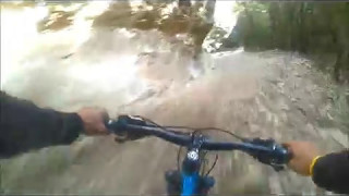
Cet itinéraire est parmi les plus appréciés du massif. Les 800 premiers mètres se déroulent sur une large crête parsemée de blocs rocheux, le sentier est sinueux et lent. La suite au fond d'une combe est un peu plus rapide, alternant passages caillouteux avec passages sur une terre noire.

Access Info

Généralement par la piste des graviers blancs.

Local Trail Association

Recent Activity on Trail

Past Week
  • 0 rides
  •  
6 Months
  • 0 rides
  •  
All
  • 1 rides
  • Last: Oct 21, 2023
c1c2c3c4
January
February
March
April
May
June
July
August
September
October
November
December
update trails status or condition

Baume de Chat Trail Reports

statusdatedescription
Nov 15, 2025 @ 7:22pm (Europe/Paris)
Nov 15, 2025
absolument inintéressant à cause de son très mauvais état
Dec 27, 2022 @ 2:17am
Dec 27, 2022
Sentier fortement chamboulé par un orage: raviné avec beaucoup de grosses pierres.
Sep 30, 2022 @ 9:28am
Sep 30, 2022
Sep 30, 2022 @ 9:27am
Sep 30, 2022
Very nice Trail!! Unfortunetly a "Bikehater" put a lot of big stones on the Trail...
Jan 16, 2022 @ 12:59am
Jan 16, 2022
more »
Status:
on Nov 15, 2025
Dry
Avg: 4.32 (3 votes)
Your vote: 0

view (35)
close
3D
Trail Conditions
  • Unknown
  • Snow Groomed
  • Snow Packed
  • Snow Covered
  • Snow Cover Partial
  • Freeze/thaw Cycle
  • Icy
  • Prevalent Mud
  • Wet
  • Variable
  • Ideal
  • Dry
  • Very Dry
Trail Flow (Ridden Direction)
Trailforks scans users ridelogs to determine the most popular direction each trail is ridden. A good flowing trail network will have most trails flowing in a single direction according to their intension.
The colour categories are based on what percentage of riders are riding a trail in its intended direction.
  • > 96%
  • > 90%
  • > 80%
  • > 70%
  • > 50%
  • < 50%
  • bi-directional trail
  • no data
Trail Last Ridden
Trailforks scans ridelogs to determine the last time a trail was ridden.
  • < 2 days
  • < 1 week
  • < 2 weeks
  • < 1 month
  • < 6 months
  • > 6 months
Trail Ridden Direction
The intended direction a trail should be ridden.
  • Downhill Only
  • Downhill Primary
  • Both Directions
  • Uphill Primary
  • Uphill Only
  • One Direction
Contribute Details
Colors indicate trail is missing specified detail.
  • Description
  • Photos
  • Description & Photos
  • Videos
Trail Popularity ?
Trailforks scans ridelogs to determine which trails are ridden the most in the last 9 months. Trails are compared with nearby trails in the same city region with a possible 25 colour shades. Think of this as a heatmap, more rides = more kinetic energy = warmer colors.
  • most popular
  • popular
  • less popular
  • not popular
ATV/ORV/OHV Filter
Max Vehicle Width
inches
US Cell Coverage
Legend
cell carrier legend

Radar Time
Activity Recordings
Trailforks uses anonymized public activity data. ?
Activity Recordings
Trailforks uses anonymized public activity data. ?
Personal Heatmap
Activity Types
all / none
Options
2
Date range month
Winter Trails
Warning A routing network for winter maps does not exist. Selecting trails using the winter trails layer has been disabled.
Missing Trails
Most Popular
Least Popular
Trails are colored based on popularity. The more popular a trail is, the more red. Less popular trails trend towards green.
Jump Magnitude Heatmap
Heatmap of where riders jump on trails. Zoom in to see individual jumps, click circles to view jump details.
BC Backroad Status

Service Road Atlas is a free to use, community-driven service for viewing and creating reports on the numerous back-country service roads around B.C. and Alberta.

map legend
Slope Aspect
Direction the slope faces
Flat N NE E SE S SW W NW
Trails Deemphasized
Trails are shown in grey.
disable
Only show trails with no bike usage.
Enable
Suggested Layers
Based on selected activity type

    Save the current map location and zoom level as your default home location whenever this page is loaded.

    Save
        Directions to baume-de-chat trailhead (44.163380, 5.211490)

        Photos

        17 more »
        48 |
        Oct 5, 2024 @ 11:48pm
        Oct 5, 2024
        34 |
        Oct 5, 2024 @ 11:48pm
        Oct 5, 2024
        35 |
        Oct 5, 2024 @ 11:48pm
        Oct 5, 2024
        32 |
        Oct 5, 2024 @ 11:47pm
        Oct 5, 2024

        Videos

        2 more »
        Baume de chat, mont Ventoux
        9:26 | 384 | Dec 26, 2021 , Bédoin
        Combe du Cha
        10:01 | 354 | Feb 27, 2020 , Bédoin

        5 Reviews & Comments


        We hope you've been enjoying Trailforks!

        Create a FREE account to view trail comments and much more.

        Frequently Asked Questions About Baume de Chat

        Where is Baume de Chat located?
        Baume de Chat is located in Parc Naturel Régional du Mont-Ventoux, Bédoin, France. It is part of the Parc Naturel Régional du Mont-Ventoux trail network. The trailhead is located at coordinates 44.16338, 5.21149.
        How hard is Baume de Chat?
        Baume de Chat is rated as Red difficulty. The average grade is 16.5%.
        What is the elevation gain for Baume de Chat?
        The trail has 1,903 ft of elevation descent. The elevation ranges from 1,535 ft to 3,438 ft.
        Is Baume de Chat a point to point trail?
        Yes, Baume de Chat is a point to point trail. The direction is Downhill Only. The trail type is singletrack.

        Hit the Trail

        Open in App

        Get this trail on your phone instantly.
        open trail in app

        Download Trail

        Save to wishlist, Garmin & download.
        save the trail

        Find Related Routes

        Find routes and users activities that include this trail.
        find routes for this trail

        You must enter a description before submitting.