more stats
2.2 miles
Distance
-1,586 ft
Descent
2 miles
High Point
-1,586 ft
Altitude change
8,999 ft
Altitude min
10,585 ft
Altitude start
8,999 ft
Altitude end
-13.8%
Grade
-59.5%
Grade max
4.7%
Grade min
13 ft
Distance climb
2 miles
Distance down
187 ft
Distance flat

Bear Hole Trail Details

  • Activities
    • Hike
    • Mountain Bike
    • Winter Fat Bike
    • Horse
    • Trail Running
  • Riding Area
    Tushar Peaks
    Beaver, Utah
  • Ref Number
    #072
  • Difficulty Rating
  • Local Popularity
    5 in Mountain Biking [+]
    • 5 in Trail Running
    • 5 in Hiking
    • 5 in Horseback
  • Global Ranking
    #328270 in Mountain Biking [+]
    • #312490 in Trail Running
    • #297243 in Hiking
    • #9943 in Horseback
  • Hiking SAC Scale
    T3 Demanding Mountain Hiking
  • Trail Type
    Singletrack
  • Bike Type
    AM, XC, Fat
  • Direction
    Both Directions
  • Climb Difficulty
    Double Black Diamond
  • Physical Rating
    Hard
  • Trail Visibility
    Sometimes hard to follow
  • Dogs Allowed
    Yes
  • Land Owner
    USFS

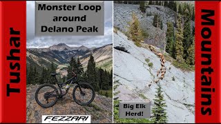
Super steep FS trail descending from Skyline NRT down into Cottonwood Creek. The lower part of it follows along the remains of an old road. Passes by the remains of a very old cabin.Steep wild descent on a MTB. Would not try to climb up on a bike. Steep beautiful hike up or down.

Recent Activity on Trail

Past Week
  • 0 rides
  •  
6 Months
  • 0 rides
  •  
All
  • 0 rides
  •  
update trails status or condition

Bear Hole Trail Trail Reports

no reports have been added for Bear Hole Trail yet, add a trail report.
Trail reports are used to indicate a trails current condition and inform builders and other riders about any issues on a trail.
Status:
no votes yet
Your vote: 0

view (1)
close
3D
Trail Conditions
  • Unknown
  • Snow Groomed
  • Snow Packed
  • Snow Covered
  • Snow Cover Partial
  • Freeze/thaw Cycle
  • Icy
  • Prevalent Mud
  • Wet
  • Variable
  • Ideal
  • Dry
  • Very Dry
Trail Flow (Ridden Direction)
Trailforks scans users ridelogs to determine the most popular direction each trail is ridden. A good flowing trail network will have most trails flowing in a single direction according to their intension.
The colour categories are based on what percentage of riders are riding a trail in its intended direction.
  • > 96%
  • > 90%
  • > 80%
  • > 70%
  • > 50%
  • < 50%
  • bi-directional trail
  • no data
Trail Last Ridden
Trailforks scans ridelogs to determine the last time a trail was ridden.
  • < 2 days
  • < 1 week
  • < 2 weeks
  • < 1 month
  • < 6 months
  • > 6 months
Trail Ridden Direction
The intended direction a trail should be ridden.
  • Downhill Only
  • Downhill Primary
  • Both Directions
  • Uphill Primary
  • Uphill Only
  • One Direction
Contribute Details
Colors indicate trail is missing specified detail.
  • Description
  • Photos
  • Description & Photos
  • Videos
Trail Popularity ?
Trailforks scans ridelogs to determine which trails are ridden the most in the last 9 months. Trails are compared with nearby trails in the same city region with a possible 25 colour shades. Think of this as a heatmap, more rides = more kinetic energy = warmer colors.
  • most popular
  • popular
  • less popular
  • not popular
ATV/ORV/OHV Filter
Max Vehicle Width
inches
US Cell Coverage
Legend
cell carrier legend

Radar Time
Activity Recordings
Trailforks uses anonymized public activity data. ?
Activity Recordings
Trailforks uses anonymized public activity data. ?
Personal Heatmap
Activity Types
all / none
Options
2
Date range month
Winter Trails
Warning A routing network for winter maps does not exist. Selecting trails using the winter trails layer has been disabled.
Missing Trails
Most Popular
Least Popular
Trails are colored based on popularity. The more popular a trail is, the more red. Less popular trails trend towards green.
Jump Magnitude Heatmap
Heatmap of where riders jump on trails. Zoom in to see individual jumps, click circles to view jump details.
BC Backroad Status

Service Road Atlas is a free to use, community-driven service for viewing and creating reports on the numerous back-country service roads around B.C. and Alberta.

map legend
Slope Aspect
Direction the slope faces
Flat N NE E SE S SW W NW
Trails Deemphasized
Trails are shown in grey.
disable
Only show trails with no bike usage.
Enable
Suggested Layers
Based on selected activity type

    Save the current map location and zoom level as your default home location whenever this page is loaded.

    Save
        Directions to bear-hole-trail trailhead (38.336320, -112.337230)

        Photos

        14 more »
        23 |
        Oct 1, 2023 @ 9:58am
        Oct 1, 2023
        24 |
        Sep 4, 2022 @ 5:54pm
        Sep 4, 2022
        17 |
        Sep 4, 2022 @ 5:54pm
        Sep 4, 2022
        26 |
        Sep 4, 2022 @ 5:54pm
        Sep 4, 2022

        Videos

        2 more »
        youtuber Big Epic Delano Peak Loop in the Tushar...
        37:38 | 103 | Sep 25, 2023 , Beaver
        Lake Stream Trail to Bear Hole with Skydio 2...
        32:12 | 76 | Aug 18, 2022 , Beaver

        Reviews / Comments

        No reviews yet, be the first to write a review or ask a question.
        Use trail reports to comment on trail conditions.


        We hope you've been enjoying Trailforks!

        Create a FREE account to view trail comments and much more.

        • By minerbikerTF Pro & contributors
        • #554485 - 429 views

        Frequently Asked Questions About Bear Hole Trail

        Where is Bear Hole Trail located?
        Bear Hole Trail is located in Tushar Peaks, Beaver, Utah, United States. It is part of the Tushar Peaks trail network. The trailhead is located at coordinates 38.33632, -112.33723.
        How hard is Bear Hole Trail?
        Bear Hole Trail is rated as Black Diamond difficulty. The physical rating is Hard. The average grade is 13.8%. The climb difficulty is rated Double Black Diamond.
        What is the elevation gain for Bear Hole Trail?
        The trail has 1,586 ft of elevation descent. The elevation ranges from 8,999 ft to 10,587 ft.
        Is Bear Hole Trail a point to point trail?
        Bear Hole Trail is not a point to point trail. The direction is Both Directions. The trail type is singletrack.

        Hit the Trail

        Open in App

        Get this trail on your phone instantly.
        open trail in app

        Download Trail

        Save to wishlist, Garmin & download.
        save the trail

        Find Related Routes

        Find routes and users activities that include this trail.
        find routes for this trail

        You must enter a description before submitting.