more stats
1.4 miles
Distance
142 ft
Climb
-143 ft
Descent
00:11:46
Avg time
-1 ft
Altitude change
3,060 ft
Altitude min
3,201 ft
Altitude max
3,062 ft
Altitude start
3,061 ft
Altitude end
-16.6%
Grade max
17.4%
Grade min
3,114 ft
Distance climb
2,589 ft
Distance down
1,322 ft
Distance flat
00:11:46
Avg time

Bears Best Details

  • Activities
    • Mountain Bike
    • Hike
    • Trail Running
  • Riding Area
    Red Rock - Bear’s Best
    Las Vegas, Nevada
  • Difficulty Rating
  • Local Popularity
    100 in Mountain Biking [+]
    • 60 in Trail Running
    • 85 in Hiking
  • Global Ranking
    #40992 in Mountain Biking [+]
    • #98419 in Trail Running
    • #50251 in Hiking
  • Trail Type
    Singletrack
  • Bike Type
    XC
  • Direction
    Both Directions
  • Climb Difficulty
    Green
  • Physical Rating
    Moderate
  • Dogs Allowed
    Yes
  • eBike Allowed
  • TTFs on Trail
    Bridge, Rock Garden

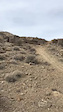
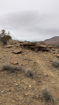
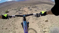
Desert trails with a rocky washes, bridges, and flowing singletrack. The trails are mostly gentle climbs and can be combined for miles of fun, right in the city. Used to be a lot bigger, but now you can only skirt the outside.

This trail is unsanctioned.

Trail Supporters
  • BLM
    BLM
    Land Manager

Recent Activity on Trail

Past Week
  • 4 rides
  • 11 miles average
6 Months
  • 119 rides
  • 13 miles avg distance
All
  • 1,449 rides
  • Last: Jun 16, 2026
c1c2c3c4
January
February
March
April
May
June
July
August
September
October
November
December
update trails status or condition

Bears Best Trail Reports

statusdatedescription
Feb 13, 2026 @ 2:06pm (America/Los_Angeles)
Feb 13, 2026
Jan 12, 2026 @ 10:53pm (America/Los_Angeles)
Jan 12, 2026
Fun little loop
Nov 11, 2025 @ 10:26am (America/Los_Angeles)
Nov 11, 2025
Berrys Dive and TK are gone due to development. Only real way to get to PermaGrin ttfrom the N / NW is via Benchmark. Round the Outside dead ends...
Oct 18, 2025 @ 9:58am (America/Los_Angeles)
Oct 18, 2025
So much construction. Fences up everywhere. Bears Best (the area) is quickly getting taken over by development. So sad.
Oct 13, 2025 @ 6:54am (America/Los_Angeles)
Oct 13, 2025
more »
Status:
on Feb 13, 2026
Dry
Avg: 4 (14 votes)
Your vote: 0

view (9,623)
close
3D
Trail Conditions
  • Unknown
  • Snow Groomed
  • Snow Packed
  • Snow Covered
  • Snow Cover Partial
  • Freeze/thaw Cycle
  • Icy
  • Prevalent Mud
  • Wet
  • Variable
  • Ideal
  • Dry
  • Very Dry
Trail Flow (Ridden Direction)
Trailforks scans users ridelogs to determine the most popular direction each trail is ridden. A good flowing trail network will have most trails flowing in a single direction according to their intension.
The colour categories are based on what percentage of riders are riding a trail in its intended direction.
  • > 96%
  • > 90%
  • > 80%
  • > 70%
  • > 50%
  • < 50%
  • bi-directional trail
  • no data
Trail Last Ridden
Trailforks scans ridelogs to determine the last time a trail was ridden.
  • < 2 days
  • < 1 week
  • < 2 weeks
  • < 1 month
  • < 6 months
  • > 6 months
Trail Ridden Direction
The intended direction a trail should be ridden.
  • Downhill Only
  • Downhill Primary
  • Both Directions
  • Uphill Primary
  • Uphill Only
  • One Direction
Contribute Details
Colors indicate trail is missing specified detail.
  • Description
  • Photos
  • Description & Photos
  • Videos
Trail Popularity ?
Trailforks scans ridelogs to determine which trails are ridden the most in the last 9 months. Trails are compared with nearby trails in the same city region with a possible 25 colour shades. Think of this as a heatmap, more rides = more kinetic energy = warmer colors.
  • most popular
  • popular
  • less popular
  • not popular
ATV/ORV/OHV Filter
Max Vehicle Width
inches
US Cell Coverage
Legend
cell carrier legend

Radar Time
Activity Recordings
Trailforks uses anonymized public activity data. ?
Activity Recordings
Trailforks uses anonymized public activity data. ?
Personal Heatmap
Activity Types
all / none
Options
2
Date range month
Winter Trails
Warning A routing network for winter maps does not exist. Selecting trails using the winter trails layer has been disabled.
Missing Trails
Most Popular
Least Popular
Trails are colored based on popularity. The more popular a trail is, the more red. Less popular trails trend towards green.
Jump Magnitude Heatmap
Heatmap of where riders jump on trails. Zoom in to see individual jumps, click circles to view jump details.
BC Backroad Status

Service Road Atlas is a free to use, community-driven service for viewing and creating reports on the numerous back-country service roads around B.C. and Alberta.

map legend
Slope Aspect
Direction the slope faces
Flat N NE E SE S SW W NW
Trails Deemphasized
Trails are shown in grey.
disable
Only show trails with no bike usage.
Enable
Suggested Layers
Based on selected activity type

    Save the current map location and zoom level as your default home location whenever this page is loaded.

    Save
        Directions to bears-best trailhead (36.110680, -115.352960)

        Photos

        45 more »
        70 |
        Oct 19, 2024 @ 11:06am
        Oct 19, 2024
        205 |
        Mar 8, 2023 @ 11:49am
        Mar 8, 2023
        117 |
        Mar 8, 2023 @ 11:49am
        Mar 8, 2023
        143 |
        Sep 16, 2022 @ 9:56pm
        Sep 16, 2022

        Videos

        12 more »
        youtuber Best of Bears Best - Las Vegas’ Ultimate...
        14:34 | 17 | May 31, 2026 , Las Vegas
        good little crash
        0:11 | 272 | Feb 3, 2022 , Las Vegas
        Porn Star jump
        0:21 | 701 | Mar 15, 2018 , Las Vegas
        Mini edit from bears best jump line
        0:15 | 842 | May 3, 2016 , Las Vegas

        Routes with this trail

        4.3 32 miles 3,201 ft 21
        blue diamond to blue diamond around the cowboy
        5.0 11 miles 1,126 ft 16
        Bear's Best Access Road, connecting to Gnarley, Yellow Hoe, Round the Outside, back to the Access Road
        5.0 16 miles 1,778 ft 9 Loop
        Reserved for people who like to earn their DH.

        2 Reviews & Comments


        We hope you've been enjoying Trailforks!

        Create a FREE account to view trail comments and much more.

        • #4995 - 24,642 views

        Frequently Asked Questions About Bears Best

        Where is Bears Best located?
        Bears Best is located in Red Rock - Bear’s Best, Las Vegas, Nevada, United States. It is part of the Red Rock - Bear’s Best trail network. The trailhead is located at coordinates 36.11068, -115.35296.
        How hard is Bears Best?
        Bears Best is rated as Blue difficulty. The physical rating is Moderate. The climb difficulty is rated Green.
        What is the elevation gain for Bears Best?
        Bears Best has 142 ft of elevation gain. The trail has 143 ft of elevation descent. The elevation ranges from 3,060 ft to 3,201 ft.
        Is Bears Best a point to point trail?
        Bears Best is not a point to point trail. The direction is Both Directions. The trail type is singletrack.

        Hit the Trail

        Open in App

        Get this trail on your phone instantly.
        open trail in app

        Download Trail

        Save to wishlist, Garmin & download.
        save the trail

        Find Related Routes

        Find routes and users activities that include this trail.
        find routes for this trail

        You must enter a description before submitting.