more stats
1.2 miles
Distance
28 ft
Climb
-48 ft
Descent
00:08:55
Avg time
-20 ft
Altitude change
292 ft
Altitude min
316 ft
Altitude max
312 ft
Altitude start
292 ft
Altitude end
-0.3%
Grade
-10%
Grade max
8.8%
Grade min
1,394 ft
Distance climb
2,136 ft
Distance down
2,621 ft
Distance flat
00:08:55
Avg time

Beaver Flats Details

  • Activities
    • Mountain Bike
    • E-Bike
    • Winter Fat Bike
    • Hike
    • Trail Running
    • Snowshoe
    • Nordic Ski
  • Riding Area
    Don Valley
    Toronto, Ontario
  • AKA
    OOB
  • Difficulty Rating
  • Voted Difficulty
    Blue (3 votes)
  • Local Popularity
    75 in Mountain Biking [+]
    • 95 in E-Biking
    • 85 in Trail Running
    • 95 in Hiking
    • 5 in Snowshoeing
    • 100 in Nordic Skiing
  • Global Ranking
    #4383 in Mountain Biking [+]
    • #3647 in E-Biking
    • #248 in Trail Running
    • #1187 in Hiking
    • #1552 in Snowshoeing
  • Hiking SAC Scale
    T1 Hiking
  • Trail Type
    Singletrack
  • Bike Type
    AM, XC, Fat, CX
  • Direction
    Both Directions
  • Climb Difficulty
    Green
  • Physical Rating
    Easy
  • Trail Visibility
    Always easy to follow
  • Dogs Allowed
    Yes
  • eBike Allowed
    Yes up to Class 1
  • TTFs on Trail
    Berm, Bridge, Ladder Bridge, Log Ride, Rock Garden, Other
  • Land Owner
    City of Toronto / Toronto Region Conservation Authority

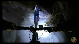
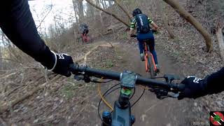
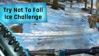
A mostly flat trail to the west side of a little branch of the Don River. Thanks to countless volunteer hours, the trail is quite ride-able, with wooden bridges, paving stones, cleared brush, and nice log rolls. The trail is more or less flat, with some twisty turns. Ride in both directions, but the flow is arguably better from north to south.

Beaver Flats is a classic bypass for Catalyst. When one sees a fork, just remember that Beaver stays quite close to the water, and generally does not climb very much.

Be wary of erosion along the river bank, especially after a storm. High water can also float trash onto the trail, so please help by carrying out a piece of garbage.

This trail is unsanctioned.

Recent Activity on Trail

Past Week
  • 0 rides
  •  
6 Months
  • 4 rides
  • 14 miles avg distance
All
  • 5,707 rides
  • Last: Jun 1, 2026
c1c2c3c4
January
February
March
April
May
June
July
August
September
October
November
December
update trails status or condition

Beaver Flats Trail Reports

statusdatedescription
May 25, 2026 @ 8:35pm (America/Toronto)
May 25, 2026
There is now a reroute around that particular section on the Northern half that was consistently flooded. Thanks to the Don Valley Rodents for the...
May 10, 2026 @ 7:03pm (America/Toronto)
May 10, 2026
Tried how far one can get from North, but soon became so muddy.
May 2, 2026 @ 3:56pm (America/Toronto)
May 2, 2026
South end to Overlea Boulevard is rideable but theres a fence up under the bridge citing tree removal and it even goes through Cata. The north...
Apr 23, 2026 @ 4:44pm (America/Toronto)
Apr 23, 2026
South end to construction is pretty good aside from the one section that is getting washed out slowly.
Oct 25, 2025 @ 11:21am (America/Toronto)
Oct 25, 2025
more »
Status:
on May 25, 2026
Wet
Avg: 3.66 (29 votes)
Your vote: 0

view (12,419)
close
3D
Trail Conditions
  • Unknown
  • Snow Groomed
  • Snow Packed
  • Snow Covered
  • Snow Cover Partial
  • Freeze/thaw Cycle
  • Icy
  • Prevalent Mud
  • Wet
  • Variable
  • Ideal
  • Dry
  • Very Dry
Trail Flow (Ridden Direction)
Trailforks scans users ridelogs to determine the most popular direction each trail is ridden. A good flowing trail network will have most trails flowing in a single direction according to their intension.
The colour categories are based on what percentage of riders are riding a trail in its intended direction.
  • > 96%
  • > 90%
  • > 80%
  • > 70%
  • > 50%
  • < 50%
  • bi-directional trail
  • no data
Trail Last Ridden
Trailforks scans ridelogs to determine the last time a trail was ridden.
  • < 2 days
  • < 1 week
  • < 2 weeks
  • < 1 month
  • < 6 months
  • > 6 months
Trail Ridden Direction
The intended direction a trail should be ridden.
  • Downhill Only
  • Downhill Primary
  • Both Directions
  • Uphill Primary
  • Uphill Only
  • One Direction
Contribute Details
Colors indicate trail is missing specified detail.
  • Description
  • Photos
  • Description & Photos
  • Videos
Trail Popularity ?
Trailforks scans ridelogs to determine which trails are ridden the most in the last 9 months. Trails are compared with nearby trails in the same city region with a possible 25 colour shades. Think of this as a heatmap, more rides = more kinetic energy = warmer colors.
  • most popular
  • popular
  • less popular
  • not popular
ATV/ORV/OHV Filter
Max Vehicle Width
inches
US Cell Coverage
Legend
cell carrier legend

Radar Time
Activity Recordings
Trailforks uses anonymized public activity data. ?
Activity Recordings
Trailforks uses anonymized public activity data. ?
Personal Heatmap
Activity Types
all / none
Options
2
Date range month
Winter Trails
Warning A routing network for winter maps does not exist. Selecting trails using the winter trails layer has been disabled.
Missing Trails
Most Popular
Least Popular
Trails are colored based on popularity. The more popular a trail is, the more red. Less popular trails trend towards green.
Jump Magnitude Heatmap
Heatmap of where riders jump on trails. Zoom in to see individual jumps, click circles to view jump details.
BC Backroad Status

Service Road Atlas is a free to use, community-driven service for viewing and creating reports on the numerous back-country service roads around B.C. and Alberta.

map legend
Slope Aspect
Direction the slope faces
Flat N NE E SE S SW W NW
Trails Deemphasized
Trails are shown in grey.
disable
Only show trails with no bike usage.
Enable
Suggested Layers
Based on selected activity type

    Save the current map location and zoom level as your default home location whenever this page is loaded.

    Save
        Directions to beaver-flats trailhead (43.715660, -79.346510)

        Photos

        56 more »
        417 |
        Oct 25, 2020 @ 6:42pm
        Oct 25, 2020
        27 |
        May 3, 2026 @ 8:05am
        May 3, 2026
        34 |
        May 2, 2026 @ 3:55pm
        May 2, 2026
        25 |
        May 2, 2026 @ 3:55pm
        May 2, 2026

        Videos

        9 more »
        Don Valley | Winterror Night Rolling Beaver...
        11:09 | 212 | May 23, 2022 , Toronto
        Don Valley MTB - Beaver Flats - North to South...
        9:28 | 417 | May 23, 2022 , Toronto
        Super Icy Trails in the Don Valley...
        9:57 | 252 | Mar 4, 2022 , Toronto
        Beaver Moon
        3:52 | 227 | Jul 27, 2021 , Toronto

        Routes with this trail

        5.0 59 miles 5,018 ft 111 Loop
        100k loop through the greater Valley, the route has almost no repeat sections. Consists mostly of...
        5.0 11 miles 875 ft 41 Loop
        Meeting at the Bridge in the Don Valley at the North End of Beaver Flats, we head south on for a warm up...
        8 miles 432 ft 14 Loop
        A small loop to try out a few green and blue runs in the . There is one short, steep black run that can be...

        17 Reviews & Comments


        We hope you've been enjoying Trailforks!

        Create a FREE account to view trail comments and much more.

        • #40940 - 11,656 views

        Frequently Asked Questions About Beaver Flats

        Where is Beaver Flats located?
        Beaver Flats is located in Don Valley, Toronto, Ontario, Canada. It is part of the Don Valley trail network. The trailhead is located at coordinates 43.71566, -79.34651.
        How hard is Beaver Flats?
        Beaver Flats is rated as Blue difficulty. The physical rating is Easy. The average grade is 0.3%. The climb difficulty is rated Green.
        What is the elevation gain for Beaver Flats?
        Beaver Flats has 9 m of elevation gain. The trail has 15 m of elevation descent. The elevation ranges from 89 m to 96 m.
        Is Beaver Flats a point to point trail?
        Beaver Flats is not a point to point trail. The direction is Both Directions. The trail type is singletrack.

        Hit the Trail

        Open in App

        Get this trail on your phone instantly.
        open trail in app

        Download Trail

        Save to wishlist, Garmin & download.
        save the trail

        Find Related Routes

        Find routes and users activities that include this trail.
        find routes for this trail

        You must enter a description before submitting.