more stats
1.3 miles
Distance
61 ft
Climb
-374 ft
Descent
00:15:32
Avg time
-315 ft
Altitude change
1,033 ft
Altitude min
1,377 ft
Altitude max
1,348 ft
Altitude start
1,033 ft
Altitude end
-4.5%
Grade
-34.3%
Grade max
16%
Grade min
1,539 ft
Distance climb
4,790 ft
Distance down
646 ft
Distance flat
00:15:32
Avg time

Belzébrute Details

  • Activities
    • Mountain Bike
    • E-Bike
  • Riding Area
    E47- Empire 47
    Lac Delage, Quebec
  • Difficulty Rating
  • Local Popularity
    90 in Mountain Biking [+]
    • 90 in E-Biking
  • Global Ranking
    #4963 in Mountain Biking
  • Trail Type
    Singletrack
  • Bike Type
    AM
  • Direction
    Downhill Only
    Popular Direction Shown
  • Climb Difficulty
    Green
  • Physical Rating
    Easy
  • Trail Visibility
    Always easy to follow
  • eBike Allowed
    Yes up to Class 1
  • TTFs on Trail
    Berm, Bridge, Drop, Jump, Gap Jump, Rock Face

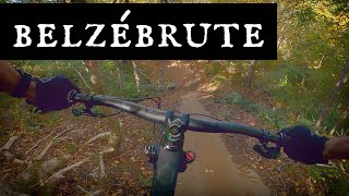
Sentier de FUNDURO - enduro accessible pour tous niveaux à partir d'intermédiaire (présence de lignes alternatives nommées LA BRUTE pour les riders plus avancés - drops, longues slabs, off-camber, etc).
Excellente piste pour progresser sur des slabs sécuritaires et fleurter avec les features.
Une piste aménagée par L'Organisation au printemps 2019.

Traditionally Indigenous Territory

Recent Activity on Trail

Past Week
  • 14 rides
  • 18.2 km average
6 Months
  • 37 rides
  • 23.3 km avg distance
All
  • 1,647 rides
  • Last: Jun 4, 2026
c1c2c3c4
January
February
March
April
May
June
July
August
September
October
November
December
update trails status or condition

Belzébrute Trail Reports

statusdatedescription
Oct 8, 2025 @ 1:53pm (America/Moncton)
Oct 8, 2025
reporter
Sep 18, 2025 @ 12:58pm (America/Toronto)
Sep 18, 2025
Great blue trail with optional black features. So fun. Best trail of the day.
Aug 26, 2025 @ 1:33pm
Aug 26, 2025
Jun 11, 2025 @ 6:56pm
Jun 11, 2025
Sep 24, 2024 @ 10:23am
Sep 24, 2024
Loved this trails sooooo much fun!
more »
Status:
on Oct 8, 2025
Variable
Avg: 4.18 (40 votes)
Your vote: 0

view (8,005)
close
3D
Trail Conditions
  • Unknown
  • Snow Groomed
  • Snow Packed
  • Snow Covered
  • Snow Cover Partial
  • Freeze/thaw Cycle
  • Icy
  • Prevalent Mud
  • Wet
  • Variable
  • Ideal
  • Dry
  • Very Dry
Trail Flow (Ridden Direction)
Trailforks scans users ridelogs to determine the most popular direction each trail is ridden. A good flowing trail network will have most trails flowing in a single direction according to their intension.
The colour categories are based on what percentage of riders are riding a trail in its intended direction.
  • > 96%
  • > 90%
  • > 80%
  • > 70%
  • > 50%
  • < 50%
  • bi-directional trail
  • no data
Trail Last Ridden
Trailforks scans ridelogs to determine the last time a trail was ridden.
  • < 2 days
  • < 1 week
  • < 2 weeks
  • < 1 month
  • < 6 months
  • > 6 months
Trail Ridden Direction
The intended direction a trail should be ridden.
  • Downhill Only
  • Downhill Primary
  • Both Directions
  • Uphill Primary
  • Uphill Only
  • One Direction
Contribute Details
Colors indicate trail is missing specified detail.
  • Description
  • Photos
  • Description & Photos
  • Videos
Trail Popularity ?
Trailforks scans ridelogs to determine which trails are ridden the most in the last 9 months. Trails are compared with nearby trails in the same city region with a possible 25 colour shades. Think of this as a heatmap, more rides = more kinetic energy = warmer colors.
  • most popular
  • popular
  • less popular
  • not popular
ATV/ORV/OHV Filter
Max Vehicle Width
inches
US Cell Coverage
Legend
cell carrier legend

Radar Time
Activity Recordings
Trailforks uses anonymized public activity data. ?
Activity Recordings
Trailforks uses anonymized public activity data. ?
Personal Heatmap
Activity Types
all / none
Options
2
Date range month
Winter Trails
Warning A routing network for winter maps does not exist. Selecting trails using the winter trails layer has been disabled.
Missing Trails
Most Popular
Least Popular
Trails are colored based on popularity. The more popular a trail is, the more red. Less popular trails trend towards green.
Jump Magnitude Heatmap
Heatmap of where riders jump on trails. Zoom in to see individual jumps, click circles to view jump details.
BC Backroad Status

Service Road Atlas is a free to use, community-driven service for viewing and creating reports on the numerous back-country service roads around B.C. and Alberta.

map legend
Slope Aspect
Direction the slope faces
Flat N NE E SE S SW W NW
Trails Deemphasized
Trails are shown in grey.
disable
Only show trails with no bike usage.
Enable
Suggested Layers
Based on selected activity type

    Save the current map location and zoom level as your default home location whenever this page is loaded.

    Save
        Directions to belzebrute trailhead (46.974040, -71.422170)

        Photos

        9 more »
        152 |
        Jul 19, 2024 @ 11:29am
        Jul 19, 2024
        121 |
        Jul 19, 2024 @ 11:30am
        Jul 19, 2024
        265 |
        Aug 10, 2022 @ 5:02am
        Aug 10, 2022
        294 |
        Oct 6, 2021 @ 6:28pm
        Oct 6, 2021

        Videos

        7 more »
        youtuber Another English POV -  Belzébrute at Empire 47
        14:46 | 763 | Oct 14, 2021 , Lac Delage
        youtuber De la Nouveauté à E47 - La Belzébrute ! !
        5:53 | 1941 | Aug 29, 2019 , Lac Delage
        Empire 47: Riding for the Mere Mortals
        11:00 | 68 | Aug 2, 2025 , Lac Delage
        Pad Religion + Belzébrute | Empire 47
        14:01 | 146 | Oct 16, 2023 , Lac Delage

        Routes with this trail

        4.0 10 miles 1,415 ft 5 Point to Point
        17 km mixed with Bleu and black trails. Mixed Crosscountry/Enduro
        1.0 7 miles 1,020 ft 7
        This is a varied circuit that requires significant pedalling to reach the top. The long descent, smooth...
        9 miles 1,246 ft 6 Loop
        intermediat route including sommit 1 and 2. Most popular trails to do.

        Reviews / Comments

        No reviews yet, be the first to write a review or ask a question.
        Use trail reports to comment on trail conditions.


        We hope you've been enjoying Trailforks!

        Create a FREE account to view trail comments and much more.

        • By julienmarceau E47 & contributors
        • #210930 - 4,590 views

        Frequently Asked Questions About Belzébrute

        Where is Belzébrute located?
        Belzébrute is located in E47- Empire 47, Lac Delage, Quebec, Canada. It is part of the E47- Empire 47 trail network. The trailhead is located at coordinates 46.97404, -71.42217.
        How hard is Belzébrute?
        Belzébrute is rated as Blue difficulty. The physical rating is Easy. The average grade is 4.5%. The climb difficulty is rated Green.
        What is the elevation gain for Belzébrute?
        Belzébrute has 61 ft of elevation gain. The trail has 374 ft of elevation descent. The elevation ranges from 1,033 ft to 1,377 ft.
        Is Belzébrute a point to point trail?
        Yes, Belzébrute is a point to point trail. The direction is Downhill Only. The trail type is singletrack.

        Hit the Trail

        Open in App

        Get this trail on your phone instantly.
        open trail in app

        Download Trail

        Save to wishlist, Garmin & download.
        save the trail

        Find Related Routes

        Find routes and users activities that include this trail.
        find routes for this trail

        You must enter a description before submitting.