TRAIL DATA QUALITY ERROR

C3 This trail potentially overlaps an existing trail. Trails should not overlap, the trail should be cropped or broken into multiple trails to avoid overlaps. In some cases trails parallel each other closely, falsely trigging this error.

#692400
#837563
more stats
1.4 miles
Distance
11 ft
Climb
-1,239 ft
Descent
00:08:59
Avg time
-1,239 ft
Altitude change
1,625 ft
Altitude min
2,864 ft
Altitude max
2,864 ft
Altitude start
1,624 ft
Altitude end
-16.9%
Grade
-80.7%
Grade max
4.4%
Grade min
233 ft
Distance climb
1 mile
Distance down
305 ft
Distance flat
00:08:59
Avg time

BielTrail Details

  • Activities
    • Mountain Bike
    • E-Bike
  • Riding Area
    Magglingen
    Biel/Bienne
  • Difficulty Rating
  • Voted Difficulty
    Red (3 votes)
  • Local Popularity
    95 in Mountain Biking [+]
    • 85 in E-Biking
  • Global Ranking
    #20687 in Mountain Biking [+]
    • #7994 in E-Biking
  • Trail Type
    Machine Groomed
  • Bike Type
    DH, AM
  • Climb Difficulty
    Green
  • Physical Rating
    Hard
  • Season
    Nov-Feb: kein Transport schmutziger Bikes, keine Waschanlage
  • eBike Allowed
    Yes up to Class 1
  • TTFs on Trail
    Drop, Jump
  • Ride in Rain
    Yes

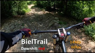
Kurze, steile Passagen, steinig, wurzelig, abwechslungsreich, Kicker von 2 – 9m, Chickenlines, Anlieger-Sektion.

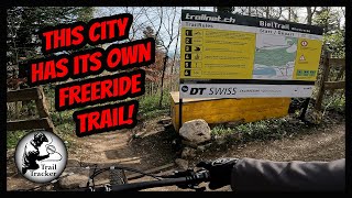
Beim Bau wurde Wert gelegt, die Eigenart des Geländes mit den verschiedenen Untergründen und Erhebungen auszunutzen. Streckenlänge: 1950m, Höhenmeter: 440 m. Magglingen Bahn fährt im 15min-Takt.

Reinigungsanlage: Hinter der Talstation Magglingen Bahn. Von November – Ende Februar werden keine stark verschmutzen Biker/Bikes transportiert. Keine Waschanlage in dieser Zeit.

Für Fragen zum Trail, Rückmeldungen usw: Meldet euch beim Betriebsleiter unter: bieltrail@trailnet.ch

Access Info

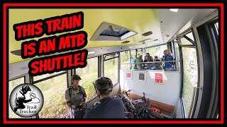
Shuttle mit der Magglingen Bahn. Tarife: https://www.vb-tpb.ch/de/tarife/

Local Trail Association

Recent Activity on Trail

Past Week
  • 5 rides
  • 16 miles average
6 Months
  • 64 rides
  • 19 miles avg distance
All
  • 217 rides
  • Last: Jun 17, 2026
c1c2c3c4
January
February
March
April
May
June
July
August
September
October
November
December
update trails status or condition

BielTrail Trail Reports

Status:
on Mar 21, 2026
Dry
Avg: 4.27 (32 votes)
Your vote: 0

view (2,722)
close
3D
Trail Conditions
  • Unknown
  • Snow Groomed
  • Snow Packed
  • Snow Covered
  • Snow Cover Partial
  • Freeze/thaw Cycle
  • Icy
  • Prevalent Mud
  • Wet
  • Variable
  • Ideal
  • Dry
  • Very Dry
Trail Flow (Ridden Direction)
Trailforks scans users ridelogs to determine the most popular direction each trail is ridden. A good flowing trail network will have most trails flowing in a single direction according to their intension.
The colour categories are based on what percentage of riders are riding a trail in its intended direction.
  • > 96%
  • > 90%
  • > 80%
  • > 70%
  • > 50%
  • < 50%
  • bi-directional trail
  • no data
Trail Last Ridden
Trailforks scans ridelogs to determine the last time a trail was ridden.
  • < 2 days
  • < 1 week
  • < 2 weeks
  • < 1 month
  • < 6 months
  • > 6 months
Trail Ridden Direction
The intended direction a trail should be ridden.
  • Downhill Only
  • Downhill Primary
  • Both Directions
  • Uphill Primary
  • Uphill Only
  • One Direction
Contribute Details
Colors indicate trail is missing specified detail.
  • Description
  • Photos
  • Description & Photos
  • Videos
Trail Popularity ?
Trailforks scans ridelogs to determine which trails are ridden the most in the last 9 months. Trails are compared with nearby trails in the same city region with a possible 25 colour shades. Think of this as a heatmap, more rides = more kinetic energy = warmer colors.
  • most popular
  • popular
  • less popular
  • not popular
ATV/ORV/OHV Filter
Max Vehicle Width
inches
US Cell Coverage
Legend
cell carrier legend

Radar Time
Activity Recordings
Trailforks uses anonymized public activity data. ?
Activity Recordings
Trailforks uses anonymized public activity data. ?
Personal Heatmap
Activity Types
all / none
Options
2
Date range month
Winter Trails
Warning A routing network for winter maps does not exist. Selecting trails using the winter trails layer has been disabled.
Missing Trails
Most Popular
Least Popular
Trails are colored based on popularity. The more popular a trail is, the more red. Less popular trails trend towards green.
Jump Magnitude Heatmap
Heatmap of where riders jump on trails. Zoom in to see individual jumps, click circles to view jump details.
BC Backroad Status

Service Road Atlas is a free to use, community-driven service for viewing and creating reports on the numerous back-country service roads around B.C. and Alberta.

map legend
Slope Aspect
Direction the slope faces
Flat N NE E SE S SW W NW
Trails Deemphasized
Trails are shown in grey.
disable
Only show trails with no bike usage.
Enable
Suggested Layers
Based on selected activity type

    Save the current map location and zoom level as your default home location whenever this page is loaded.

    Save
        Directions to bieltrail trailhead (47.139010, 7.214140)

        Photos

        28 more »
        172 |
        Jun 7, 2024 @ 10:12am
        Jun 7, 2024
        178 |
        Jun 7, 2024 @ 10:12am
        Jun 7, 2024
        155 |
        Jun 7, 2024 @ 10:12am
        Jun 7, 2024
        160 |
        Jun 7, 2024 @ 10:12am
        Jun 7, 2024

        Videos

        8 more »
        youtuber Enduro Trails in Biel
        13:14 | 262 | May 21, 2024 , Biel/Bienne
        youtuber Biel Trail - City Freeride Fun
        6:59 | 265 | May 25, 2024 , Biel/Bienne
        Biel trail
        6:44 | 132 | Jan 15, 2025 , Biel/Bienne
        Biel Trail Magglingen | 06.2021 | POV | 1440p
        7:05 | 357 | Jul 29, 2023 , Biel/Bienne

        Routes with this trail

        6 miles 687 ft 11
        Premier essai enchainement Macolin

        Reviews / Comments

        No reviews yet, be the first to write a review or ask a question.
        Use trail reports to comment on trail conditions.


        We hope you've been enjoying Trailforks!

        Create a FREE account to view trail comments and much more.

        • By jbbove & contributors
        • #34096 - 8,196 views

        Frequently Asked Questions About BielTrail

        Where is BielTrail located?
        BielTrail is located in Magglingen, Biel/Bienne, Switzerland. It is part of the Magglingen trail network. The trailhead is located at coordinates 47.13916, 7.21567.
        How hard is BielTrail?
        BielTrail is rated as Red difficulty. The physical rating is Hard. The average grade is 18.3%. The climb difficulty is rated Green.
        What is the elevation gain for BielTrail?
        The trail has 1,124 ft of elevation descent. The elevation ranges from 1,677 ft to 2,801 ft.
        Is BielTrail a point to point trail?
        Yes, BielTrail is a point to point trail. The direction is Downhill Only. The trail type is machine groomed.

        Hit the Trail

        Open in App

        Get this trail on your phone instantly.
        open trail in app

        Download Trail

        Save to wishlist, Garmin & download.
        save the trail

        Find Related Routes

        Find routes and users activities that include this trail.
        find routes for this trail

        You must enter a description before submitting.