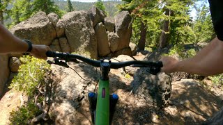
more stats
2.2 miles
Distance
27 ft
Climb
-768 ft
Descent
00:17:21
Avg time
-742 ft
Altitude change
7,109 ft
Altitude min
7,860 ft
Altitude max
7,853 ft
Altitude start
7,110 ft
Altitude end
-6.4%
Grade
-27.6%
Grade max
8.1%
Grade min
1,037 ft
Distance climb
2 miles
Distance down
302 ft
Distance flat
00:17:21
Avg time

Big Chief Trail (Upper) Details

  • Activities
    • Mountain Bike
    • E-Bike
    • Horse
    • Hike
    • Trail Running
  • Riding Area
    Big Chief
    Truckee, California
  • Ref Number
    #16E85
  • Difficulty Rating
  • Voted Difficulty
    Black Diamond (5 votes)
  • Local Popularity
    95 in Mountain Biking [+]
    • 95 in E-Biking
    • 35 in Trail Running
    • 50 in Hiking
    • 5 in Horseback
  • Global Ranking
    #19048 in Mountain Biking [+]
    • #1966 in E-Biking
    • #123837 in Trail Running
    • #74464 in Hiking
    • #840 in Horseback
  • Hiking SAC Scale
    T2 Mountain Hiking
  • Trail Type
    Singletrack
  • Bike Type
    DH, AM
  • Direction
    Downhill Primary
    Popular Direction Shown
  • Climb Difficulty
    Double Black Diamond
  • Physical Rating
    Hard
  • Trail Visibility
    Always easy to follow
  • Dogs Allowed
    Yes
  • eBike Allowed
    Yes up to Class 1
  • TTFs on Trail
    Berm, Drop, Jump, Gap Jump, Rock Face, Rock Garden
  • Land Owner
    USFS - Truckee Ranger District

Upper section of Big Chief Trail - if you enjoyed the features of the lower section but were hoping for a bit more momentum, you will love this section. The upper section is more difficult than the lower, with a handful of mandatory technical sections approaching double-black difficulty.

The Truckee Trails Foundation worked with the USFS and Northstar California on a 7-mile non-motorized trail connecting the southern tip of the Sawtooth Trail up to Watson Lake and the Tahoe Rim Trail. Construction was completed in fall of 2018. A huge thanks to the National Forest Foundation and REI for making this possible

Traditionally Indigenous Territory

Recent Activity on Trail

Past Week
  • 6 rides
  • 19 miles average
6 Months
  • 14 rides
  • 19 miles avg distance
All
  • 617 rides
  • Last: Jun 17, 2026
c1c2c3c4
January
February
March
April
May
June
July
August
September
October
November
December
update trails status or condition

Big Chief Trail... Trail Reports

statusdatedescription
Sep 9, 2025 @ 9:46am
Sep 9, 2025
Aug 5, 2025 @ 6:21pm
Aug 5, 2025
Dry but ok. No trees down.
Jun 4, 2025 @ 9:24am
Jun 4, 2025
Totally clear
Oct 20, 2024 @ 1:37pm
Oct 20, 2024
Riding really nice after the recent rain and snow.
Jul 6, 2024 @ 7:34am
Jul 6, 2024
more »
Status:
on Sep 9, 2025
Dry
Avg: 4.4 (31 votes)
Your vote: 0

view (3,041)
close
3D
Trail Conditions
  • Unknown
  • Snow Groomed
  • Snow Packed
  • Snow Covered
  • Snow Cover Partial
  • Freeze/thaw Cycle
  • Icy
  • Prevalent Mud
  • Wet
  • Variable
  • Ideal
  • Dry
  • Very Dry
Trail Flow (Ridden Direction)
Trailforks scans users ridelogs to determine the most popular direction each trail is ridden. A good flowing trail network will have most trails flowing in a single direction according to their intension.
The colour categories are based on what percentage of riders are riding a trail in its intended direction.
  • > 96%
  • > 90%
  • > 80%
  • > 70%
  • > 50%
  • < 50%
  • bi-directional trail
  • no data
Trail Last Ridden
Trailforks scans ridelogs to determine the last time a trail was ridden.
  • < 2 days
  • < 1 week
  • < 2 weeks
  • < 1 month
  • < 6 months
  • > 6 months
Trail Ridden Direction
The intended direction a trail should be ridden.
  • Downhill Only
  • Downhill Primary
  • Both Directions
  • Uphill Primary
  • Uphill Only
  • One Direction
Contribute Details
Colors indicate trail is missing specified detail.
  • Description
  • Photos
  • Description & Photos
  • Videos
Trail Popularity ?
Trailforks scans ridelogs to determine which trails are ridden the most in the last 9 months. Trails are compared with nearby trails in the same city region with a possible 25 colour shades. Think of this as a heatmap, more rides = more kinetic energy = warmer colors.
  • most popular
  • popular
  • less popular
  • not popular
ATV/ORV/OHV Filter
Max Vehicle Width
inches
US Cell Coverage
Legend
cell carrier legend

Radar Time
Activity Recordings
Trailforks uses anonymized public activity data. ?
Activity Recordings
Trailforks uses anonymized public activity data. ?
Personal Heatmap
Activity Types
all / none
Options
2
Date range month
Winter Trails
Warning A routing network for winter maps does not exist. Selecting trails using the winter trails layer has been disabled.
Missing Trails
Most Popular
Least Popular
Trails are colored based on popularity. The more popular a trail is, the more red. Less popular trails trend towards green.
Jump Magnitude Heatmap
Heatmap of where riders jump on trails. Zoom in to see individual jumps, click circles to view jump details.
BC Backroad Status

Service Road Atlas is a free to use, community-driven service for viewing and creating reports on the numerous back-country service roads around B.C. and Alberta.

map legend
Slope Aspect
Direction the slope faces
Flat N NE E SE S SW W NW
Trails Deemphasized
Trails are shown in grey.
disable
Only show trails with no bike usage.
Enable
Suggested Layers
Based on selected activity type

    Save the current map location and zoom level as your default home location whenever this page is loaded.

    Save
        Directions to big-chief-trail-upper-150776 trailhead (39.229500, -120.145840)

        Photos

        28 more »
        78 |
        Aug 5, 2025 @ 6:22pm
        Aug 5, 2025
        63 |
        Aug 5, 2025 @ 6:22pm
        Aug 5, 2025
        53 |
        Aug 5, 2025 @ 6:22pm
        Aug 5, 2025
        61 |
        Aug 5, 2025 @ 6:22pm
        Aug 5, 2025

        Videos

        15 more »
        youtuber Best Trail in Tahoe - Big Chief Trail -...
        15:16 | 1463 | Jan 3, 2020 , Truckee
        youtuber Mountain biking Big Chief trail (Lower...
        12:29 | 863 | Oct 20, 2019 , Truckee
        youtuber Big Chief Trail 2019 (Truckee, CA) Mountain Biking
        15:16 | 927 | Aug 4, 2019 , Truckee
        youtuber Big Chief Trail (Upper) / Truckee, CA / MTB
        6:47 | 104 | Jul 8, 2023 , Truckee

        Routes with this trail

        4.0 15 miles 1,946 ft 2 Loop
        Climb road drop trail. Mostly drop but definitely pedally and a little climbing on the "descent". Although...
        4.0 33 miles 5,129 ft 50
        Planning for a trip that is coming up.
        28 miles 3,648 ft 17 Loop
        Climb road drop trail. Mostly drop but definitely pedally and a little climbing on the "descent". Although...

        21 Reviews & Comments


        We hope you've been enjoying Trailforks!

        Create a FREE account to view trail comments and much more.

        • By TheAngryTomatoTF Pro TRAILFORKS & contributors
        • #150776 - 22,996 views

        Frequently Asked Questions About Big Chief Trail (Upper)

        Where is Big Chief Trail (Upper) located?
        Big Chief Trail (Upper) is located in Big Chief, Truckee, California, United States. It is part of the Big Chief trail network. The trailhead is located at coordinates 39.2295, -120.14584.
        How hard is Big Chief Trail (Upper)?
        Big Chief Trail (Upper) is rated as Black Diamond difficulty. The physical rating is Hard. The average grade is 6.4%. The climb difficulty is rated Double Black Diamond.
        What is the elevation gain for Big Chief Trail (Upper)?
        Big Chief Trail (Upper) has 27 ft of elevation gain. The trail has 768 ft of elevation descent. The elevation ranges from 7,109 ft to 7,860 ft.
        Is Big Chief Trail (Upper) a point to point trail?
        Big Chief Trail (Upper) is not a point to point trail. The direction is Downhill Primary. The trail type is singletrack.

        Hit the Trail

        Open in App

        Get this trail on your phone instantly.
        open trail in app

        Download Trail

        Save to wishlist, Garmin & download.
        save the trail

        Find Related Routes

        Find routes and users activities that include this trail.
        find routes for this trail

        You must enter a description before submitting.