more stats
2,871 ft
Distance
-725 ft
Descent
00:05:54
Avg time
-725 ft
Altitude change
2,545 ft
Altitude min
3,270 ft
Altitude max
3,270 ft
Altitude start
2,546 ft
Altitude end
-25.3%
Grade
-70.1%
Grade max
1%
Grade min
2,838 ft
Distance down
33 ft
Distance flat
00:05:54
Avg time

Billy Epic Details

  • Activities
    • Mountain Bike
    • E-Bike
    • Hike
    • Trail Running
    • Observed Trials
  • Riding Area
    Westside - Rainbow
    Whistler, British Columbia
  • Difficulty Rating
  • Voted Difficulty
    Black Diamond (1 vote)
  • Local Popularity
    70 in Mountain Biking [+]
    • 60 in E-Biking
    • 55 in Trail Running
    • 60 in Hiking
    • 85 in Observed Trials
  • Global Ranking
    #48009 in Mountain Biking [+]
    • #68831 in E-Biking
    • #110912 in Trail Running
    • #81293 in Hiking
    • #33 in Observed Trials
  • Hiking SAC Scale
    T2 Mountain Hiking
  • Trail Type
    Singletrack
  • Bike Type
    DH, AM, XC
  • Direction
    Downhill Primary
    Popular Direction Shown
  • Physical Rating
    Hard
  • Trail Visibility
    Always easy to follow
  • Dogs Allowed
    Yes
  • eBike Allowed
    Yes up to Class 1
  • TTFs on Trail
    Rock Face
  • Ride in Rain
    Yes

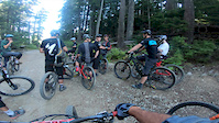
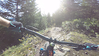
Billy Epic is an excellent old-school descent off the Flank Trail. The trail features outstanding views and great technical riding over rocks and roots. As you descend, take a moment to think about bikers in the mid-90s riding this trail with 2 inches of front suspension (and steep head tubes)

Access Info

The trail is accessed by riding to the top of Alpine Way and continuing along the dirt road as per Rick's Roost. Continue past the descent for Cat Scratch Fever and climb all the way to the Flank Trail. Travel south along the Flank Trail for about 10 or 15 minutes to a clearing (Paraglider's launch). The trail head for Bilyl Epic is about 5 minutes past this spot and is signed.

Local Trail Association

Recent Activity on Trail

Past Week
  • 1 rides
  • 7 miles average
6 Months
  • 37 rides
  • 15 miles avg distance
All
  • 525 rides
  • Last: Jun 24, 2026
c1c2c3c4
January
February
March
April
May
June
July
August
September
October
November
December
update trails status or condition

Billy Epic Trail Reports

statusdatedescription
Apr 17, 2026 @ 9:11pm (America/Vancouver)
Apr 17, 2026
reporter
Cleared the trees. You know that chute section near the bottom with the choose-your-own-adventure lines? Well the far left extra-spicy line has...
Mar 23, 2026 @ 9:22pm (America/Vancouver)
Mar 23, 2026
couple of medium trees down. If I was less lazy and taken my saw i could have moved them.
Aug 9, 2025 @ 8:31am
Aug 9, 2025
Jul 28, 2025 @ 12:58pm
Jul 28, 2025
Dry but running great
Jul 22, 2025 @ 8:15am
Jul 22, 2025
Super dry, quite sketchy in some places
more »
Status:
on Apr 17, 2026
Ideal
Avg: 4.34 (23 votes)
Your vote: 0

view (3,590)
close
3D
Trail Conditions
  • Unknown
  • Snow Groomed
  • Snow Packed
  • Snow Covered
  • Snow Cover Partial
  • Freeze/thaw Cycle
  • Icy
  • Prevalent Mud
  • Wet
  • Variable
  • Ideal
  • Dry
  • Very Dry
Trail Flow (Ridden Direction)
Trailforks scans users ridelogs to determine the most popular direction each trail is ridden. A good flowing trail network will have most trails flowing in a single direction according to their intension.
The colour categories are based on what percentage of riders are riding a trail in its intended direction.
  • > 96%
  • > 90%
  • > 80%
  • > 70%
  • > 50%
  • < 50%
  • bi-directional trail
  • no data
Trail Last Ridden
Trailforks scans ridelogs to determine the last time a trail was ridden.
  • < 2 days
  • < 1 week
  • < 2 weeks
  • < 1 month
  • < 6 months
  • > 6 months
Trail Ridden Direction
The intended direction a trail should be ridden.
  • Downhill Only
  • Downhill Primary
  • Both Directions
  • Uphill Primary
  • Uphill Only
  • One Direction
Contribute Details
Colors indicate trail is missing specified detail.
  • Description
  • Photos
  • Description & Photos
  • Videos
Trail Popularity ?
Trailforks scans ridelogs to determine which trails are ridden the most in the last 9 months. Trails are compared with nearby trails in the same city region with a possible 25 colour shades. Think of this as a heatmap, more rides = more kinetic energy = warmer colors.
  • most popular
  • popular
  • less popular
  • not popular
ATV/ORV/OHV Filter
Max Vehicle Width
inches
US Cell Coverage
Legend
cell carrier legend

Radar Time
Activity Recordings
Trailforks uses anonymized public activity data. ?
Activity Recordings
Trailforks uses anonymized public activity data. ?
Personal Heatmap
Activity Types
all / none
Options
2
Date range month
Winter Trails
Warning A routing network for winter maps does not exist. Selecting trails using the winter trails layer has been disabled.
Missing Trails
Most Popular
Least Popular
Trails are colored based on popularity. The more popular a trail is, the more red. Less popular trails trend towards green.
Jump Magnitude Heatmap
Heatmap of where riders jump on trails. Zoom in to see individual jumps, click circles to view jump details.
BC Backroad Status

Service Road Atlas is a free to use, community-driven service for viewing and creating reports on the numerous back-country service roads around B.C. and Alberta.

map legend
Slope Aspect
Direction the slope faces
Flat N NE E SE S SW W NW
Trails Deemphasized
Trails are shown in grey.
disable
Only show trails with no bike usage.
Enable
Suggested Layers
Based on selected activity type

    Save the current map location and zoom level as your default home location whenever this page is loaded.

    Save
        Directions to billy-epic trailhead (50.140680, -122.986810)

        Photos

        65 more »
        454 |
        Aug 18, 2017 @ 8:33pm
        Aug 18, 2017
        539 |
        Aug 14, 2017 @ 6:04pm
        Aug 14, 2017
        271 |
        Sep 15, 2020 @ 11:22pm
        Sep 15, 2020
        221 |
        Jun 6, 2020 @ 10:30am
        Jun 6, 2020

        Videos

        3 more »
        BILLY EPIC 4K - NEW JERRYS ON THE BLOCK
        2:35 | 1157 | Aug 16, 2020 , Whistler
        Media Day with the EWS in Whistler Stage 2 and 3
        3:22 | 431 | Aug 8, 2019 , Whistler
        First Ride Back
        0:43 | 595 | Jun 5, 2018 , Whistler

        Articles

        Video: Riding Some Of Whistler's Finest Singletrack
        Jun 24, 2019 from pinkbike.com
        Jason Lucas and Pete Matthews spent a day exploring three different networks around Whistler and share their first impressions.

        Trail Lists

        Routes with this trail

        3.0 5 miles 1,369 ft 6
        2021 Worca Virtual Toonie #6 by Free Radicals, Evo and RMU Time to check out what's so good about Alpine?...
        17 miles 4,540 ft 21
        Full Course: 5 Stages Stage 1 - > Stage 2 - > Cat Scratch Stage 3 - Stage 4 - > Howler Stage 5 -...
        75 miles 12,757 ft 73 Loop
        The Merritt Crown is a 12 hour 120 km 3300 vertical metres endurance race run in Merritt BC. Due to the...

        Trail Products

        5 Reviews & Comments


        We hope you've been enjoying Trailforks!

        Create a FREE account to view trail comments and much more.

        • By canadakaTF Pro Trailforks & contributors
        • #1669 - 13,647 views

        Frequently Asked Questions About Billy Epic

        Where is Billy Epic located?
        Billy Epic is located in Westside - Rainbow, Whistler, British Columbia, Canada. It is part of the Westside - Rainbow trail network. The trailhead is located at coordinates 50.14068, -122.98681.
        How hard is Billy Epic?
        Billy Epic is rated as Black Diamond difficulty. The physical rating is Hard. The average grade is 25.3%.
        What is the elevation gain for Billy Epic?
        The trail has 725 ft of elevation descent. The elevation ranges from 2,545 ft to 3,270 ft.
        Is Billy Epic a point to point trail?
        Billy Epic is not a point to point trail. The direction is Downhill Primary. The trail type is singletrack.

        Hit the Trail

        Open in App

        Get this trail on your phone instantly.
        open trail in app

        Download Trail

        Save to wishlist, Garmin & download.
        save the trail

        Find Related Routes

        Find routes and users activities that include this trail.
        find routes for this trail

        You must enter a description before submitting.