more stats
4,558 ft
Distance
389 ft
Climb
-175 ft
Descent
00:11:21
Avg time
215 ft
Altitude change
4,416 ft
Altitude min
4,631 ft
Altitude max
4,416 ft
Altitude start
4,631 ft
Altitude end
4.714%
Grade
-115.949%
Grade max
117.152%
Grade min
2,431 ft
Distance climb
1,742 ft
Distance down
385 ft
Distance flat
00:11:21
Avg time

Birdsong Details

  • Activities
    • Mountain Bike
    • Hike
    • Trail Running
  • Riding Area
    Ogden
    , Utah
  • Difficulty Rating
  • Voted Difficulty
    Green (1 vote)
  • Local Popularity
    65 in Mountain Biking [+]
    • 55 in Trail Running
    • 45 in Hiking
  • Global Ranking
    #101653 in Mountain Biking [+]
    • #98802 in Trail Running
    • #111530 in Hiking
  • Trail Type
    Singletrack
  • Bike Type
    XC
  • Direction
    Both Directions
  • Climb Difficulty
    Blue
  • Physical Rating
    Moderate
  • Dogs Allowed
    Yes

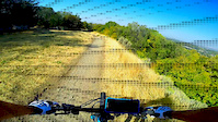
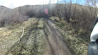
Really fun trail, that is part of the Rainbow Loop. Great in either direction, and when combined with the BST, the loop is a lot of fun. Some minor cliff exposure sets up on a little open mesa then drops you through a deep forested area with dense tree coverage.

Local Trail Association
Traditionally Indigenous Territory

Recent Activity on Trail

Past Week
  • 1 rides
  • 8 miles average
6 Months
  • 22 rides
  • 11 miles avg distance
All
  • 383 rides
  • Last: Jun 10, 2026
c1c2c3c4
January
February
March
April
May
June
July
August
September
October
November
December
update trails status or condition

Birdsong Trail Reports

statusdatedescription
May 8, 2026 @ 2:26pm (America/Boise)
May 8, 2026
May 1, 2026 @ 1:33pm (America/Boise)
May 1, 2026
Aug 17, 2025 @ 7:41am
Aug 17, 2025
closed still...
Apr 10, 2025 @ 1:06pm
Apr 10, 2025
Connection to BST is closed to clear trees. Birdsong DH is still accessible from the top, but you have to loop it.
Mar 25, 2025 @ 5:43pm
Mar 25, 2025
Open & dry mud pot holes
more »
Status:
on May 8, 2026
Dry
Avg: 3.59 (4 votes)
Your vote: 0

view (2,986)
close
3D
Trail Conditions
  • Unknown
  • Snow Groomed
  • Snow Packed
  • Snow Covered
  • Snow Cover Partial
  • Freeze/thaw Cycle
  • Icy
  • Prevalent Mud
  • Wet
  • Variable
  • Ideal
  • Dry
  • Very Dry
Trail Flow (Ridden Direction)
Trailforks scans users ridelogs to determine the most popular direction each trail is ridden. A good flowing trail network will have most trails flowing in a single direction according to their intension.
The colour categories are based on what percentage of riders are riding a trail in its intended direction.
  • > 96%
  • > 90%
  • > 80%
  • > 70%
  • > 50%
  • < 50%
  • bi-directional trail
  • no data
Trail Last Ridden
Trailforks scans ridelogs to determine the last time a trail was ridden.
  • < 2 days
  • < 1 week
  • < 2 weeks
  • < 1 month
  • < 6 months
  • > 6 months
Trail Ridden Direction
The intended direction a trail should be ridden.
  • Downhill Only
  • Downhill Primary
  • Both Directions
  • Uphill Primary
  • Uphill Only
  • One Direction
Contribute Details
Colors indicate trail is missing specified detail.
  • Description
  • Photos
  • Description & Photos
  • Videos
Trail Popularity ?
Trailforks scans ridelogs to determine which trails are ridden the most in the last 9 months. Trails are compared with nearby trails in the same city region with a possible 25 colour shades. Think of this as a heatmap, more rides = more kinetic energy = warmer colors.
  • most popular
  • popular
  • less popular
  • not popular
ATV/ORV/OHV Filter
Max Vehicle Width
inches
US Cell Coverage
Legend
cell carrier legend

Radar Time
Activity Recordings
Trailforks uses anonymized public activity data. ?
Activity Recordings
Trailforks uses anonymized public activity data. ?
Personal Heatmap
Activity Types
all / none
Options
2
Date range month
Winter Trails
Warning A routing network for winter maps does not exist. Selecting trails using the winter trails layer has been disabled.
Missing Trails
Most Popular
Least Popular
Trails are colored based on popularity. The more popular a trail is, the more red. Less popular trails trend towards green.
Jump Magnitude Heatmap
Heatmap of where riders jump on trails. Zoom in to see individual jumps, click circles to view jump details.
BC Backroad Status

Service Road Atlas is a free to use, community-driven service for viewing and creating reports on the numerous back-country service roads around B.C. and Alberta.

map legend
Slope Aspect
Direction the slope faces
Flat N NE E SE S SW W NW
Trails Deemphasized
Trails are shown in grey.
disable
Only show trails with no bike usage.
Enable
Suggested Layers
Based on selected activity type

    Save the current map location and zoom level as your default home location whenever this page is loaded.

    Save
        Directions to birdsong trailhead (41.235080, -111.930820)

        Photos

        2 more »
        131 |
        Feb 11, 2019 @ 9:44am
        Feb 11, 2019
        236 |
        Dec 10, 2015 @ 9:38am
        Dec 10, 2015
        35 |
        Aug 17, 2025 @ 7:41am
        Aug 17, 2025

        Videos

        2 more »
        Birdsong Down
        4:58 | 92 | Oct 10, 2020 , Ogden
        Songbird POV
        5:54 | 190 | Mar 9, 2015 , Ogden

        Routes with this trail

        8 miles 1,202 ft 5 Loop
        a decent amount of climbing combined with some fun / fast downhill sections
        2 miles 383 ft 1
        13 miles 2,677 ft 9 Loop
        Out to the knob, down Ogden bike park, then up Indian trail and back on the road

        1 Review & Comments


        We hope you've been enjoying Trailforks!

        Create a FREE account to view trail comments and much more.

        • By toddTF Pro Trailforks & contributors
        • #11069 - 3,380 views

        Frequently Asked Questions About Birdsong

        Where is Birdsong located?
        Birdsong is located in Ogden, Utah, United States. It is part of the Ogden trail network. The trailhead is located at coordinates 41.23508, -111.93082.
        How hard is Birdsong?
        Birdsong is rated as Blue difficulty. The physical rating is Moderate. The average grade is 4.714%. The climb difficulty is rated Blue.
        What is the elevation gain for Birdsong?
        Birdsong has 389 ft of elevation gain. The trail has 175 ft of elevation descent. The elevation ranges from 4,416 ft to 4,631 ft.
        Is Birdsong a point to point trail?
        Birdsong is not a point to point trail. The direction is Both Directions. The trail type is singletrack.

        Hit the Trail

        Open in App

        Get this trail on your phone instantly.
        open trail in app

        Download Trail

        Save to wishlist, Garmin & download.
        save the trail

        Find Related Routes

        Find routes and users activities that include this trail.
        find routes for this trail

        You must enter a description before submitting.