This trail is archived
This trail is permanently closed/decommissioned
more stats
827 ft
Distance
-140 ft
Descent
00:17:42
Avg time
-140 ft
Altitude change
2,090 ft
Altitude min
2,230 ft
Altitude max
2,230 ft
Altitude start
2,090 ft
Altitude end
-16.91%
Grade
-33.467%
Grade max
-8.159%
Grade min
827 ft
Distance down
00:17:42
Avg time

Bitches Brew Details

  • Activities
    • Mountain Bike
    • Hike
    • Trail Running
  • Riding Area
    Mount Fromme
    North Vancouver, British Columbia
  • Difficulty Rating
  • Voted Difficulty
    Double Black Diamond (1 vote)
  • Local Popularity
    5 in Mountain Biking [+]
    • 5 in Trail Running
    • 5 in Hiking
  • Trail Type
    Singletrack
  • Bike Type
    DH, AM
  • Direction
    Downhill Primary
  • Physical Rating
    Hard
  • Dogs Allowed
    Yes
  • TTFs on Trail
    Drop, Skinny
  • Land Owner
    District of North Vancouver

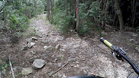
A short technical trail containing natural and man-made TTFs of doubtful structural.

Most of the man-made TTFs have been torn out and this is largely a decommissioned trail. The lower part of Bitches was merged into the new Executioner.

Access Info

About 15 feet off the end of the 6th switchback, look south for sign hanging on tree. GPS route goes from there to Dreamweaver Accessed off Executioner, it continues down past Dreamweaver to the Baden Powell or can turn onto Dreamweaver.

Recent Activity on Trail

Past Week
  • 0 rides
  •  
6 Months
  • 0 rides
  •  
All
  • 21 rides
  • Last: May 15, 2020
c1c2c3c4
January
February
March
April
May
June
July
August
September
October
November
December
update trails status or condition

Bitches Brew Trail Reports

statusdatedescription
Aug 2, 2018 @ 3:39pm
Aug 2, 2018
More hiking than biking. VERY gnarly. Use Exicutioner to access Dreamweaver.
Jun 29, 2016 @ 2:13am
Jun 29, 2016
The entire 2nd half of the trail is covered in fallen trees and is being reclaimed by the forest. A slog to get out and hike upto Executioner. Or...
Oct 6, 2015 @ 7:35pm
Oct 6, 2015
Pretty much out of action. Mother Nature is well on the way to reclaiming.
Mar 7, 2015 @ 2:59pm
Mar 7, 2015
Most of the features are rotted out. Really in need of refurbishing.
Nov 11, 2014 @ 5:08pm
Nov 11, 2014
more »
Status:
on Aug 2, 2018
Avg: 3.74 (10 votes)
Your vote: 0

view (132)
close
3D
Trail Conditions
  • Unknown
  • Snow Groomed
  • Snow Packed
  • Snow Covered
  • Snow Cover Partial
  • Freeze/thaw Cycle
  • Icy
  • Prevalent Mud
  • Wet
  • Variable
  • Ideal
  • Dry
  • Very Dry
Trail Flow (Ridden Direction)
Trailforks scans users ridelogs to determine the most popular direction each trail is ridden. A good flowing trail network will have most trails flowing in a single direction according to their intension.
The colour categories are based on what percentage of riders are riding a trail in its intended direction.
  • > 96%
  • > 90%
  • > 80%
  • > 70%
  • > 50%
  • < 50%
  • bi-directional trail
  • no data
Trail Last Ridden
Trailforks scans ridelogs to determine the last time a trail was ridden.
  • < 2 days
  • < 1 week
  • < 2 weeks
  • < 1 month
  • < 6 months
  • > 6 months
Trail Ridden Direction
The intended direction a trail should be ridden.
  • Downhill Only
  • Downhill Primary
  • Both Directions
  • Uphill Primary
  • Uphill Only
  • One Direction
Contribute Details
Colors indicate trail is missing specified detail.
  • Description
  • Photos
  • Description & Photos
  • Videos
Trail Popularity ?
Trailforks scans ridelogs to determine which trails are ridden the most in the last 9 months. Trails are compared with nearby trails in the same city region with a possible 25 colour shades. Think of this as a heatmap, more rides = more kinetic energy = warmer colors.
  • most popular
  • popular
  • less popular
  • not popular
ATV/ORV/OHV Filter
Max Vehicle Width
inches
US Cell Coverage
Legend
cell carrier legend

Radar Time
Activity Recordings
Trailforks uses anonymized public activity data. ?
Activity Recordings
Trailforks uses anonymized public activity data. ?
Personal Heatmap
Activity Types
all / none
Options
2
Date range month
Winter Trails
Warning A routing network for winter maps does not exist. Selecting trails using the winter trails layer has been disabled.
Missing Trails
Most Popular
Least Popular
Trails are colored based on popularity. The more popular a trail is, the more red. Less popular trails trend towards green.
Jump Magnitude Heatmap
Heatmap of where riders jump on trails. Zoom in to see individual jumps, click circles to view jump details.
BC Backroad Status

Service Road Atlas is a free to use, community-driven service for viewing and creating reports on the numerous back-country service roads around B.C. and Alberta.

map legend
Slope Aspect
Direction the slope faces
Flat N NE E SE S SW W NW
Trails Deemphasized
Trails are shown in grey.
disable
Only show trails with no bike usage.
Enable
Suggested Layers
Based on selected activity type

    Save the current map location and zoom level as your default home location whenever this page is loaded.

    Save
        Directions to bitches-brew trailhead (49.362060, -123.068850)

        Photos

        9 more »
        263 |
        Nov 3, 2018 @ 8:28am
        Nov 3, 2018
        224 |
        Nov 3, 2018 @ 8:28am
        Nov 3, 2018
        319 |
        Jun 29, 2016 @ 11:54pm
        Jun 29, 2016
        594 |
        Aug 21, 2015 @ 10:57am
        Aug 21, 2015

        Videos

        1 more »
        Bitches Brew/Peer Gynt
        4:11 | 471 | May 21, 2017 , North Vancouver

        Trail Lists

        Reviews / Comments

        No reviews yet, be the first to write a review or ask a question.
        Use trail reports to comment on trail conditions.


        We hope you've been enjoying Trailforks!

        Create a FREE account to view trail comments and much more.

        • By canadakaTF Pro Trailforks & contributors
        • #165 - 8,356 views

        Hit the Trail

        Open in App

        Get this trail on your phone instantly.
        open trail in app

        Download Trail

        Save to wishlist, Garmin & download.
        save the trail

        Find Related Routes

        Find routes and users activities that include this trail.
        find routes for this trail

        You must enter a description before submitting.