more stats
3.4 miles
Distance
101 ft
Climb
-1,592 ft
Descent
00:42:49
Avg time
-1,491 ft
Altitude change
748 ft
Altitude min
2,240 ft
Altitude max
2,240 ft
Altitude start
748 ft
Altitude end
-8.3%
Grade
-58%
Grade max
19.2%
Grade min
2,500 ft
Distance climb
3 miles
Distance down
404 ft
Distance flat
00:42:49
Avg time

Black Cap Connector Details

  • Activities
    • Mountain Bike
    • Hike
    • Trail Running
  • Riding Area
    East Side Trails (North Conway)
    Conway, New Hampshire
  • Difficulty Rating
  • Local Popularity
    35 in Mountain Biking [+]
    • 65 in Trail Running
    • 50 in Hiking
  • Global Ranking
    #79480 in Mountain Biking [+]
    • #89578 in Trail Running
    • #32579 in Hiking
  • Hiking SAC Scale
    T2 Mountain Hiking
  • Trail Type
    Singletrack
  • Bike Type
    AM, XC
  • Direction
    Downhill Primary
    Popular Direction Shown
  • Climb Difficulty
    Black Diamond
  • Physical Rating
    Hard
  • Trail Visibility
    Always easy to follow
  • Alpine Trail
    Yes
  • eBike Allowed
  • Land Owner

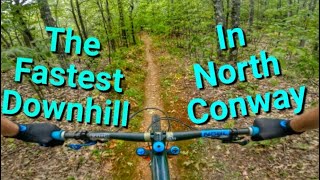
A North Conway classic, Black Cap connector follows an old motorcycle trail along the ridge from Black cap to Peaked. This trail has a backcountry feel, and is maintained as such. Expect natural obstacles and wet conditions.

Local Trail Association
Traditionally Indigenous Territory

Recent Activity on Trail

Past Week
  • 1 rides
  • 23 miles average
6 Months
  • 3 rides
  • 19 miles avg distance
All
  • 132 rides
  • Last: Jun 22, 2026
c1c2c3c4
January
February
March
April
May
June
July
August
September
October
November
December
update trails status or condition

Black Cap Connector Trail Reports

statusdatedescription
Jan 8, 2026 @ 8:41pm (America/New_York)
Jan 8, 2026
reporter
Aug 23, 2025 @ 12:50pm
Aug 23, 2025
Rejected
the trail appears to be completely closed if approached from sidehill. it's double track at this point, and covered in brush and limbs clearly...
Jul 14, 2025 @ 1:44pm
Jul 14, 2025
snowmobile club has bull dozed top section down to mason brook trail intersection
May 28, 2025 @ 6:05am
May 28, 2025
reporter
Dec 6, 2024 @ 7:05am
Dec 6, 2024
reporter
more »
Status:
on Jan 8, 2026
Avg: 3.46 (11 votes)
Your vote: 0

view (515)
close
3D
Trail Conditions
  • Unknown
  • Snow Groomed
  • Snow Packed
  • Snow Covered
  • Snow Cover Partial
  • Freeze/thaw Cycle
  • Icy
  • Prevalent Mud
  • Wet
  • Variable
  • Ideal
  • Dry
  • Very Dry
Trail Flow (Ridden Direction)
Trailforks scans users ridelogs to determine the most popular direction each trail is ridden. A good flowing trail network will have most trails flowing in a single direction according to their intension.
The colour categories are based on what percentage of riders are riding a trail in its intended direction.
  • > 96%
  • > 90%
  • > 80%
  • > 70%
  • > 50%
  • < 50%
  • bi-directional trail
  • no data
Trail Last Ridden
Trailforks scans ridelogs to determine the last time a trail was ridden.
  • < 2 days
  • < 1 week
  • < 2 weeks
  • < 1 month
  • < 6 months
  • > 6 months
Trail Ridden Direction
The intended direction a trail should be ridden.
  • Downhill Only
  • Downhill Primary
  • Both Directions
  • Uphill Primary
  • Uphill Only
  • One Direction
Contribute Details
Colors indicate trail is missing specified detail.
  • Description
  • Photos
  • Description & Photos
  • Videos
Trail Popularity ?
Trailforks scans ridelogs to determine which trails are ridden the most in the last 9 months. Trails are compared with nearby trails in the same city region with a possible 25 colour shades. Think of this as a heatmap, more rides = more kinetic energy = warmer colors.
  • most popular
  • popular
  • less popular
  • not popular
ATV/ORV/OHV Filter
Max Vehicle Width
inches
US Cell Coverage
Legend
cell carrier legend

Radar Time
Activity Recordings
Trailforks uses anonymized public activity data. ?
Activity Recordings
Trailforks uses anonymized public activity data. ?
Personal Heatmap
Activity Types
all / none
Options
2
Date range month
Winter Trails
Warning A routing network for winter maps does not exist. Selecting trails using the winter trails layer has been disabled.
Missing Trails
Most Popular
Least Popular
Trails are colored based on popularity. The more popular a trail is, the more red. Less popular trails trend towards green.
Jump Magnitude Heatmap
Heatmap of where riders jump on trails. Zoom in to see individual jumps, click circles to view jump details.
BC Backroad Status

Service Road Atlas is a free to use, community-driven service for viewing and creating reports on the numerous back-country service roads around B.C. and Alberta.

map legend
Slope Aspect
Direction the slope faces
Flat N NE E SE S SW W NW
Trails Deemphasized
Trails are shown in grey.
disable
Only show trails with no bike usage.
Enable
Suggested Layers
Based on selected activity type

    Save the current map location and zoom level as your default home location whenever this page is loaded.

    Save
        Directions to black-cap-connector trailhead (44.054660, -71.068180)

        Photos

        3 more »
        78 |
        Apr 28, 2025 @ 3:14pm
        Apr 28, 2025
        187 |
        Jul 18, 2020 @ 1:55pm
        Jul 18, 2020
        71 |
        Sep 16, 2024 @ 5:18am
        Sep 16, 2024

        Videos

        1 more »
        youtuber The Fastest Downhill in North Conway NH |...
        12:21 | 1527 | Oct 3, 2020 , Conway

        Routes with this trail

        25 miles 3,986 ft 9 Loop
        East Side loop with elevation.
        1.4 19 miles 3,531 ft 12 Loop
        A Big Loop, Edited North Conway, NH
        17 miles 3,493 ft 20
        Bikepacking Day 1. From parking lot to Providence Pond Shelter

        6 Reviews & Comments


        We hope you've been enjoying Trailforks!

        Create a FREE account to view trail comments and much more.

        • By charles0210 & contributors
        • #71741 - 6,038 views

        Frequently Asked Questions About Black Cap Connector

        Where is Black Cap Connector located?
        Black Cap Connector is located in East Side Trails (North Conway), Conway, New Hampshire, United States. It is part of the East Side Trails (North Conway) trail network. The trailhead is located at coordinates 44.05466, -71.06818.
        How hard is Black Cap Connector?
        Black Cap Connector is rated as Black Diamond difficulty. The physical rating is Hard. The average grade is 8.3%. The climb difficulty is rated Black Diamond.
        What is the elevation gain for Black Cap Connector?
        Black Cap Connector has 101 ft of elevation gain. The trail has 1,592 ft of elevation descent. The elevation ranges from 748 ft to 2,240 ft.
        Is Black Cap Connector a point to point trail?
        Black Cap Connector is not a point to point trail. The direction is Downhill Primary. The trail type is singletrack.

        Hit the Trail

        Open in App

        Get this trail on your phone instantly.
        open trail in app

        Download Trail

        Save to wishlist, Garmin & download.
        save the trail

        Find Related Routes

        Find routes and users activities that include this trail.
        find routes for this trail

        You must enter a description before submitting.