more stats
1.2 miles
Distance
76 ft
Climb
-537 ft
Descent
00:14:01
Avg time
-461 ft
Altitude change
2,130 ft
Altitude min
2,628 ft
Altitude max
2,597 ft
Altitude start
2,136 ft
Altitude end
-7.4%
Grade
-37.5%
Grade max
17.7%
Grade min
1,050 ft
Distance climb
5,079 ft
Distance down
66 ft
Distance flat
00:14:01
Avg time

Blunderbuss Details

  • Activities
    • Mountain Bike
    • Horse
    • Hike
    • Trail Running
  • Riding Area
    McDonald Hollow
    Blacksburg, Virginia
  • Difficulty Rating
  • Voted Difficulty
    Double Black Diamond (2 votes)
  • Local Popularity
    70 in Mountain Biking [+]
    • 70 in Trail Running
    • 45 in Hiking
    • 5 in Horseback
  • Global Ranking
    #19721 in Mountain Biking [+]
    • #106973 in Hiking
  • Hiking SAC Scale
    T1 Hiking
  • Trail Type
    Singletrack
  • Bike Type
    AM
  • Direction
    Downhill Primary
    Popular Direction Shown
  • Climb Difficulty
    Black Diamond
  • Physical Rating
    Hard
  • Dogs Allowed
    Yes
  • eBike Allowed
  • TTFs on Trail
    A-Frame, Berm, Drop, Jump, Gap Jump, Rock Garden

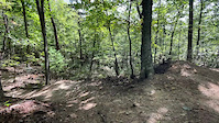
Great two flavors trail with jumps and some big optional gaps. Flows well and is fast from the top, then gets chunky a bit after crossing Highway. The trail climbs after the rocks near Wilkes Wood before descending on a moderate grade, gradually steepening with more airtime options. After one last easy climb, the final descent contains the biggest features on the trail, with numerous step downs, the biggest of which is the rock drop under the power lines, to a large step-up. More flow after these features, before the trail ends, intersecting with the upper part of Ida May.

Trail Supporters
Local Trail Association
Traditionally Indigenous Territory

Recent Activity on Trail

Past Week
  • 2 rides
  • 5 miles average
6 Months
  • 13 rides
  • 8 miles avg distance
All
  • 70 rides
  • Last: Jun 16, 2026
c1c2c3c4
January
February
March
April
May
June
July
August
September
October
November
December
update trails status or condition

Blunderbuss Trail Reports

Status:
on Jan 6, 2026
Very Dry
Avg: 4.17 (6 votes)
Your vote: 0

view (823)
close
3D
Trail Conditions
  • Unknown
  • Snow Groomed
  • Snow Packed
  • Snow Covered
  • Snow Cover Partial
  • Freeze/thaw Cycle
  • Icy
  • Prevalent Mud
  • Wet
  • Variable
  • Ideal
  • Dry
  • Very Dry
Trail Flow (Ridden Direction)
Trailforks scans users ridelogs to determine the most popular direction each trail is ridden. A good flowing trail network will have most trails flowing in a single direction according to their intension.
The colour categories are based on what percentage of riders are riding a trail in its intended direction.
  • > 96%
  • > 90%
  • > 80%
  • > 70%
  • > 50%
  • < 50%
  • bi-directional trail
  • no data
Trail Last Ridden
Trailforks scans ridelogs to determine the last time a trail was ridden.
  • < 2 days
  • < 1 week
  • < 2 weeks
  • < 1 month
  • < 6 months
  • > 6 months
Trail Ridden Direction
The intended direction a trail should be ridden.
  • Downhill Only
  • Downhill Primary
  • Both Directions
  • Uphill Primary
  • Uphill Only
  • One Direction
Contribute Details
Colors indicate trail is missing specified detail.
  • Description
  • Photos
  • Description & Photos
  • Videos
Trail Popularity ?
Trailforks scans ridelogs to determine which trails are ridden the most in the last 9 months. Trails are compared with nearby trails in the same city region with a possible 25 colour shades. Think of this as a heatmap, more rides = more kinetic energy = warmer colors.
  • most popular
  • popular
  • less popular
  • not popular
ATV/ORV/OHV Filter
Max Vehicle Width
inches
US Cell Coverage
Legend
cell carrier legend

Radar Time
Activity Recordings
Trailforks uses anonymized public activity data. ?
Activity Recordings
Trailforks uses anonymized public activity data. ?
Personal Heatmap
Activity Types
all / none
Options
2
Date range month
Winter Trails
Warning A routing network for winter maps does not exist. Selecting trails using the winter trails layer has been disabled.
Missing Trails
Most Popular
Least Popular
Trails are colored based on popularity. The more popular a trail is, the more red. Less popular trails trend towards green.
Jump Magnitude Heatmap
Heatmap of where riders jump on trails. Zoom in to see individual jumps, click circles to view jump details.
BC Backroad Status

Service Road Atlas is a free to use, community-driven service for viewing and creating reports on the numerous back-country service roads around B.C. and Alberta.

map legend
Slope Aspect
Direction the slope faces
Flat N NE E SE S SW W NW
Trails Deemphasized
Trails are shown in grey.
disable
Only show trails with no bike usage.
Enable
Suggested Layers
Based on selected activity type

    Save the current map location and zoom level as your default home location whenever this page is loaded.

    Save
        Directions to blunderbuss trailhead (37.249210, -80.487100)

        Photos

        43 more »
        213 |
        Oct 15, 2022 @ 11:14pm
        Oct 15, 2022
        136 |
        Oct 15, 2022 @ 11:14pm
        Oct 15, 2022
        132 |
        Oct 15, 2022 @ 11:15pm
        Oct 15, 2022
        142 |
        Aug 28, 2022 @ 3:23pm
        Aug 28, 2022

        Videos

        3 more »
        McDonald Hollow Park - Blunderbuss Trail
        2:17 | 631 | May 22, 2021 , Blacksburg
        Gopro Raw Footage: Blunderbuss, FlowTrail MTB ...
        0:10 | 438 | Apr 28, 2021 , Blacksburg
        'Tree Gap' Jump
        0:16 | 196 | Oct 18, 2021 , Blacksburg

        Routes with this trail

        14 miles 2,545 ft 8
        This is the official enduro route for the Virginia Tech Brush Mountain Blitz, 2024.
        21 miles 2,972 ft 18 Loop
        Long Route with technical climbs, fast and fun downhills and grenn cruising.
        21 miles 3,031 ft 19 Loop
        Do the Prickly Pear-Skull Cap-Trillium from McDonald Hollow, flowy greens, techy climbs (Snakeroot) fast...

        4 Reviews & Comments


        We hope you've been enjoying Trailforks!

        Create a FREE account to view trail comments and much more.

        Nearby Trails

        • By toddTF Pro Trailforks & contributors
        • #431507 - 2,543 views

        Frequently Asked Questions About Blunderbuss

        Where is Blunderbuss located?
        Blunderbuss is located in McDonald Hollow, Blacksburg, Virginia, United States. It is part of the McDonald Hollow trail network. The trailhead is located at coordinates 37.24921, -80.4871.
        How hard is Blunderbuss?
        Blunderbuss is rated as Black Diamond difficulty. The physical rating is Hard. The average grade is 7.4%. The climb difficulty is rated Black Diamond.
        What is the elevation gain for Blunderbuss?
        Blunderbuss has 76 ft of elevation gain. The trail has 537 ft of elevation descent. The elevation ranges from 2,130 ft to 2,628 ft.
        Is Blunderbuss a point to point trail?
        Blunderbuss is not a point to point trail. The direction is Downhill Primary. The trail type is singletrack.

        Hit the Trail

        Open in App

        Get this trail on your phone instantly.
        open trail in app

        Download Trail

        Save to wishlist, Garmin & download.
        save the trail

        Find Related Routes

        Find routes and users activities that include this trail.
        find routes for this trail

        You must enter a description before submitting.