more stats
1,457 ft
Distance
-3 ft
Descent
00:03:34
Avg time
-3 ft
Altitude change
2,725 ft
Altitude min
2,728 ft
Altitude max
2,728 ft
Altitude start
2,725 ft
Altitude end
-0.232%
Grade
-0.56%
Grade max
0.029%
Grade min
844 ft
Distance down
537 ft
Distance flat
00:03:34
Avg time

Bog Trail Details

  • Activities
    • Mountain Bike
    • Gravel Bike
    • Adaptive Bike
    • Hike
    • Trail Running
  • Riding Area
    Laurel Mountain
    Ligonier, Pennsylvania
  • Difficulty Rating
  • Local Popularity
    50 in Mountain Biking [+]
    • 5 in Trail Running
    • 75 in Hiking
  • Global Ranking
    #228904 in Mountain Biking [+]
    • #291668 in Trail Running
    • #79158 in Hiking
  • Trail Type
    Gravel Path
  • Bike Type
    XC, Gravel, Adaptive MTB
  • Direction
    Both Directions[+]
    • Both Directions for Gravel Biking
  • Climb Difficulty
    Green
  • Physical Rating
    Easy
  • Dogs Allowed
    Yes
  • Land Owner
    Forbes State Forest

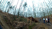
This dead end trail takes users to a boardwalk overlook of the scenic Spruce Flats Bog which contains a number of rare and unique plants. Display plaques provide more detailed information. This is a popular walking trail for those visiting Laurel Summit State Park, which is surrounded by Forbes State Forest. Riders should be alert for other users and yield accordingly. The Picnic Area Trail starts part way back this trail, on the right.

Access Info

Due to the nature of the soil and the ridge top location these trails should be avoided after it has recently rained. This a also a great place to cross country ski in the winter since the Laurel Ridge gets more snow than anywhere else Trails are closed to biking during snow cover. See www.paccsa.org/lrwebcam for webcam.

Traditionally Indigenous Territory

Recent Activity on Trail

Past Week
  • 0 rides
  •  
6 Months
  • 1 rides
  • 12 miles avg distance
All
  • 15 rides
  • Last: Jun 16, 2026
c1c2c3c4
January
February
March
April
May
June
July
August
September
October
November
December
update trails status or condition

Bog Trail Trail Reports

no reports have been added for Bog Trail yet, add a trail report.
Trail reports are used to indicate a trails current condition and inform builders and other riders about any issues on a trail.
Status:
no votes yet
Your vote: 0

view (206)
close
3D
Trail Conditions
  • Unknown
  • Snow Groomed
  • Snow Packed
  • Snow Covered
  • Snow Cover Partial
  • Freeze/thaw Cycle
  • Icy
  • Prevalent Mud
  • Wet
  • Variable
  • Ideal
  • Dry
  • Very Dry
Trail Flow (Ridden Direction)
Trailforks scans users ridelogs to determine the most popular direction each trail is ridden. A good flowing trail network will have most trails flowing in a single direction according to their intension.
The colour categories are based on what percentage of riders are riding a trail in its intended direction.
  • > 96%
  • > 90%
  • > 80%
  • > 70%
  • > 50%
  • < 50%
  • bi-directional trail
  • no data
Trail Last Ridden
Trailforks scans ridelogs to determine the last time a trail was ridden.
  • < 2 days
  • < 1 week
  • < 2 weeks
  • < 1 month
  • < 6 months
  • > 6 months
Trail Ridden Direction
The intended direction a trail should be ridden.
  • Downhill Only
  • Downhill Primary
  • Both Directions
  • Uphill Primary
  • Uphill Only
  • One Direction
Contribute Details
Colors indicate trail is missing specified detail.
  • Description
  • Photos
  • Description & Photos
  • Videos
Trail Popularity ?
Trailforks scans ridelogs to determine which trails are ridden the most in the last 9 months. Trails are compared with nearby trails in the same city region with a possible 25 colour shades. Think of this as a heatmap, more rides = more kinetic energy = warmer colors.
  • most popular
  • popular
  • less popular
  • not popular
ATV/ORV/OHV Filter
Max Vehicle Width
inches
US Cell Coverage
Legend
cell carrier legend

Radar Time
Activity Recordings
Trailforks uses anonymized public activity data. ?
Activity Recordings
Trailforks uses anonymized public activity data. ?
Personal Heatmap
Activity Types
all / none
Options
2
Date range month
Winter Trails
Warning A routing network for winter maps does not exist. Selecting trails using the winter trails layer has been disabled.
Missing Trails
Most Popular
Least Popular
Trails are colored based on popularity. The more popular a trail is, the more red. Less popular trails trend towards green.
Jump Magnitude Heatmap
Heatmap of where riders jump on trails. Zoom in to see individual jumps, click circles to view jump details.
BC Backroad Status

Service Road Atlas is a free to use, community-driven service for viewing and creating reports on the numerous back-country service roads around B.C. and Alberta.

map legend
Slope Aspect
Direction the slope faces
Flat N NE E SE S SW W NW
Trails Deemphasized
Trails are shown in grey.
disable
Only show trails with no bike usage.
Enable
Suggested Layers
Based on selected activity type

    Save the current map location and zoom level as your default home location whenever this page is loaded.

    Save
        Directions to bog-trail trailhead (40.117934, -79.176153)

        Photos

        3 more »
        344 |
        Apr 29, 2013 @ 6:36am
        Apr 29, 2013
        458 |
        Apr 29, 2013 @ 6:37am
        Apr 29, 2013
        341 |
        May 1, 2013 @ 12:56pm
        May 1, 2013

        Videos

        1 more »
        Filthy trails gap
        0:12 | 313 | Dec 22, 2013 , Ligonier

        Routes with this trail

        14 miles 471 ft 3
        This ride highlights the easiest trails of the network linked to provide a tour of the entire ridge. While...

        Reviews / Comments

        No reviews yet, be the first to write a review or ask a question.
        Use trail reports to comment on trail conditions.


        We hope you've been enjoying Trailforks!

        Create a FREE account to view trail comments and much more.

        Frequently Asked Questions About Bog Trail

        Where is Bog Trail located?
        Bog Trail is located in Laurel Mountain, Ligonier, Pennsylvania, United States. It is part of the Laurel Mountain trail network. The trailhead is located at coordinates 40.11793, -79.17615.
        How hard is Bog Trail?
        Bog Trail is rated as Green difficulty. The physical rating is Easy. The average grade is 0.232%. The climb difficulty is rated Green.
        What is the elevation gain for Bog Trail?
        The trail has 3 ft of elevation descent. The elevation ranges from 2,725 ft to 2,728 ft.
        Is Bog Trail a point to point trail?
        Bog Trail is not a point to point trail. The direction is Both Directions. The trail type is gravel path.

        Hit the Trail

        Open in App

        Get this trail on your phone instantly.
        open trail in app

        Download Trail

        Save to wishlist, Garmin & download.
        save the trail

        Find Related Routes

        Find routes and users activities that include this trail.
        find routes for this trail

        You must enter a description before submitting.