more stats
1.9 miles
Distance
26 ft
Climb
-1,373 ft
Descent
00:18:12
Avg time
-1,357 ft
Altitude change
1,044 ft
Altitude min
2,402 ft
Altitude max
2,402 ft
Altitude start
1,043 ft
Altitude end
-13.6%
Grade
-69.1%
Grade max
8.5%
Grade min
761 ft
Distance climb
2 miles
Distance down
00:18:12
Avg time

Borderline Details

  • Activities
    • Mountain Bike
    • E-Bike
    • Hike
    • Trail Running
  • Riding Area
  • AKA
    Rosskopftrail
  • Difficulty Rating
  • Voted Difficulty
    Red (15 votes)
  • Local Popularity
    95 in Mountain Biking [+]
    • 100 in E-Biking
    • 50 in Trail Running
    • 5 in Hiking
  • Global Ranking
    #348 in Mountain Biking [+]
    • #1704 in E-Biking
    • #34576 in Trail Running
    • #111434 in Hiking
  • Trail Type
    Singletrack
  • Bike Type
    DH, AM
  • Physical Rating
    Moderate
  • Dogs Allowed
    Yes
  • eBike Allowed
  • TTFs on Trail
    Berm, Drop, Jump
  • Year Opened
    2010

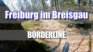
Die Borderline wurde 2007 als erster offizieller Trail in Freiburg eröffnet.

Startpunkt ist am Rosskopf, von wo aus die Borderline nach Süden ins Dreisamtal zur Jugendherberge führt. Der obere Abschnitt ist steil und technisch anspruchsvoll, gespickt mit steinigen Passagen und größeren Stufen, die Fahrtechnik abverlangen. Weiter unten öffnet sich der Trail, wird schneller und bietet flowige Anliegerkurven, kleine Sprünge und seit 2025 auch eine neue Jumpline in Sektion 5 für extra Airtime. Richtung Ende sorgen steile, wurzelige Passagen noch einmal für Abwechslung.

Disclaimer

Nachtfahrverbot – Trail ausschließlich bergab befahrbar. – Keine abgesperrte Downhillstrecke, Fußgänger möglich!

Trail Supporters
  • Maintainer
Local Trail Association

Recent Activity on Trail

Past Week
  • 5 rides
  • 20.3 km average
6 Months
  • 111 rides
  • 26.5 km avg distance
All
  • 1,130 rides
  • Last: Jun 18, 2026
c1c2c3c4
January
February
March
April
May
June
July
August
September
October
November
December
update trails status or condition

Borderline Trail Reports

statusdatedescription
Apr 29, 2026 @ 11:13am (Europe/Busingen)
Apr 29, 2026
2nd section still closed - destroyed due to logging work.
Apr 6, 2026 @ 9:09pm (Europe/Berlin)
Apr 6, 2026
2nd section still closed - destroyed due to logging work.
Mar 21, 2026 @ 9:48pm (Europe/Berlin)
Mar 21, 2026
2nd section is closed due to logging
Mar 9, 2026 @ 4:12pm (Europe/Busingen)
Mar 9, 2026
Aug 30, 2025 @ 11:06am
Aug 30, 2025
more »
Status:
on Apr 29, 2026
Ideal
Avg: 4.48 (69 votes)
Your vote: 0

view (6,367)
close
3D
Trail Conditions
  • Unknown
  • Snow Groomed
  • Snow Packed
  • Snow Covered
  • Snow Cover Partial
  • Freeze/thaw Cycle
  • Icy
  • Prevalent Mud
  • Wet
  • Variable
  • Ideal
  • Dry
  • Very Dry
Trail Flow (Ridden Direction)
Trailforks scans users ridelogs to determine the most popular direction each trail is ridden. A good flowing trail network will have most trails flowing in a single direction according to their intension.
The colour categories are based on what percentage of riders are riding a trail in its intended direction.
  • > 96%
  • > 90%
  • > 80%
  • > 70%
  • > 50%
  • < 50%
  • bi-directional trail
  • no data
Trail Last Ridden
Trailforks scans ridelogs to determine the last time a trail was ridden.
  • < 2 days
  • < 1 week
  • < 2 weeks
  • < 1 month
  • < 6 months
  • > 6 months
Trail Ridden Direction
The intended direction a trail should be ridden.
  • Downhill Only
  • Downhill Primary
  • Both Directions
  • Uphill Primary
  • Uphill Only
  • One Direction
Contribute Details
Colors indicate trail is missing specified detail.
  • Description
  • Photos
  • Description & Photos
  • Videos
Trail Popularity ?
Trailforks scans ridelogs to determine which trails are ridden the most in the last 9 months. Trails are compared with nearby trails in the same city region with a possible 25 colour shades. Think of this as a heatmap, more rides = more kinetic energy = warmer colors.
  • most popular
  • popular
  • less popular
  • not popular
ATV/ORV/OHV Filter
Max Vehicle Width
inches
US Cell Coverage
Legend
cell carrier legend

Radar Time
Activity Recordings
Trailforks uses anonymized public activity data. ?
Activity Recordings
Trailforks uses anonymized public activity data. ?
Personal Heatmap
Activity Types
all / none
Options
2
Date range month
Winter Trails
Warning A routing network for winter maps does not exist. Selecting trails using the winter trails layer has been disabled.
Missing Trails
Most Popular
Least Popular
Trails are colored based on popularity. The more popular a trail is, the more red. Less popular trails trend towards green.
Jump Magnitude Heatmap
Heatmap of where riders jump on trails. Zoom in to see individual jumps, click circles to view jump details.
BC Backroad Status

Service Road Atlas is a free to use, community-driven service for viewing and creating reports on the numerous back-country service roads around B.C. and Alberta.

map legend
Slope Aspect
Direction the slope faces
Flat N NE E SE S SW W NW
Trails Deemphasized
Trails are shown in grey.
disable
Only show trails with no bike usage.
Enable
Suggested Layers
Based on selected activity type

    Save the current map location and zoom level as your default home location whenever this page is loaded.

    Save
        Directions to borderline-9844 trailhead (48.008840, 7.901090)

        Photos

        59 more »
        21 |
        May 26, 2026 @ 9:42am
        May 26, 2026
        15 |
        May 26, 2026 @ 9:42am
        May 26, 2026
        25 |
        May 26, 2026 @ 9:15am
        May 26, 2026
        19 |
        May 26, 2026 @ 9:15am
        May 26, 2026

        Videos

        24 more »
        youtuber FREIBURG Borderline mit Trail Tracker, Trail...
        8:58 | 572 | Jun 26, 2023 , Freiburg Im Breisgau
        Freiburg im Breisgau Borderline   Trail
        8:42 | 46 | Apr 7, 2026 , Freiburg Im Breisgau
        Germany | Freiburg im Breisgau | Borderline 2025
        8:06 | 137 | Apr 27, 2025 , Freiburg Im Breisgau
        I’M BACK! Borderline Trail in Freiburg
        15:41 | 175 | Feb 19, 2024 , Freiburg Im Breisgau

        Routes with this trail

        3.7 13 miles 3,359 ft 6
        Freiburg classic trails up and down
        2.5 22 miles 4,206 ft 6 Loop
        Route for the event "Freiburger Dreierlei". Three of the finest trails in Freiburg combined with easy Uphills.
        4.0 23 miles 5,493 ft 21
        long ride from east to west for fun times

        4 Reviews & Comments


        We hope you've been enjoying Trailforks!

        Create a FREE account to view trail comments and much more.

        • By BastiEnduro & contributors
        • #9844 - 16,964 views

        Frequently Asked Questions About Borderline

        Where is Borderline located?
        Borderline is located in Freiburg Im Breisgau, Germany. It is part of the Freiburg Im Breisgau trail network. The trailhead is located at coordinates 48.00884, 7.90109.
        How hard is Borderline?
        Borderline is rated as Red difficulty. The physical rating is Moderate. The average grade is 13.6%.
        What is the elevation gain for Borderline?
        Borderline has 8 m of elevation gain. The trail has 418 m of elevation descent. The elevation ranges from 318 m to 732 m.
        How long is Borderline?
        Borderline is 3.1 km long. The trail type is singletrack.

        Hit the Trail

        Open in App

        Get this trail on your phone instantly.
        open trail in app

        Download Trail

        Save to wishlist, Garmin & download.
        save the trail

        Find Related Routes

        Find routes and users activities that include this trail.
        find routes for this trail

        You must enter a description before submitting.