more stats
2.5 miles
Distance
11 ft
Climb
-1,668 ft
Descent
00:27:49
Avg time
-1,657 ft
Altitude change
1,343 ft
Altitude min
3,000 ft
Altitude max
3,000 ft
Altitude start
1,342 ft
Altitude end
-12.3%
Grade
-46.9%
Grade max
7.6%
Grade min
568 ft
Distance climb
2 miles
Distance down
472 ft
Distance flat
00:27:49
Avg time

Borówa Details

  • Activities
    • Hike
    • Mountain Bike
    • E-Bike
    • Trail Running
  • Riding Area
  • Difficulty Rating
  • Voted Difficulty
    Red (3 votes)
  • Local Popularity
    35 in Mountain Biking [+]
    • 25 in E-Biking
    • 5 in Trail Running
    • 5 in Hiking
  • Global Ranking
    #33967 in Mountain Biking [+]
    • #32486 in E-Biking
    • #116622 in Trail Running
    • #111744 in Hiking
  • Hiking SAC Scale
    T1 Hiking
  • Trail Type
    Singletrack
  • Bike Type
    AM, XC
  • Physical Rating
    Moderate
  • Trail Visibility
    Sometimes hard to follow
  • Dogs Allowed
    Yes
  • eBike Allowed
    Yes up to Class 1
  • TTFs on Trail
    Pump Track, Roller Coaster
  • Ride in Rain
    Yes
  • Year Opened
    2017

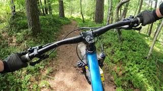
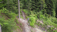
Classic nice and flowy singletrack that leads through many blueberrie fields (hence polish nickname "borówa"). Few steeper parts but nothing extreme, pure fun Smile
Ps. Prepared for Enduro Trails Adventure 2018/2020

Edit 2020: it starts now at the top, the steepest section is just as a choice ("killer" trail), main trail goes on the "chicken line" or "hard chicken"

This trail is unsanctioned.

Trail Supporters

Recent Activity on Trail

Past Week
  • 1 rides
  • 20 miles average
6 Months
  • 9 rides
  • 19 miles avg distance
All
  • 88 rides
  • Last: Jun 24, 2026
c1c2c3c4
January
February
March
April
May
June
July
August
September
October
November
December
update trails status or condition

Borówa Trail Reports

statusdatedescription
May 17, 2026 @ 3:54pm (Europe/Warsaw)
May 17, 2026
Trasa wróciła do swojego standardowego stanu czyli na nowo znowu cała zablokowana gałęziami i drzewami przez miłych ludzi. Najlepiej jechać...
Mar 24, 2026 @ 4:53pm (Europe/Bratislava)
Mar 24, 2026
Czysto - żadnych gałęzi. Pięknie przygotowana ścieżka :)
Sep 29, 2025 @ 9:05pm (Europe/Warsaw)
Sep 29, 2025
From half down, practically impassable; someone was angry with hundreds of branches across the trail / od połowy w dół praktycznie...
Sep 7, 2025 @ 2:29am
Sep 7, 2025
lots of debris on trail
Aug 18, 2025 @ 7:55am
Aug 18, 2025
o dziwo czysto....
more »
Status:
on May 17, 2026
Avg: 4.63 (16 votes)
Your vote: 0

view (1,389)
close
3D
Trail Conditions
  • Unknown
  • Snow Groomed
  • Snow Packed
  • Snow Covered
  • Snow Cover Partial
  • Freeze/thaw Cycle
  • Icy
  • Prevalent Mud
  • Wet
  • Variable
  • Ideal
  • Dry
  • Very Dry
Trail Flow (Ridden Direction)
Trailforks scans users ridelogs to determine the most popular direction each trail is ridden. A good flowing trail network will have most trails flowing in a single direction according to their intension.
The colour categories are based on what percentage of riders are riding a trail in its intended direction.
  • > 96%
  • > 90%
  • > 80%
  • > 70%
  • > 50%
  • < 50%
  • bi-directional trail
  • no data
Trail Last Ridden
Trailforks scans ridelogs to determine the last time a trail was ridden.
  • < 2 days
  • < 1 week
  • < 2 weeks
  • < 1 month
  • < 6 months
  • > 6 months
Trail Ridden Direction
The intended direction a trail should be ridden.
  • Downhill Only
  • Downhill Primary
  • Both Directions
  • Uphill Primary
  • Uphill Only
  • One Direction
Contribute Details
Colors indicate trail is missing specified detail.
  • Description
  • Photos
  • Description & Photos
  • Videos
Trail Popularity ?
Trailforks scans ridelogs to determine which trails are ridden the most in the last 9 months. Trails are compared with nearby trails in the same city region with a possible 25 colour shades. Think of this as a heatmap, more rides = more kinetic energy = warmer colors.
  • most popular
  • popular
  • less popular
  • not popular
ATV/ORV/OHV Filter
Max Vehicle Width
inches
US Cell Coverage
Legend
cell carrier legend

Radar Time
Activity Recordings
Trailforks uses anonymized public activity data. ?
Activity Recordings
Trailforks uses anonymized public activity data. ?
Personal Heatmap
Activity Types
all / none
Options
2
Date range month
Winter Trails
Warning A routing network for winter maps does not exist. Selecting trails using the winter trails layer has been disabled.
Missing Trails
Most Popular
Least Popular
Trails are colored based on popularity. The more popular a trail is, the more red. Less popular trails trend towards green.
Jump Magnitude Heatmap
Heatmap of where riders jump on trails. Zoom in to see individual jumps, click circles to view jump details.
BC Backroad Status

Service Road Atlas is a free to use, community-driven service for viewing and creating reports on the numerous back-country service roads around B.C. and Alberta.

map legend
Slope Aspect
Direction the slope faces
Flat N NE E SE S SW W NW
Trails Deemphasized
Trails are shown in grey.
disable
Only show trails with no bike usage.
Enable
Suggested Layers
Based on selected activity type

    Save the current map location and zoom level as your default home location whenever this page is loaded.

    Save
        Directions to borowa trailhead (49.768630, 19.144800)

        Photos

        19 more »
        171 |
        Jun 12, 2022 @ 1:08pm
        Jun 12, 2022
        207 |
        Jun 12, 2022 @ 1:08pm
        Jun 12, 2022
        261 |
        Sep 18, 2020 @ 12:39pm
        Sep 18, 2020
        268 |
        Sep 18, 2020 @ 12:02pm
        Sep 18, 2020

        Videos

        4 more »
        Borówa, Magurka - enduro MTB Bielsko-Biała -...
        17:03 | 216 | May 27, 2024 , Bielsko-Biała
        Magurka - Borówa // Wilcze Ścieżki,...
        12:03 | 775 | Nov 30, 2020 , Bielsko-Biała
        Borówa
        0:55 | 420 | May 17, 2020 , Bielsko-Biała
        gleba dario
        0:09 | 237 | May 25, 2021 , Bielsko-Biała

        9 Reviews & Comments


        We hope you've been enjoying Trailforks!

        Create a FREE account to view trail comments and much more.

        • #145145 - 8,028 views

        Frequently Asked Questions About Borówa

        Where is Borówa located?
        Borówa is located in Enduro Trails Bielsko-Biała, Bielsko-Biała, Poland. It is part of the Enduro Trails Bielsko-Biała trail network. The trailhead is located at coordinates 49.76863, 19.1448.
        How hard is Borówa?
        Borówa is rated as Red difficulty. The physical rating is Moderate. The average grade is 12.3%.
        What is the elevation gain for Borówa?
        Borówa has 11 ft of elevation gain. The trail has 1,668 ft of elevation descent. The elevation ranges from 1,343 ft to 3,000 ft.
        How long is Borówa?
        Borówa is 2.5 miles long. The trail type is singletrack.

        Hit the Trail

        Open in App

        Get this trail on your phone instantly.
        open trail in app

        Download Trail

        Save to wishlist, Garmin & download.
        save the trail

        Find Related Routes

        Find routes and users activities that include this trail.
        find routes for this trail

        You must enter a description before submitting.