more stats
2,972 ft
Distance
8 ft
Climb
-9 ft
Descent
00:03:39
Avg time
-1 ft
Altitude change
429 ft
Altitude min
439 ft
Altitude max
439 ft
Altitude start
436 ft
Altitude end
-4.4%
Grade max
3.3%
Grade min
528 ft
Distance climb
594 ft
Distance down
1,847 ft
Distance flat
00:03:39
Avg time

Bowtie Rim Details

  • Activities
    • Mountain Bike
    • E-Bike
    • Adaptive Bike
    • Winter Fat Bike
    • Hike
    • Trail Running
  • Riding Area
    Los Peñasquitos Canyon
    San Diego, California
  • Difficulty Rating
  • Voted Difficulty
    Blue (4 votes)
  • Local Popularity
    100 in Mountain Biking [+]
    • 100 in E-Biking
    • 75 in Trail Running
    • 95 in Hiking
  • Global Ranking
    #41332 in Mountain Biking [+]
    • #4110 in E-Biking
    • #71943 in Trail Running
    • #36854 in Hiking
  • Trail Type
    Singletrack
  • Bike Type
    AM, XC, Fat, Adaptive MTB
  • Direction
    One Direction
  • Climb Difficulty
    Green
  • Physical Rating
    Easy
  • Trail Visibility
    Always easy to follow
  • Family Friendly
    Yes
  • Dogs Allowed
    Yes
  • eBike Allowed
    Yes up to Class 1
  • Land Owner
    City of San Diego

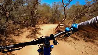
Short singletrack alternative to the fire road. One way travel only - Directional from west to east. Gets a little tight along nature preserve fencing.

Adaptive Bike Info
aMTB Green Rating: Beginner features and moderate terrain.

Gets narrow along the nature preserve fence, but its mostly flat and majority of aMTB's will be fine.

Local Trail Association
Traditionally Indigenous Territory

Recent Activity on Trail

Past Week
  • 15 rides
  • 14 miles average
6 Months
  • 475 rides
  • 14 miles avg distance
All
  • 4,026 rides
  • Last: Jun 19, 2026
c1c2c3c4
January
February
March
April
May
June
July
August
September
October
November
December
update trails status or condition

Bowtie Rim Trail Reports

statusdatedescription
Apr 8, 2026 @ 7:53am (America/Los_Angeles)
Apr 8, 2026
Running great today!
Feb 27, 2026 @ 8:49am (America/Los_Angeles)
Feb 27, 2026
Running great today!
Jan 14, 2026 @ 9:47am (America/Los_Angeles)
Jan 14, 2026
Running great today!
Sep 21, 2025 @ 8:19am (America/Los_Angeles)
Sep 21, 2025
Sep 14, 2025 @ 3:32pm (America/Los_Angeles)
Sep 14, 2025
This trail is running good, but unfortunately they closed and destroyed the fun twisty trail between this one and West Rim
more »
Status:
on Apr 8, 2026
Ideal
Avg: 4.05 (12 votes)
Your vote: 0

view (20,084)
close
3D
Trail Conditions
  • Unknown
  • Snow Groomed
  • Snow Packed
  • Snow Covered
  • Snow Cover Partial
  • Freeze/thaw Cycle
  • Icy
  • Prevalent Mud
  • Wet
  • Variable
  • Ideal
  • Dry
  • Very Dry
Trail Flow (Ridden Direction)
Trailforks scans users ridelogs to determine the most popular direction each trail is ridden. A good flowing trail network will have most trails flowing in a single direction according to their intension.
The colour categories are based on what percentage of riders are riding a trail in its intended direction.
  • > 96%
  • > 90%
  • > 80%
  • > 70%
  • > 50%
  • < 50%
  • bi-directional trail
  • no data
Trail Last Ridden
Trailforks scans ridelogs to determine the last time a trail was ridden.
  • < 2 days
  • < 1 week
  • < 2 weeks
  • < 1 month
  • < 6 months
  • > 6 months
Trail Ridden Direction
The intended direction a trail should be ridden.
  • Downhill Only
  • Downhill Primary
  • Both Directions
  • Uphill Primary
  • Uphill Only
  • One Direction
Contribute Details
Colors indicate trail is missing specified detail.
  • Description
  • Photos
  • Description & Photos
  • Videos
Trail Popularity ?
Trailforks scans ridelogs to determine which trails are ridden the most in the last 9 months. Trails are compared with nearby trails in the same city region with a possible 25 colour shades. Think of this as a heatmap, more rides = more kinetic energy = warmer colors.
  • most popular
  • popular
  • less popular
  • not popular
ATV/ORV/OHV Filter
Max Vehicle Width
inches
US Cell Coverage
Legend
cell carrier legend

Radar Time
Activity Recordings
Trailforks uses anonymized public activity data. ?
Activity Recordings
Trailforks uses anonymized public activity data. ?
Personal Heatmap
Activity Types
all / none
Options
2
Date range month
Winter Trails
Warning A routing network for winter maps does not exist. Selecting trails using the winter trails layer has been disabled.
Missing Trails
Most Popular
Least Popular
Trails are colored based on popularity. The more popular a trail is, the more red. Less popular trails trend towards green.
Jump Magnitude Heatmap
Heatmap of where riders jump on trails. Zoom in to see individual jumps, click circles to view jump details.
BC Backroad Status

Service Road Atlas is a free to use, community-driven service for viewing and creating reports on the numerous back-country service roads around B.C. and Alberta.

map legend
Slope Aspect
Direction the slope faces
Flat N NE E SE S SW W NW
Trails Deemphasized
Trails are shown in grey.
disable
Only show trails with no bike usage.
Enable
Suggested Layers
Based on selected activity type

    Save the current map location and zoom level as your default home location whenever this page is loaded.

    Save
        Directions to bowtie-rim trailhead (32.944150, -117.167550)

        Photos

        2 more »
        58 |
        Apr 7, 2025 @ 11:14am
        Apr 7, 2025
        116 |
        May 15, 2021 @ 9:12am
        May 15, 2021
        48 |
        Sep 14, 2025 @ 3:32pm
        Sep 14, 2025
        42 |
        Sep 14, 2025 @ 3:32pm
        Sep 14, 2025

        Videos

        7 more »
        MTB night ride with Bobcats, San Diego...
        6:45 | 22 | Mar 16, 2026 , San Diego
        San Diego MTB Review TUNNEL 4, Best In SD?
        10:38 | 75 | Jun 16, 2024 , San Diego
        Bowtie Rim Trail | San Diego Mountain Biking |...
        2:26 | 272 | Aug 5, 2022 , San Diego
        PQ “MTB KIDS EDITION”
        9:45 | 214 | Jun 25, 2021 , San Diego

        Routes with this trail

        2.7 12 miles 771 ft 4 Loop
        This loop is created for adaptive mountain bikers and is rated as aMTB 2! It has very advanced sections,...
        4.3 22 miles 1,799 ft 21
        Those bells that you hear are not those of in the East End of London, where the Cockney accent is heard....
        3.5 23 miles 1,957 ft 61 Loop
        This route through Los Penasquitos Canyon and Del Mar Mesa hits some of the most popular trails in the...

        2 Reviews & Comments


        We hope you've been enjoying Trailforks!

        Create a FREE account to view trail comments and much more.

        • By The-dirt-farmerTF Pro & contributors
        • #48309 - 4,180 views

        Frequently Asked Questions About Bowtie Rim

        Where is Bowtie Rim located?
        Bowtie Rim is located in Los Peñasquitos Canyon, San Diego, California, United States. It is part of the Los Peñasquitos Canyon trail network. The trailhead is located at coordinates 32.94415, -117.16755.
        How hard is Bowtie Rim?
        Bowtie Rim is rated as Green difficulty. The physical rating is Easy. The climb difficulty is rated Green.
        What is the elevation gain for Bowtie Rim?
        Bowtie Rim has 8 ft of elevation gain. The trail has 9 ft of elevation descent. The elevation ranges from 429 ft to 439 ft.
        Is Bowtie Rim a point to point trail?
        Yes, Bowtie Rim is a point to point trail. The direction is One Direction. The trail type is singletrack.

        Hit the Trail

        Open in App

        Get this trail on your phone instantly.
        open trail in app

        Download Trail

        Save to wishlist, Garmin & download.
        save the trail

        Find Related Routes

        Find routes and users activities that include this trail.
        find routes for this trail

        You must enter a description before submitting.