more stats
4,226 ft
Distance
5 ft
Climb
-90 ft
Descent
00:04:19
Avg time
-85 ft
Altitude change
4,234 ft
Altitude min
4,323 ft
Altitude max
4,319 ft
Altitude start
4,236 ft
Altitude end
-2%
Grade
-13.2%
Grade max
3.6%
Grade min
522 ft
Distance climb
2,556 ft
Distance down
1,148 ft
Distance flat
00:04:19
Avg time

Boyd Cave Trail Details

  • Activities
    • Mountain Bike
    • Adaptive Bike
    • Hike
    • Trail Running
  • Riding Area
    Horse Butte
    Bend, Oregon
  • Difficulty Rating
  • Local Popularity
    15 in Mountain Biking [+]
    • 90 in Trail Running
    • 45 in Hiking
  • Global Ranking
    #106545 in Mountain Biking [+]
    • #44887 in Trail Running
    • #109510 in Hiking
  • Trail Type
    Singletrack
  • Bike Type
  • Direction
    Both Directions
  • Climb Difficulty
    Blue
  • Physical Rating
    Moderate
  • Dogs Allowed
    Yes
  • eBike Allowed

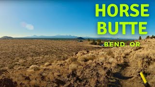
Boyd Cave is a short trail (less than a mile) which takes you to Coyote Loop Trail at the road crossing to Arnold Ice Cave trail. The trail starts on a gravel road that leads you to the entrance to Boyd Cave (100 yards away) which is a nice detour and one of many natural lava caves in the area East of Bend.

Adaptive Bike Info
aMTB Blue Rating: Intermediate features and steeper terrain.

aMTB rating is provided for general information only and may not reflect the technical difficulty of the trail or a particular rider's support needs. COTA completed a trail assessment process, please find more information on our website: https://www.cotamtb.com/amtb-trail-information.html. Contact Oregon Adaptive Sports for more information or ride support: https://oregonadaptivesports.org.

Trail Supporters

  • USFS
    Land Manager

Recent Activity on Trail

Past Week
  • 0 rides
  •  
6 Months
  • 0 rides
  •  
All
  • 851 rides
  • Last: Oct 4, 2025
c1c2c3c4
January
February
March
April
May
June
July
August
September
October
November
December
update trails status or condition

Boyd Cave Trail Trail Reports

statusdatedescription
May 7, 2025 @ 12:13pm
May 7, 2025
reporter The Deschutes National Forest will temporarily close the Cabin Butte Vegetation Management Project area south of Bend, Oregon, beginning May 1, to...
Aug 26, 2024 @ 6:28pm
Aug 26, 2024
Jun 7, 2024 @ 5:48pm
Jun 7, 2024
Mar 17, 2024 @ 9:15am
Mar 17, 2024
Jan 28, 2024 @ 5:44am
Jan 28, 2024
More ice and water than expected. Some muddy spots.
more »
Status:
on May 7, 2025
Avg: 3.65 (3 votes)
Your vote: 0

view (3,232)
close
3D
Trail Conditions
  • Unknown
  • Snow Groomed
  • Snow Packed
  • Snow Covered
  • Snow Cover Partial
  • Freeze/thaw Cycle
  • Icy
  • Prevalent Mud
  • Wet
  • Variable
  • Ideal
  • Dry
  • Very Dry
Trail Flow (Ridden Direction)
Trailforks scans users ridelogs to determine the most popular direction each trail is ridden. A good flowing trail network will have most trails flowing in a single direction according to their intension.
The colour categories are based on what percentage of riders are riding a trail in its intended direction.
  • > 96%
  • > 90%
  • > 80%
  • > 70%
  • > 50%
  • < 50%
  • bi-directional trail
  • no data
Trail Last Ridden
Trailforks scans ridelogs to determine the last time a trail was ridden.
  • < 2 days
  • < 1 week
  • < 2 weeks
  • < 1 month
  • < 6 months
  • > 6 months
Trail Ridden Direction
The intended direction a trail should be ridden.
  • Downhill Only
  • Downhill Primary
  • Both Directions
  • Uphill Primary
  • Uphill Only
  • One Direction
Contribute Details
Colors indicate trail is missing specified detail.
  • Description
  • Photos
  • Description & Photos
  • Videos
Trail Popularity ?
Trailforks scans ridelogs to determine which trails are ridden the most in the last 9 months. Trails are compared with nearby trails in the same city region with a possible 25 colour shades. Think of this as a heatmap, more rides = more kinetic energy = warmer colors.
  • most popular
  • popular
  • less popular
  • not popular
ATV/ORV/OHV Filter
Max Vehicle Width
inches
US Cell Coverage
Legend
cell carrier legend

Radar Time
Activity Recordings
Trailforks uses anonymized public activity data. ?
Activity Recordings
Trailforks uses anonymized public activity data. ?
Personal Heatmap
Activity Types
all / none
Options
2
Date range month
Winter Trails
Warning A routing network for winter maps does not exist. Selecting trails using the winter trails layer has been disabled.
Missing Trails
Most Popular
Least Popular
Trails are colored based on popularity. The more popular a trail is, the more red. Less popular trails trend towards green.
Jump Magnitude Heatmap
Heatmap of where riders jump on trails. Zoom in to see individual jumps, click circles to view jump details.
BC Backroad Status

Service Road Atlas is a free to use, community-driven service for viewing and creating reports on the numerous back-country service roads around B.C. and Alberta.

map legend
Slope Aspect
Direction the slope faces
Flat N NE E SE S SW W NW
Trails Deemphasized
Trails are shown in grey.
disable
Only show trails with no bike usage.
Enable
Suggested Layers
Based on selected activity type

    Save the current map location and zoom level as your default home location whenever this page is loaded.

    Save
        Directions to boyd-cave-trail trailhead (43.939000, -121.198700)

        Photos

        4 more »
        52 |
        Jul 11, 2024 @ 8:36am
        Jul 11, 2024
        88 |
        Apr 1, 2022 @ 9:04am
        Apr 1, 2022
        88 |
        Apr 1, 2022 @ 9:04am
        Apr 1, 2022
        112 |
        Sep 27, 2020 @ 2:54pm
        Sep 27, 2020

        Videos

        1 more »
        Mountain Biking Horse Butte - Bend, Oregon
        8:00 | 342 | Jan 9, 2022 , Bend

        Routes with this trail

        4.4 10 miles 574 ft 1 Loop
        Ridden counterclockwise Narrow singletrack trail in high desert landscape, edges of trail very brushy,...
        10 miles 575 ft 1
        This is a classic route enjoyed by bikes and trail runners. This is equally good in either direction and...
        2.7 26 miles 1,951 ft 5
        Great loop for early/late season. Often good to go before most of lower Phil's.

        Trail Products

        Reviews / Comments

        No reviews yet, be the first to write a review or ask a question.
        Use trail reports to comment on trail conditions.


        We hope you've been enjoying Trailforks!

        Create a FREE account to view trail comments and much more.

        • By cringeTF Pro & contributors
        • #86353 - 2,034 views

        Frequently Asked Questions About Boyd Cave Trail

        Where is Boyd Cave Trail located?
        Boyd Cave Trail is located in Horse Butte, Bend, Oregon, United States. It is part of the Horse Butte trail network. The trailhead is located at coordinates 43.939, -121.1987.
        How hard is Boyd Cave Trail?
        Boyd Cave Trail is rated as Blue difficulty. The physical rating is Moderate. The average grade is 2%. The climb difficulty is rated Blue.
        What is the elevation gain for Boyd Cave Trail?
        Boyd Cave Trail has 5 ft of elevation gain. The trail has 90 ft of elevation descent. The elevation ranges from 4,234 ft to 4,323 ft.
        Is Boyd Cave Trail a point to point trail?
        Boyd Cave Trail is not a point to point trail. The direction is Both Directions. The trail type is singletrack.

        Hit the Trail

        Open in App

        Get this trail on your phone instantly.
        open trail in app

        Download Trail

        Save to wishlist, Garmin & download.
        save the trail

        Find Related Routes

        Find routes and users activities that include this trail.
        find routes for this trail

        You must enter a description before submitting.