more stats
1,496 ft
Distance
-229 ft
Descent
00:03:33
Avg time
-229 ft
Altitude change
1,010 ft
Altitude min
1,239 ft
Altitude max
1,239 ft
Altitude start
1,010 ft
Altitude end
-15.3%
Grade
-29.2%
Grade max
-4.2%
Grade min
1,496 ft
Distance down
00:03:33
Avg time

Braap Details

  • Activities
    • Mountain Bike
    • Hike
    • Trail Running
  • Riding Area
    Burke Mountain
    Coquitlam, British Columbia
  • AKA
    Tyler's Trail, Braap 2
  • Difficulty Rating
  • Voted Difficulty
    Blue (5 votes)
  • Local Popularity
    95 in Mountain Biking [+]
    • 60 in Trail Running
    • 80 in Hiking
  • Global Ranking
    #2101 in Mountain Biking [+]
    • #35148 in Trail Running
    • #1612 in Hiking
  • Hiking SAC Scale
    T1 Hiking
  • Trail Type
    Singletrack
  • Bike Type
    DH, AM, XC
  • Direction
    Downhill Only
    Popular Direction Shown
  • Climb Difficulty
    Green
  • Physical Rating
    Easy
  • Trail Visibility
    Always easy to follow
  • Dogs Allowed
    Yes
  • TTFs on Trail
    Berm, Bridge, Drop, Jump, Rock Garden

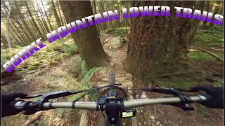
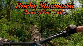
Flowy trail with a whole bunch of small-medium drops and gap jumps over logs. Great to progress your skills and speed.

This trail is unsanctioned.

Recent Activity on Trail

Past Week
  • 9 rides
  • 6 miles average
6 Months
  • 176 rides
  • 7 miles avg distance
All
  • 2,029 rides
  • Last: Jun 19, 2026
c1c2c3c4
January
February
March
April
May
June
July
August
September
October
November
December
Status:
on May 30, 2026
Ideal
Avg: 4.28 (53 votes)
Your vote: 0

view (10,923)
close
3D
Trail Conditions
  • Unknown
  • Snow Groomed
  • Snow Packed
  • Snow Covered
  • Snow Cover Partial
  • Freeze/thaw Cycle
  • Icy
  • Prevalent Mud
  • Wet
  • Variable
  • Ideal
  • Dry
  • Very Dry
Trail Flow (Ridden Direction)
Trailforks scans users ridelogs to determine the most popular direction each trail is ridden. A good flowing trail network will have most trails flowing in a single direction according to their intension.
The colour categories are based on what percentage of riders are riding a trail in its intended direction.
  • > 96%
  • > 90%
  • > 80%
  • > 70%
  • > 50%
  • < 50%
  • bi-directional trail
  • no data
Trail Last Ridden
Trailforks scans ridelogs to determine the last time a trail was ridden.
  • < 2 days
  • < 1 week
  • < 2 weeks
  • < 1 month
  • < 6 months
  • > 6 months
Trail Ridden Direction
The intended direction a trail should be ridden.
  • Downhill Only
  • Downhill Primary
  • Both Directions
  • Uphill Primary
  • Uphill Only
  • One Direction
Contribute Details
Colors indicate trail is missing specified detail.
  • Description
  • Photos
  • Description & Photos
  • Videos
Trail Popularity ?
Trailforks scans ridelogs to determine which trails are ridden the most in the last 9 months. Trails are compared with nearby trails in the same city region with a possible 25 colour shades. Think of this as a heatmap, more rides = more kinetic energy = warmer colors.
  • most popular
  • popular
  • less popular
  • not popular
ATV/ORV/OHV Filter
Max Vehicle Width
inches
US Cell Coverage
Legend
cell carrier legend

Radar Time
Activity Recordings
Trailforks uses anonymized public activity data. ?
Activity Recordings
Trailforks uses anonymized public activity data. ?
Personal Heatmap
Activity Types
all / none
Options
2
Date range month
Winter Trails
Warning A routing network for winter maps does not exist. Selecting trails using the winter trails layer has been disabled.
Missing Trails
Most Popular
Least Popular
Trails are colored based on popularity. The more popular a trail is, the more red. Less popular trails trend towards green.
Jump Magnitude Heatmap
Heatmap of where riders jump on trails. Zoom in to see individual jumps, click circles to view jump details.
BC Backroad Status

Service Road Atlas is a free to use, community-driven service for viewing and creating reports on the numerous back-country service roads around B.C. and Alberta.

map legend
Slope Aspect
Direction the slope faces
Flat N NE E SE S SW W NW
Trails Deemphasized
Trails are shown in grey.
disable
Only show trails with no bike usage.
Enable
Suggested Layers
Based on selected activity type

    Save the current map location and zoom level as your default home location whenever this page is loaded.

    Save
        Directions to braap trailhead (49.311890, -122.743160)

        Photos

        89 more »
        218 |
        Jul 10, 2021 @ 9:20pm
        Jul 10, 2021
        200 |
        Jul 10, 2021 @ 9:20pm
        Jul 10, 2021
        176 |
        Jul 10, 2021 @ 9:20pm
        Jul 10, 2021
        254 |
        Jul 10, 2021 @ 9:21pm
        Jul 10, 2021

        Videos

        38 more »
        youtuber Braap - Hustler - Burke Mountain MTB
        3:17 | 810 | Jan 28, 2022 , Coquitlam
        BURKE MOUNTAIN LOWER TRAILS | INTENSE TAZER MX...
        7:45 | 61 | Nov 14, 2025 , Coquitlam
        youtuber Braap
        12:52 | 149 | Jun 3, 2025 , Coquitlam
        Braap Burke Mtn April 15 2024
        0:34 | 329 | May 12, 2024 , Coquitlam

        Routes with this trail

        5.0 5 miles 1,432 ft 7
        Some of the best trails on lower burke.
        2.5 6 miles 1,404 ft 26
        An easy intro to Burke Mountain, this route takes you on the longest climb first, getting progressively...
        4 miles 1,351 ft 13 Loop
        This is a nice loop to go on some of the easy black diamonds, the climb isn't too bad, but one of my...

        Trail Products

        11 Reviews & Comments


        We hope you've been enjoying Trailforks!

        Create a FREE account to view trail comments and much more.

        • #2123 - 12,972 views

        Frequently Asked Questions About Braap

        Where is Braap located?
        Braap is located in Burke Mountain, Coquitlam, British Columbia, Canada. It is part of the Burke Mountain trail network. The trailhead is located at coordinates 49.31189, -122.74316.
        How hard is Braap?
        Braap is rated as Black Diamond difficulty. The physical rating is Easy. The average grade is 15.3%. The climb difficulty is rated Green.
        What is the elevation gain for Braap?
        The trail has 229 ft of elevation descent. The elevation ranges from 1,010 ft to 1,239 ft.
        Is Braap a point to point trail?
        Yes, Braap is a point to point trail. The direction is Downhill Only. The trail type is singletrack.

        Hit the Trail

        Open in App

        Get this trail on your phone instantly.
        open trail in app

        Download Trail

        Save to wishlist, Garmin & download.
        save the trail

        Find Related Routes

        Find routes and users activities that include this trail.
        find routes for this trail

        You must enter a description before submitting.