more stats
1,677 ft
Distance
170 ft
Climb
-12 ft
Descent
00:09:22
Avg time
157 ft
Altitude change
1,073 ft
Altitude min
1,231 ft
Altitude max
1,073 ft
Altitude start
1,230 ft
Altitude end
9.4%
Grade
-9.8%
Grade max
28.8%
Grade min
1,276 ft
Distance climb
194 ft
Distance down
210 ft
Distance flat
00:09:22
Avg time

Breathless Details

  • Activities
    • Mountain Bike
    • E-Bike
    • Hike
    • Trail Running
  • Riding Area
    Hartland Mountain Bike Park
    Victoria, British Columbia
  • Difficulty Rating
  • Voted Difficulty
    Black Diamond (4 votes)
  • Local Popularity
    85 in Mountain Biking [+]
    • 85 in E-Biking
    • 65 in Trail Running
    • 70 in Hiking
  • Global Ranking
    #65874 in Mountain Biking [+]
    • #17035 in E-Biking
    • #83567 in Trail Running
    • #63907 in Hiking
  • Trail Type
    Singletrack
  • Bike Type
    AM, XC
  • Direction
    Both Directions
    Popular Direction Shown
  • Climb Difficulty
    Double Black Diamond
  • Physical Rating
    Extreme
  • Dogs Allowed
    Yes
  • eBike Allowed
    Yes up to Class 1
  • Ride in Rain
    Yes
  • Land Owner
    Capital Regional District

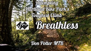
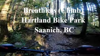
The name says it all. This trail can be ridden in either direction. Either way is a steep ascent with tight switchbacks full of loose rock. Most of the trail extends just beyond the Hartland Bike Park boundary which was defined well after the trail had already been made.

Trail Supporters
  • Original: Ken Sauer, Ian Scanlan
    Builder
Local Trail Association

Recent Activity on Trail

Past Week
  • 15 rides
  • 8 miles average
6 Months
  • 242 rides
  • 8 miles avg distance
All
  • 1,690 rides
  • Last: Jun 17, 2026
c1c2c3c4
January
February
March
April
May
June
July
August
September
October
November
December
update trails status or condition

Breathless Trail Reports

statusdatedescription
Feb 24, 2026 @ 8:02am (America/Vancouver)
Feb 24, 2026
There is a large tree down just above where the new bypass is. The tree effects the original line for the trail. Just take the bypass, which I'm...
Feb 4, 2026 @ 10:45am (America/Vancouver)
Feb 4, 2026
Jan 24, 2026 @ 1:59pm (America/Vancouver)
Jan 24, 2026
Jan 16, 2026 @ 1:10pm (America/Vancouver)
Jan 16, 2026
Nov 2, 2025 @ 11:32am (America/Vancouver)
Nov 2, 2025
more »
Status:
on Feb 24, 2026
Variable
Avg: 3 (16 votes)
Your vote: 0

view (8,863)
close
3D
Trail Conditions
  • Unknown
  • Snow Groomed
  • Snow Packed
  • Snow Covered
  • Snow Cover Partial
  • Freeze/thaw Cycle
  • Icy
  • Prevalent Mud
  • Wet
  • Variable
  • Ideal
  • Dry
  • Very Dry
Trail Flow (Ridden Direction)
Trailforks scans users ridelogs to determine the most popular direction each trail is ridden. A good flowing trail network will have most trails flowing in a single direction according to their intension.
The colour categories are based on what percentage of riders are riding a trail in its intended direction.
  • > 96%
  • > 90%
  • > 80%
  • > 70%
  • > 50%
  • < 50%
  • bi-directional trail
  • no data
Trail Last Ridden
Trailforks scans ridelogs to determine the last time a trail was ridden.
  • < 2 days
  • < 1 week
  • < 2 weeks
  • < 1 month
  • < 6 months
  • > 6 months
Trail Ridden Direction
The intended direction a trail should be ridden.
  • Downhill Only
  • Downhill Primary
  • Both Directions
  • Uphill Primary
  • Uphill Only
  • One Direction
Contribute Details
Colors indicate trail is missing specified detail.
  • Description
  • Photos
  • Description & Photos
  • Videos
Trail Popularity ?
Trailforks scans ridelogs to determine which trails are ridden the most in the last 9 months. Trails are compared with nearby trails in the same city region with a possible 25 colour shades. Think of this as a heatmap, more rides = more kinetic energy = warmer colors.
  • most popular
  • popular
  • less popular
  • not popular
ATV/ORV/OHV Filter
Max Vehicle Width
inches
US Cell Coverage
Legend
cell carrier legend

Radar Time
Activity Recordings
Trailforks uses anonymized public activity data. ?
Activity Recordings
Trailforks uses anonymized public activity data. ?
Personal Heatmap
Activity Types
all / none
Options
2
Date range month
Winter Trails
Warning A routing network for winter maps does not exist. Selecting trails using the winter trails layer has been disabled.
Missing Trails
Most Popular
Least Popular
Trails are colored based on popularity. The more popular a trail is, the more red. Less popular trails trend towards green.
Jump Magnitude Heatmap
Heatmap of where riders jump on trails. Zoom in to see individual jumps, click circles to view jump details.
BC Backroad Status

Service Road Atlas is a free to use, community-driven service for viewing and creating reports on the numerous back-country service roads around B.C. and Alberta.

map legend
Slope Aspect
Direction the slope faces
Flat N NE E SE S SW W NW
Trails Deemphasized
Trails are shown in grey.
disable
Only show trails with no bike usage.
Enable
Suggested Layers
Based on selected activity type

    Save the current map location and zoom level as your default home location whenever this page is loaded.

    Save
        Directions to breathless trailhead (48.536820, -123.476120)

        Photos

        6 more »
        185 |
        Aug 5, 2021 @ 8:07pm
        Aug 5, 2021
        147 |
        Mar 20, 2021 @ 4:49pm
        Mar 20, 2021
        222 |
        May 14, 2016 @ 6:43pm
        May 14, 2016
        236 |
        May 14, 2016 @ 6:43pm
        May 14, 2016

        Videos

        2 more »
        Hartland Bike Park's Double Black Diamond...
        8:49 | 211 | Apr 19, 2025 , Victoria
        Breathless (Climb) at Hartland Bike Park,...
        9:49 | 183 | Nov 3, 2023 , Victoria

        Routes with this trail

        10 miles 2,262 ft 14
        Hartland Section with no crossing
        9 miles 2,341 ft 13
        Idea 2, less road riding to maximize safety
        10 miles 2,315 ft 15
        3rd option, starts higher, adds more trail

        6 Reviews & Comments


        We hope you've been enjoying Trailforks!

        Create a FREE account to view trail comments and much more.

        • By KZ-Powned & contributors
        • #1145 - 4,459 views

        Frequently Asked Questions About Breathless

        Where is Breathless located?
        Breathless is located in Hartland Mountain Bike Park, Victoria, British Columbia, Canada. It is part of the Hartland Mountain Bike Park trail network. The trailhead is located at coordinates 48.53682, -123.47612.
        How hard is Breathless?
        Breathless is rated as Double Black Diamond difficulty. The physical rating is Extreme. The average grade is 9.4%. The climb difficulty is rated Double Black Diamond.
        What is the elevation gain for Breathless?
        Breathless has 170 ft of elevation gain. The trail has 12 ft of elevation descent. The elevation ranges from 1,073 ft to 1,231 ft.
        Is Breathless a point to point trail?
        Breathless is not a point to point trail. The direction is Both Directions. The trail type is singletrack.

        Hit the Trail

        Open in App

        Get this trail on your phone instantly.
        open trail in app

        Download Trail

        Save to wishlist, Garmin & download.
        save the trail

        Find Related Routes

        Find routes and users activities that include this trail.
        find routes for this trail

        You must enter a description before submitting.