
Open in App
Get this trail on your phone instantly.

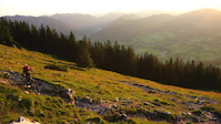
The upper part right from the summit has the most difficult sections. For sure some S4. After the summit descent it gets more easy till the Bucher Alm. At the Alm the fun and flowy bottom section starts.
Forest road up to Bucher Alm. From there continue the forest road for 3 more turns, then start pushing/carrying your bike 300 vertical meters up to the summit.
This trail is unsanctioned.
Please respect the trail rules, and respect & be friendly to the hikers - they have the right of way.
| c1 | c2 | c3 | c4 |
|---|---|---|---|
January | February | March | April |
May | June | July | August |
September | October | November | December |

Service Road Atlas is a free to use, community-driven service for viewing and creating reports on the numerous back-country service roads around B.C. and Alberta.
Save the current map location and zoom level as your default home location whenever this page is loaded.
SaveWe hope you've been enjoying Trailforks!
Create a FREE account to view trail comments and much more.
You must enter a description before submitting.

