more stats
3,504 ft
Distance
-851 ft
Descent
00:10:10
Avg time
-851 ft
Altitude change
4,968 ft
Altitude min
5,819 ft
Altitude max
5,819 ft
Altitude start
4,967 ft
Altitude end
-24.3%
Grade
-47.9%
Grade max
-4.6%
Grade min
3,504 ft
Distance down
00:10:10
Avg time

Brothers Details

  • Activities
    • Mountain Bike
    • E-Bike
  • Riding Area
    Prairie Mountain
    Bragg Creek, Alberta
  • Difficulty Rating
  • Voted Difficulty
    Black Diamond (2 votes)
  • Local Popularity
    75 in Mountain Biking [+]
    • 95 in E-Biking
  • Global Ranking
    #40051 in Mountain Biking [+]
    • #13454 in E-Biking
  • Trail Type
    Singletrack
  • Bike Type
    AM
  • Direction
    Downhill Only
    Popular Direction Shown
  • Climb Difficulty
    Blue
  • Physical Rating
    Moderate
  • Trail Visibility
    Always easy to follow
  • Dogs Allowed
    Yes
  • eBike Allowed
    Yes up to Class 1
  • TTFs on Trail
    Jump
  • Land Owner
    AE+P

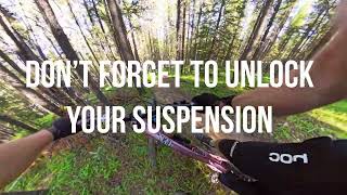
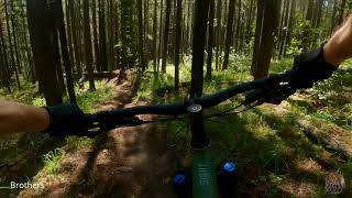
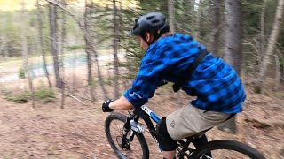
Singletrack through the trees with steep sections and punchy handbuilt berms. A few booters exist on the line so be ready for maximum fun. End of the trail has a triple option ranging from technical move to an easier ride araound - choose wisely.
*Avoid riding this trail when conditions are wet.*

Access Info

Park at Ing Mine parking lot. Climb the gated road between the highway and parking lot. Trail begins across form uShoulda, off the road.

Local Trail Association

Recent Activity on Trail

Past Week
  • 4 rides
  • 7 miles average
6 Months
  • 37 rides
  • 11 miles avg distance
All
  • 330 rides
  • Last: Jun 19, 2026
c1c2c3c4
January
February
March
April
May
June
July
August
September
October
November
December
update trails status or condition

Brothers Trail Reports

Status:
on Jun 6, 2026
Ideal
Avg: 4.34 (20 votes)
Your vote: 0

view (2,381)
close
3D
Trail Conditions
  • Unknown
  • Snow Groomed
  • Snow Packed
  • Snow Covered
  • Snow Cover Partial
  • Freeze/thaw Cycle
  • Icy
  • Prevalent Mud
  • Wet
  • Variable
  • Ideal
  • Dry
  • Very Dry
Trail Flow (Ridden Direction)
Trailforks scans users ridelogs to determine the most popular direction each trail is ridden. A good flowing trail network will have most trails flowing in a single direction according to their intension.
The colour categories are based on what percentage of riders are riding a trail in its intended direction.
  • > 96%
  • > 90%
  • > 80%
  • > 70%
  • > 50%
  • < 50%
  • bi-directional trail
  • no data
Trail Last Ridden
Trailforks scans ridelogs to determine the last time a trail was ridden.
  • < 2 days
  • < 1 week
  • < 2 weeks
  • < 1 month
  • < 6 months
  • > 6 months
Trail Ridden Direction
The intended direction a trail should be ridden.
  • Downhill Only
  • Downhill Primary
  • Both Directions
  • Uphill Primary
  • Uphill Only
  • One Direction
Contribute Details
Colors indicate trail is missing specified detail.
  • Description
  • Photos
  • Description & Photos
  • Videos
Trail Popularity ?
Trailforks scans ridelogs to determine which trails are ridden the most in the last 9 months. Trails are compared with nearby trails in the same city region with a possible 25 colour shades. Think of this as a heatmap, more rides = more kinetic energy = warmer colors.
  • most popular
  • popular
  • less popular
  • not popular
ATV/ORV/OHV Filter
Max Vehicle Width
inches
US Cell Coverage
Legend
cell carrier legend

Radar Time
Activity Recordings
Trailforks uses anonymized public activity data. ?
Activity Recordings
Trailforks uses anonymized public activity data. ?
Personal Heatmap
Activity Types
all / none
Options
2
Date range month
Winter Trails
Warning A routing network for winter maps does not exist. Selecting trails using the winter trails layer has been disabled.
Missing Trails
Most Popular
Least Popular
Trails are colored based on popularity. The more popular a trail is, the more red. Less popular trails trend towards green.
Jump Magnitude Heatmap
Heatmap of where riders jump on trails. Zoom in to see individual jumps, click circles to view jump details.
BC Backroad Status

Service Road Atlas is a free to use, community-driven service for viewing and creating reports on the numerous back-country service roads around B.C. and Alberta.

map legend
Slope Aspect
Direction the slope faces
Flat N NE E SE S SW W NW
Trails Deemphasized
Trails are shown in grey.
disable
Only show trails with no bike usage.
Enable
Suggested Layers
Based on selected activity type

    Save the current map location and zoom level as your default home location whenever this page is loaded.

    Save
        Directions to brothers trailhead (50.883660, -114.772390)

        Photos

        2 more »
        422 |
        Aug 10, 2020 @ 11:30pm
        Aug 10, 2020
        369 |
        Aug 10, 2020 @ 11:30pm
        Aug 10, 2020

        Videos

        7 more »
        Brothers, Prairie Mountain
        2:58 | 388 | Jul 9, 2024 , Bragg Creek
        Brothers DH (Crashed in the end) - Prairie...
        6:22 | 561 | Jul 26, 2022 , Bragg Creek
        Brothers - Prairie Mountain
        4:09 | 484 | Jun 28, 2021 , Bragg Creek
        Brothers - Planet Spud
        3:24 | 537 | Apr 1, 2021 , Bragg Creek

        Routes with this trail

        21 miles 6,367 ft 14
        Solstice chase event intermediate course. Ride a mix of blue and black trails on Prairie Shoulder. Trail...
        44 miles 13,042 ft 23 Loop
        Solstice chase event advanced course. Ride all trails on Prairie Shoulder. Trail Order: Meaty Orge CYA

        Reviews / Comments

        No reviews yet, be the first to write a review or ask a question.
        Use trail reports to comment on trail conditions.


        We hope you've been enjoying Trailforks!

        Create a FREE account to view trail comments and much more.

        • By jitenshakunTF Pro & contributors
        • #211712 - 4,001 views

        Frequently Asked Questions About Brothers

        Where is Brothers located?
        Brothers is located in Prairie Mountain, Bragg Creek, Alberta, Canada. It is part of the Prairie Mountain trail network. The trailhead is located at coordinates 50.88366, -114.77239.
        How hard is Brothers?
        Brothers is rated as Black Diamond difficulty. The physical rating is Moderate. The average grade is 24.3%. The climb difficulty is rated Blue.
        What is the elevation gain for Brothers?
        The trail has 260 m of elevation descent. The elevation ranges from 1,514 m to 1,774 m.
        Is Brothers a point to point trail?
        Yes, Brothers is a point to point trail. The direction is Downhill Only. The trail type is singletrack.

        Hit the Trail

        Open in App

        Get this trail on your phone instantly.
        open trail in app

        Download Trail

        Save to wishlist, Garmin & download.
        save the trail

        Find Related Routes

        Find routes and users activities that include this trail.
        find routes for this trail

        You must enter a description before submitting.