more stats
4.7 miles
Distance
528 ft
Climb
-1,588 ft
Descent
01:14:50
Avg time
-1,061 ft
Altitude change
4,840 ft
Altitude min
6,279 ft
Altitude max
5,901 ft
Altitude start
4,839 ft
Altitude end
-4.2%
Grade
-53.6%
Grade max
52.6%
Grade min
4,472 ft
Distance climb
4 miles
Distance down
1,906 ft
Distance flat
01:14:50
Avg time

AZT/BP - Bug Springs #10 Details

  • Activities
    • Mountain Bike
    • Horse
    • Hike
    • Trail Running
  • Riding Area
    Mt Lemmon - Lower
    Tucson, Arizona
  • Ref Number
    B11
  • AKA
    AZT Passages for Mountain Bikes
  • Difficulty Rating
  • Voted Difficulty
    Black Diamond (4 votes)
  • Local Popularity
    95 in Mountain Biking [+]
    • 70 in Trail Running
    • 55 in Hiking
    • 5 in Horseback
  • Global Ranking
    #2371 in Mountain Biking [+]
    • #19592 in Trail Running
    • #61683 in Hiking
  • Trail Type
    Singletrack
  • Bike Type
    AM, XC
  • Direction
    Downhill Primary
    Popular Direction Shown
  • Physical Rating
    Moderate
  • Season
    Year Round
  • eBike Allowed
  • Land Owner

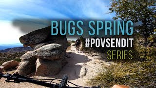
This is probably the most popular trail on Mt. Lemmon and one of the most popular in all if Tucson. Its a great start to Mt Lemmon riding for the fact that is one of the easier trails on the mountain. It is still difficult but its a good trail to see if you have graduated to the more techy stuff that Lemmon has to offer. It begins with a long 15 minute hike-a-bike followed by a techy water-bar descent. After the first descent you have an amazing rip thru the trees on to the second hike-a-bike of the day. The second HaB is much shorter than the first and right about the time you start wishing you had never brought a bike you are done with it and about to hit the payday. Now you have a quick rock techy section followed by an awesome slick rock area with stunning views. Don't forget to stop and look around. After that you have some of the best flowy ribbon singletrack on the mountain. It seems like its endless and you never want the fun to stop. You will finally come out back down at the highway were it crosses the road into Gordon Hirabayashi Campground from here most continue on down AZT/Prison Camp.

Access Info

The is mainly run as a shuttle with most leaving a car at the Molino Basin Campground and shuttling up from there.

Upper Bug Springs trailhead is where you want to start your ride. The parking area for it is at roughly milepost 11 on Mt Lemmon highway and is on your right as you are headed up. The trail is very easy to find with a big sign that you can see right from the small parking lot.

Trail Supporters
Local Trail Association

Recent Activity on Trail

Past Week
  • 0 rides
  •  
6 Months
  • 85 rides
  • 22.0 km avg distance
All
  • 656 rides
  • Last: Jun 14, 2026
c1c2c3c4
January
February
March
April
May
June
July
August
September
October
November
December
update trails status or condition

AZT/BP - Bug... Trail Reports

statusdatedescription
Apr 20, 2026 @ 9:32am (America/Phoenix)
Apr 20, 2026
first water bar from the very top of the h-a-b is in really sketchy shape. some folks are choosing to walk it since it looks like it might roll...
Apr 12, 2026 @ 9:24pm (America/Phoenix)
Apr 12, 2026
Apr 12, 2026 @ 1:49pm (America/Phoenix)
Apr 12, 2026
Feb 6, 2026 @ 4:31pm (America/Phoenix)
Feb 6, 2026
Jan 29, 2026 @ 1:10pm (America/Phoenix)
Jan 29, 2026
more »
Status:
on Apr 20, 2026
Very Dry
Avg: 4.56 (51 votes)
Your vote: 0

view (5,567)
close
3D
Trail Conditions
  • Unknown
  • Snow Groomed
  • Snow Packed
  • Snow Covered
  • Snow Cover Partial
  • Freeze/thaw Cycle
  • Icy
  • Prevalent Mud
  • Wet
  • Variable
  • Ideal
  • Dry
  • Very Dry
Trail Flow (Ridden Direction)
Trailforks scans users ridelogs to determine the most popular direction each trail is ridden. A good flowing trail network will have most trails flowing in a single direction according to their intension.
The colour categories are based on what percentage of riders are riding a trail in its intended direction.
  • > 96%
  • > 90%
  • > 80%
  • > 70%
  • > 50%
  • < 50%
  • bi-directional trail
  • no data
Trail Last Ridden
Trailforks scans ridelogs to determine the last time a trail was ridden.
  • < 2 days
  • < 1 week
  • < 2 weeks
  • < 1 month
  • < 6 months
  • > 6 months
Trail Ridden Direction
The intended direction a trail should be ridden.
  • Downhill Only
  • Downhill Primary
  • Both Directions
  • Uphill Primary
  • Uphill Only
  • One Direction
Contribute Details
Colors indicate trail is missing specified detail.
  • Description
  • Photos
  • Description & Photos
  • Videos
Trail Popularity ?
Trailforks scans ridelogs to determine which trails are ridden the most in the last 9 months. Trails are compared with nearby trails in the same city region with a possible 25 colour shades. Think of this as a heatmap, more rides = more kinetic energy = warmer colors.
  • most popular
  • popular
  • less popular
  • not popular
ATV/ORV/OHV Filter
Max Vehicle Width
inches
US Cell Coverage
Legend
cell carrier legend

Radar Time
Activity Recordings
Trailforks uses anonymized public activity data. ?
Activity Recordings
Trailforks uses anonymized public activity data. ?
Personal Heatmap
Activity Types
all / none
Options
2
Date range month
Winter Trails
Warning A routing network for winter maps does not exist. Selecting trails using the winter trails layer has been disabled.
Missing Trails
Most Popular
Least Popular
Trails are colored based on popularity. The more popular a trail is, the more red. Less popular trails trend towards green.
Jump Magnitude Heatmap
Heatmap of where riders jump on trails. Zoom in to see individual jumps, click circles to view jump details.
BC Backroad Status

Service Road Atlas is a free to use, community-driven service for viewing and creating reports on the numerous back-country service roads around B.C. and Alberta.

map legend
Slope Aspect
Direction the slope faces
Flat N NE E SE S SW W NW
Trails Deemphasized
Trails are shown in grey.
disable
Only show trails with no bike usage.
Enable
Suggested Layers
Based on selected activity type

    Save the current map location and zoom level as your default home location whenever this page is loaded.

    Save
        Directions to azt-bp-bug-springs-10 trailhead (32.374300, -110.690330)

        Photos

        70 more »
        40 |
        Apr 19, 2026 @ 8:07pm
        Apr 19, 2026
        42 |
        Apr 16, 2026 @ 2:00am
        Apr 16, 2026
        32 |
        Apr 16, 2026 @ 2:00am
        Apr 16, 2026
        30 |
        Apr 16, 2026 @ 2:00am
        Apr 16, 2026

        Videos

        24 more »
        youtuber Mountain Biking Bug Springs & Prison Camp...
        12:41 | 1054 | Jan 16, 2020 , Tucson
        youtuber BUG SPRINGS TO PRISON CAMP at Mt. Lemmon
        8:17 | 1186 | Sep 13, 2019 , Tucson
        youtuber Are These The BEST Trails in Tucson Arizona?...
        13:11 | 431 | Apr 24, 2023 , Tucson
        youtuber FROM FOREST TO DESERT! | Riding Mt. Lemmon in...
        17:47 | 1082 | Feb 22, 2019 , Tucson

        Trail Lists

        • Arizona Trail
          Arizona Trail
          160 trails
          National Scenic Trail or Official Route

        Routes with this trail

        3.6 31 miles 3,652 ft 13 Shuttled
        This is it, the real deal, the full Lemmon Drop. Its a 35mile punch in the face that will leave you...
        4.0 14 miles 1,504 ft 4 Shuttled
        Shuttle up to upper trail head and finish on La Milagrosa. Bug Springs may or may not be ride-able in winter.
        3.7 14 miles 1,573 ft 8 Point to Point
        Park at Agua Caliente Park and shuttle up to the top of . HAB up the first section of . Ride through...

        Trail Events

        17 Reviews & Comments


        We hope you've been enjoying Trailforks!

        Create a FREE account to view trail comments and much more.

        • By bigworm520TF Pro TORCA & contributors
        • #4733 - 22,149 views

        Frequently Asked Questions About AZT/BP - Bug Springs #10

        Where is AZT/BP - Bug Springs #10 located?
        AZT/BP - Bug Springs #10 is located in Mt Lemmon - Lower, Tucson, Arizona, United States. It is part of the Mt Lemmon - Lower trail network. The trailhead is located at coordinates 32.3743, -110.69033.
        How hard is AZT/BP - Bug Springs #10?
        AZT/BP - Bug Springs #10 is rated as Black Diamond difficulty. The physical rating is Moderate. The average grade is 4.2%.
        What is the elevation gain for AZT/BP - Bug Springs #10?
        AZT/BP - Bug Springs #10 has 528 ft of elevation gain. The trail has 1,588 ft of elevation descent. The elevation ranges from 4,840 ft to 6,279 ft.
        Is AZT/BP - Bug Springs #10 a point to point trail?
        AZT/BP - Bug Springs #10 is not a point to point trail. The direction is Downhill Primary. The trail type is singletrack.

        Hit the Trail

        Open in App

        Get this trail on your phone instantly.
        open trail in app

        Download Trail

        Save to wishlist, Garmin & download.
        save the trail

        Find Related Routes

        Find routes and users activities that include this trail.
        find routes for this trail

        You must enter a description before submitting.