more stats
4.7 miles
Distance
221 ft
Climb
-1,481 ft
Descent
00:35:33
Avg time
-1,260 ft
Altitude change
16 ft
Altitude min
1,283 ft
Altitude max
1,277 ft
Altitude start
16 ft
Altitude end
-5.04%
Grade
-32.968%
Grade max
22.612%
Grade min
5,205 ft
Distance climb
3 miles
Distance down
3,026 ft
Distance flat
00:35:33
Avg time

Bump Track Details

  • Activities
    • Mountain Bike
    • E-Bike
    • Gravel Bike
    • Adaptive Bike
    • Hike
    • Trail Running
  • Difficulty Rating
  • Voted Difficulty
    Green (1 vote)
  • Local Popularity
    100 in Mountain Biking [+]
    • 100 in E-Biking
    • 95 in Trail Running
    • 5 in Hiking
  • Global Ranking
    #34972 in Mountain Biking [+]
    • #2517 in E-Biking
    • #34900 in Trail Running
    • #72311 in Hiking
  • Trail Type
    Doubletrack
  • Bike Type
    DH, XC, Gravel, Adaptive MTB
  • Direction
    Downhill Primary[+]
    Popular Direction Shown
    • Downhill Primary for Gravel Biking
  • Climb Difficulty
    Black Diamond
  • Physical Rating
    Moderate
  • Dogs Allowed
    Yes
  • eBike Allowed
    Yes up to Class 1
  • Land Owner
    National Parks

This 6km track was originally an Aboriginal trail between the coastal and mountain regions, and in the early days of settlement was a crucial link between Port Douglas and the hinterland for settlers and miners.

The ascent for the Bump Track starts with a 2km challenging incline, including one nasty steep climb called Slatey Pinch at the halfway point. After this, it is 4km of rolling hilly bumps, including a steep drop into Robin's Creek,a picturesque mountain stream approximately 2km from the top of the track. The descent from The Bump is generally in good condition but the steepness combined with speed and a number of waterbars means that the Bump probably causes more injuries than any other track in the area.

There are very few technical obstacles. The drop into Robin's Creek can be very slippery and steep to exit and requires all riders to walk their bike out. The metal walkway out of the creek can be lethal with wet bike shoes. The Bump Track ends at Connolly Road in the Mowbray Valley. From Connolly Road there is a marked "RRR" track back to Port Douglas, with a beach ride along the iconic Four Mile Beach to finish.

Access Info

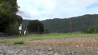
The Bump Track climb starts on Connolly Road (off Mowbray River Road) an easy ride from Port Douglas. The Bump Track descent starts on Black Mountain Road, Julatten.

Traditionally Indigenous Territory

Recent Activity on Trail

Past Week
  • 0 rides
  •  
6 Months
  • 0 rides
  •  
All
  • 41 rides
  • Last: May 24, 2026
c1c2c3c4
January
February
March
April
May
June
July
August
September
October
November
December
update trails status or condition

Bump Track Trail Reports

statusdatedescription
Sep 20, 2023 @ 8:43pm
Sep 20, 2023
Perfect condition.
Aug 20, 2023 @ 1:20am
Aug 20, 2023
Jun 26, 2023 @ 4:11pm
Jun 26, 2023
Mostly dry, an excavator was halfway up smoothing over some mucky bits. There were two small sections where we walked cos it was bumpy and...
Sep 12, 2020 @ 3:07pm
Sep 12, 2020
Track is in great condition. Lower half was slippery in the wet
Jan 26, 2020 @ 10:24pm
Jan 26, 2020
Lots of wet patches today as it rained last night.. Good fun ride. Sign says double black diamond but more like black diamond. Wait a while vines...
more »
Status:
on Sep 20, 2023
Ideal
Avg: 4.21 (3 votes)
Your vote: 0

view (619)
close
3D
Trail Conditions
  • Unknown
  • Snow Groomed
  • Snow Packed
  • Snow Covered
  • Snow Cover Partial
  • Freeze/thaw Cycle
  • Icy
  • Prevalent Mud
  • Wet
  • Variable
  • Ideal
  • Dry
  • Very Dry
Trail Flow (Ridden Direction)
Trailforks scans users ridelogs to determine the most popular direction each trail is ridden. A good flowing trail network will have most trails flowing in a single direction according to their intension.
The colour categories are based on what percentage of riders are riding a trail in its intended direction.
  • > 96%
  • > 90%
  • > 80%
  • > 70%
  • > 50%
  • < 50%
  • bi-directional trail
  • no data
Trail Last Ridden
Trailforks scans ridelogs to determine the last time a trail was ridden.
  • < 2 days
  • < 1 week
  • < 2 weeks
  • < 1 month
  • < 6 months
  • > 6 months
Trail Ridden Direction
The intended direction a trail should be ridden.
  • Downhill Only
  • Downhill Primary
  • Both Directions
  • Uphill Primary
  • Uphill Only
  • One Direction
Contribute Details
Colors indicate trail is missing specified detail.
  • Description
  • Photos
  • Description & Photos
  • Videos
Trail Popularity ?
Trailforks scans ridelogs to determine which trails are ridden the most in the last 9 months. Trails are compared with nearby trails in the same city region with a possible 25 colour shades. Think of this as a heatmap, more rides = more kinetic energy = warmer colors.
  • most popular
  • popular
  • less popular
  • not popular
ATV/ORV/OHV Filter
Max Vehicle Width
inches
US Cell Coverage
Legend
cell carrier legend

Radar Time
Activity Recordings
Trailforks uses anonymized public activity data. ?
Activity Recordings
Trailforks uses anonymized public activity data. ?
Personal Heatmap
Activity Types
all / none
Options
2
Date range month
Winter Trails
Warning A routing network for winter maps does not exist. Selecting trails using the winter trails layer has been disabled.
Missing Trails
Most Popular
Least Popular
Trails are colored based on popularity. The more popular a trail is, the more red. Less popular trails trend towards green.
Jump Magnitude Heatmap
Heatmap of where riders jump on trails. Zoom in to see individual jumps, click circles to view jump details.
BC Backroad Status

Service Road Atlas is a free to use, community-driven service for viewing and creating reports on the numerous back-country service roads around B.C. and Alberta.

map legend
Slope Aspect
Direction the slope faces
Flat N NE E SE S SW W NW
Trails Deemphasized
Trails are shown in grey.
disable
Only show trails with no bike usage.
Enable
Suggested Layers
Based on selected activity type

    Save the current map location and zoom level as your default home location whenever this page is loaded.

    Save
        Directions to bump-track trailhead (-16.602630, 145.435080)

        Photos

        58 more »
        80 |
        Jun 26, 2023 @ 5:43am
        Jun 26, 2023
        87 |
        Jun 26, 2023 @ 5:43am
        Jun 26, 2023
        70 |
        Jun 26, 2023 @ 5:43am
        Jun 26, 2023
        246 |
        Jan 23, 2018 @ 3:26am
        Jan 23, 2018

        Videos

        2 more »
        youtuber CAIRNS MTB  -  THE BUMP TRACK with Glen...
        9:39 | 3122 | Jul 22, 2019 , Port Douglas
        Ripping the Bump Track
        3:48 | 562 | Dec 11, 2011 , Port Douglas

        Trail Lists

        1 Review & Comments


        We hope you've been enjoying Trailforks!

        Create a FREE account to view trail comments and much more.

        Nearby Trails

        • By Grug & contributors
        • #101135 - 11,530 views

        Frequently Asked Questions About Bump Track

        Where is Bump Track located?
        Bump Track is located in Port Douglas, Australia. The trailhead is located at coordinates -16.60263, 145.43508.
        How hard is Bump Track?
        Bump Track is rated as Blue difficulty. The physical rating is Moderate. The average grade is 5.04%. The climb difficulty is rated Black Diamond.
        What is the elevation gain for Bump Track?
        Bump Track has 67 m of elevation gain. The trail has 451 m of elevation descent. The elevation ranges from 5 m to 391 m.
        Is Bump Track a point to point trail?
        Bump Track is not a point to point trail. The direction is Downhill Primary. The trail type is doubletrack.

        Hit the Trail

        Open in App

        Get this trail on your phone instantly.
        open trail in app

        Download Trail

        Save to wishlist, Garmin & download.
        save the trail

        Find Related Routes

        Find routes and users activities that include this trail.
        find routes for this trail

        You must enter a description before submitting.