more stats
1.1 miles
Distance
57 ft
Climb
-99 ft
Descent
00:09:02
Avg time
-44 ft
Altitude change
250 ft
Altitude min
294 ft
Altitude max
294 ft
Altitude start
249 ft
Altitude end
-0.7%
Grade
-12.7%
Grade max
8.2%
Grade min
1,860 ft
Distance climb
2,759 ft
Distance down
1,345 ft
Distance flat
00:09:02
Avg time

Cabin John Details

  • Activities
    • Mountain Bike
    • Winter Fat Bike
    • Hike
    • Trail Running
  • Riding Area
    Cabin John Park
    Bethesda, Maryland
  • Difficulty Rating
  • Voted Difficulty
    Green (1 vote)
  • Local Popularity
    40 in Mountain Biking [+]
    • 55 in Trail Running
    • 90 in Hiking
  • Global Ranking
    #113445 in Mountain Biking [+]
    • #98752 in Trail Running
    • #4084 in Hiking
  • Trail Type
    Mixed
  • Bike Type
    AM, XC, Fat
  • Direction
    Both Directions
  • Climb Difficulty
    Green
  • Physical Rating
    Moderate
  • Dogs Allowed
    Yes
  • eBike Allowed
  • TTFs on Trail
    Bridge, Rock Garden

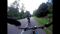
The Cabin John Trail runs along Cabin John Creek from Goya Dr. till the Potomac River. The north loop is flowy with few technical challenges. The rest of the trail is rocky and rooty on some of the descents and climbs, while other parts are flat, without and rocks or roots. Parts of the trail near the creek dry slowly, so expect some muddy areas. An excellent trail for beginners looking for a challenge. Proceed with caution at the numerous road crossings. However, it should be said that the parts of the trail along the road have a comfortably wide shoulder, and most of the roads are minor arteries.

Access Info

Parking exists at most road crossings

Trail Supporters
  • Potomac Appalachian Trail Club
    Builder
Local Trail Association
Traditionally Indigenous Territory

Recent Activity on Trail

Past Week
  • 1 rides
  • 2 miles average
6 Months
  • 6 rides
  • 6 miles avg distance
All
  • 106 rides
  • Last: Jun 17, 2026
c1c2c3c4
January
February
March
April
May
June
July
August
September
October
November
December
update trails status or condition

Cabin John Trail Reports

statusdatedescription
Aug 22, 2025 @ 2:13pm
Aug 22, 2025
Large tree down across trail, blocking trail
Apr 23, 2025 @ 12:21pm
Apr 23, 2025
Jun 4, 2024 @ 11:48am
Jun 4, 2024
Several large downed trees that are difficult to pass with a bike
Feb 5, 2024 @ 2:35am
Feb 5, 2024
Oct 8, 2022 @ 11:42am
Oct 8, 2022
90% of the trail is fine, low spots that tend to hold water are wet, but other than that it is great.
more »
Status:
on Aug 22, 2025
Avg: 3.89 (4 votes)
Your vote: 0

view (1,084)
close
3D
Trail Conditions
  • Unknown
  • Snow Groomed
  • Snow Packed
  • Snow Covered
  • Snow Cover Partial
  • Freeze/thaw Cycle
  • Icy
  • Prevalent Mud
  • Wet
  • Variable
  • Ideal
  • Dry
  • Very Dry
Trail Flow (Ridden Direction)
Trailforks scans users ridelogs to determine the most popular direction each trail is ridden. A good flowing trail network will have most trails flowing in a single direction according to their intension.
The colour categories are based on what percentage of riders are riding a trail in its intended direction.
  • > 96%
  • > 90%
  • > 80%
  • > 70%
  • > 50%
  • < 50%
  • bi-directional trail
  • no data
Trail Last Ridden
Trailforks scans ridelogs to determine the last time a trail was ridden.
  • < 2 days
  • < 1 week
  • < 2 weeks
  • < 1 month
  • < 6 months
  • > 6 months
Trail Ridden Direction
The intended direction a trail should be ridden.
  • Downhill Only
  • Downhill Primary
  • Both Directions
  • Uphill Primary
  • Uphill Only
  • One Direction
Contribute Details
Colors indicate trail is missing specified detail.
  • Description
  • Photos
  • Description & Photos
  • Videos
Trail Popularity ?
Trailforks scans ridelogs to determine which trails are ridden the most in the last 9 months. Trails are compared with nearby trails in the same city region with a possible 25 colour shades. Think of this as a heatmap, more rides = more kinetic energy = warmer colors.
  • most popular
  • popular
  • less popular
  • not popular
ATV/ORV/OHV Filter
Max Vehicle Width
inches
US Cell Coverage
Legend
cell carrier legend

Radar Time
Activity Recordings
Trailforks uses anonymized public activity data. ?
Activity Recordings
Trailforks uses anonymized public activity data. ?
Personal Heatmap
Activity Types
all / none
Options
2
Date range month
Winter Trails
Warning A routing network for winter maps does not exist. Selecting trails using the winter trails layer has been disabled.
Missing Trails
Most Popular
Least Popular
Trails are colored based on popularity. The more popular a trail is, the more red. Less popular trails trend towards green.
Jump Magnitude Heatmap
Heatmap of where riders jump on trails. Zoom in to see individual jumps, click circles to view jump details.
BC Backroad Status

Service Road Atlas is a free to use, community-driven service for viewing and creating reports on the numerous back-country service roads around B.C. and Alberta.

map legend
Slope Aspect
Direction the slope faces
Flat N NE E SE S SW W NW
Trails Deemphasized
Trails are shown in grey.
disable
Only show trails with no bike usage.
Enable
Suggested Layers
Based on selected activity type

    Save the current map location and zoom level as your default home location whenever this page is loaded.

    Save
        Directions to cabin-john trailhead (39.051430, -77.156590)

        Photos

        4 more »
        220 |
        Nov 29, 2016 @ 10:40am
        Nov 29, 2016
        281 |
        Dec 27, 2014 @ 8:00pm
        Dec 27, 2014
        22 |
        Apr 1, 2026 @ 10:30am
        Apr 1, 2026
        31 |
        Jun 4, 2024 @ 11:48am
        Jun 4, 2024

        Videos

        1 more »
        Cabin John Trail W/ Miller and Mike
        14:53 | 210 | Sep 6, 2016 , Bethesda

        Routes with this trail

        5.0 6 miles 431 ft 6 Loop
        Discover Montgomery County ride series.

        2 Reviews & Comments


        We hope you've been enjoying Trailforks!

        Create a FREE account to view trail comments and much more.

        • By chize & contributors
        • #71144 - 3,167 views

        Frequently Asked Questions About Cabin John

        Where is Cabin John located?
        Cabin John is located in Cabin John Park, Bethesda, Maryland, United States. It is part of the Cabin John Park trail network. The trailhead is located at coordinates 39.05143, -77.15659.
        How hard is Cabin John?
        Cabin John is rated as Green difficulty. The physical rating is Moderate. The average grade is 0.7%. The climb difficulty is rated Green.
        What is the elevation gain for Cabin John?
        Cabin John has 57 ft of elevation gain. The trail has 99 ft of elevation descent. The elevation ranges from 250 ft to 294 ft.
        Is Cabin John a point to point trail?
        Cabin John is not a point to point trail. The direction is Both Directions. The trail type is mixed.

        Hit the Trail

        Open in App

        Get this trail on your phone instantly.
        open trail in app

        Download Trail

        Save to wishlist, Garmin & download.
        save the trail

        Find Related Routes

        Find routes and users activities that include this trail.
        find routes for this trail

        You must enter a description before submitting.