more stats
1,161 ft
Distance
-278 ft
Descent
00:09:24
Avg time
-278 ft
Altitude change
9,171 ft
Altitude min
9,448 ft
Altitude max
9,448 ft
Altitude start
9,170 ft
Altitude end
-23.9%
Grade
-55.8%
Grade max
-9.7%
Grade min
1,161 ft
Distance down
00:09:24
Avg time

Cascadas Details

  • Activities
    • Mountain Bike
    • E-Bike
    • Hike
    • Trail Running
  • Riding Area
    Chiluca - El Moño
    Santa Ana Jilotzingo
  • AKA
    cascadas, cascada, caida
  • Difficulty Rating
  • Local Popularity
    5 in Mountain Biking [+]
    • 50 in E-Biking
    • 5 in Trail Running
    • 5 in Hiking
  • Global Ranking
    #278075 in Mountain Biking [+]
    • #77448 in E-Biking
    • #176489 in Trail Running
    • #175087 in Hiking
  • Hiking SAC Scale
    T2 Mountain Hiking
  • Trail Type
    Other
  • Bike Type
    DH, AM
  • Direction
    Downhill Only
    Popular Direction Shown
  • Climb Difficulty
    Black Diamond
  • Physical Rating
    Hard
  • Trail Visibility
    Always easy to follow
  • Season
    nov-may
  • Dogs Allowed
    Yes
  • eBike Allowed
    Yes up to Class 1

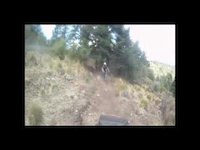
Bajada de cascadas, como su nombre lo dice es una bajada muy muy empinada de tierra suelta.

Access Info

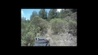
hay que subir el repecho desde donde termina la rompepiernas cruzando por la cerca de púas.

Bike Park

Recent Activity on Trail

Past Week
  • 0 rides
  •  
6 Months
  • 0 rides
  •  
All
  • 0 rides
  • Last: Jun 26, 2023
update trails status or condition

Cascadas Trail Reports

no reports have been added for Cascadas yet, add a trail report.
Trail reports are used to indicate a trails current condition and inform builders and other riders about any issues on a trail.
Status:
no votes yet
Your vote: 0

view (8)
close
3D
Trail Conditions
  • Unknown
  • Snow Groomed
  • Snow Packed
  • Snow Covered
  • Snow Cover Partial
  • Freeze/thaw Cycle
  • Icy
  • Prevalent Mud
  • Wet
  • Variable
  • Ideal
  • Dry
  • Very Dry
Trail Flow (Ridden Direction)
Trailforks scans users ridelogs to determine the most popular direction each trail is ridden. A good flowing trail network will have most trails flowing in a single direction according to their intension.
The colour categories are based on what percentage of riders are riding a trail in its intended direction.
  • > 96%
  • > 90%
  • > 80%
  • > 70%
  • > 50%
  • < 50%
  • bi-directional trail
  • no data
Trail Last Ridden
Trailforks scans ridelogs to determine the last time a trail was ridden.
  • < 2 days
  • < 1 week
  • < 2 weeks
  • < 1 month
  • < 6 months
  • > 6 months
Trail Ridden Direction
The intended direction a trail should be ridden.
  • Downhill Only
  • Downhill Primary
  • Both Directions
  • Uphill Primary
  • Uphill Only
  • One Direction
Contribute Details
Colors indicate trail is missing specified detail.
  • Description
  • Photos
  • Description & Photos
  • Videos
Trail Popularity ?
Trailforks scans ridelogs to determine which trails are ridden the most in the last 9 months. Trails are compared with nearby trails in the same city region with a possible 25 colour shades. Think of this as a heatmap, more rides = more kinetic energy = warmer colors.
  • most popular
  • popular
  • less popular
  • not popular
ATV/ORV/OHV Filter
Max Vehicle Width
inches
US Cell Coverage
Legend
cell carrier legend

Radar Time
Activity Recordings
Trailforks uses anonymized public activity data. ?
Activity Recordings
Trailforks uses anonymized public activity data. ?
Personal Heatmap
Activity Types
all / none
Options
2
Date range month
Winter Trails
Warning A routing network for winter maps does not exist. Selecting trails using the winter trails layer has been disabled.
Missing Trails
Most Popular
Least Popular
Trails are colored based on popularity. The more popular a trail is, the more red. Less popular trails trend towards green.
Jump Magnitude Heatmap
Heatmap of where riders jump on trails. Zoom in to see individual jumps, click circles to view jump details.
BC Backroad Status

Service Road Atlas is a free to use, community-driven service for viewing and creating reports on the numerous back-country service roads around B.C. and Alberta.

map legend
Slope Aspect
Direction the slope faces
Flat N NE E SE S SW W NW
Trails Deemphasized
Trails are shown in grey.
disable
Only show trails with no bike usage.
Enable
Suggested Layers
Based on selected activity type

    Save the current map location and zoom level as your default home location whenever this page is loaded.

    Save
        Directions to cascadas trailhead (19.528990, -99.330480)

        Photos

        No photos have been added for Cascadas yet, add a photo.

        Videos

        2 more »
        CASCADAS DE CHILUCA
        8:25 | 248 | May 10, 2011 , Santa Ana Jilotzingo
        CASCADAS CHILUCA PRIMERA PARTE
        6:06 | 203 | May 10, 2011 , Santa Ana Jilotzingo

        Reviews / Comments

        No reviews yet, be the first to write a review or ask a question.
        Use trail reports to comment on trail conditions.


        We hope you've been enjoying Trailforks!

        Create a FREE account to view trail comments and much more.

        • By angelsan8 & contributors
        • #438087 - 382 views

        Frequently Asked Questions About Cascadas

        Where is Cascadas located?
        Cascadas is located in Chiluca - El Moño, Santa Ana Jilotzingo, México. It is part of the Chiluca - El Moño trail network. The trailhead is located at coordinates 19.52899, -99.33048.
        How hard is Cascadas?
        Cascadas is rated as Black Diamond difficulty. The physical rating is Hard. The average grade is 23.9%. The climb difficulty is rated Black Diamond.
        What is the elevation gain for Cascadas?
        The trail has 278 ft of elevation descent. The elevation ranges from 9,171 ft to 9,448 ft.
        Is Cascadas a point to point trail?
        Yes, Cascadas is a point to point trail. The direction is Downhill Only. The trail type is other.

        Hit the Trail

        Open in App

        Get this trail on your phone instantly.
        open trail in app

        Download Trail

        Save to wishlist, Garmin & download.
        save the trail

        Find Related Routes

        Find routes and users activities that include this trail.
        find routes for this trail

        You must enter a description before submitting.