more stats
1.3 miles
Distance
121 ft
Climb
-122 ft
Descent
00:10:08
Avg time
0 ft
Altitude change
652 ft
Altitude min
711 ft
Altitude max
706 ft
Altitude start
705 ft
Altitude end
-22.9%
Grade max
15.2%
Grade min
3,031 ft
Distance climb
2,707 ft
Distance down
1,135 ft
Distance flat
00:10:08
Avg time

Trail Details

  • Activities
    • Mountain Bike
    • Gravel Bike
    • Adaptive Bike
    • Winter Fat Bike
    • Hike
    • Trail Running
    • Snowshoe
    • Backcountry Ski
    • Nordic Ski
  • Riding Area
    Palos Forest Preserve
    Willow Springs, Illinois
  • AKA
    Purple Singletrack
  • Difficulty Rating
  • Voted Difficulty
    Black Diamond (2 votes)
  • Local Popularity
    85 in Mountain Biking [+]
    • 60 in Trail Running
    • 5 in Hiking
    • 5 in Snowshoeing
    • 5 in Backcountry Skiing
    • 5 in Nordic Skiing
  • Global Ranking
    #8295 in Mountain Biking [+]
    • #52110 in Trail Running
    • #46678 in Hiking
    • #1342 in Snowshoeing
  • Trail Type
    Singletrack
  • Bike Type
    DH, AM, XC, DJ, Fat, Adaptive MTB, CX, Gravel
  • Direction
    Both Directions[+]
    • Both Directions for Adaptive Biking
  • Climb Difficulty
    Green
  • Physical Rating
    Moderate
  • Trail Visibility
    Sometimes hard to follow
  • Family Friendly
    Yes
  • Dogs Allowed
    Yes
  • eBike Allowed
  • Land Owner

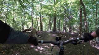
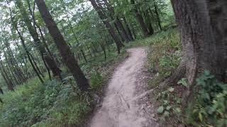
The inbound/outbound segment of this loop is suitable for new mountain bikers of all ages. The clockwise direction of the loop will be short downhill sections with a gradual climbout. The counter clockwise direction will be a gradual downhill with a series of short punchy climbs.

NOTE: The trail going across the bridge and beyond is for foot traffic only and you will risk a ticket from the Forest Preserve Police at the roadway crossing.

Adaptive Bike Info
aMTB Blue Rating: Intermediate features and steeper terrain.
Local Trail Association

Recent Activity on Trail

Past Week
  • 15 rides
  • 17 miles average
6 Months
  • 89 rides
  • 15 miles avg distance
All
  • 1,458 rides
  • Last: Jun 6, 2026
c1c2c3c4
January
February
March
April
May
June
July
August
September
October
November
December
Status:
on Sep 18, 2025
Very Dry
Avg: 4.22 (7 votes)
Your vote: 0

view (10,051)
close
3D
Trail Conditions
  • Unknown
  • Snow Groomed
  • Snow Packed
  • Snow Covered
  • Snow Cover Partial
  • Freeze/thaw Cycle
  • Icy
  • Prevalent Mud
  • Wet
  • Variable
  • Ideal
  • Dry
  • Very Dry
Trail Flow (Ridden Direction)
Trailforks scans users ridelogs to determine the most popular direction each trail is ridden. A good flowing trail network will have most trails flowing in a single direction according to their intension.
The colour categories are based on what percentage of riders are riding a trail in its intended direction.
  • > 96%
  • > 90%
  • > 80%
  • > 70%
  • > 50%
  • < 50%
  • bi-directional trail
  • no data
Trail Last Ridden
Trailforks scans ridelogs to determine the last time a trail was ridden.
  • < 2 days
  • < 1 week
  • < 2 weeks
  • < 1 month
  • < 6 months
  • > 6 months
Trail Ridden Direction
The intended direction a trail should be ridden.
  • Downhill Only
  • Downhill Primary
  • Both Directions
  • Uphill Primary
  • Uphill Only
  • One Direction
Contribute Details
Colors indicate trail is missing specified detail.
  • Description
  • Photos
  • Description & Photos
  • Videos
Trail Popularity ?
Trailforks scans ridelogs to determine which trails are ridden the most in the last 9 months. Trails are compared with nearby trails in the same city region with a possible 25 colour shades. Think of this as a heatmap, more rides = more kinetic energy = warmer colors.
  • most popular
  • popular
  • less popular
  • not popular
ATV/ORV/OHV Filter
Max Vehicle Width
inches
US Cell Coverage
Legend
cell carrier legend

Radar Time
Activity Recordings
Trailforks uses anonymized public activity data. ?
Activity Recordings
Trailforks uses anonymized public activity data. ?
Personal Heatmap
Activity Types
all / none
Options
2
Date range month
Winter Trails
Warning A routing network for winter maps does not exist. Selecting trails using the winter trails layer has been disabled.
Missing Trails
Most Popular
Least Popular
Trails are colored based on popularity. The more popular a trail is, the more red. Less popular trails trend towards green.
Jump Magnitude Heatmap
Heatmap of where riders jump on trails. Zoom in to see individual jumps, click circles to view jump details.
BC Backroad Status

Service Road Atlas is a free to use, community-driven service for viewing and creating reports on the numerous back-country service roads around B.C. and Alberta.

map legend
Slope Aspect
Direction the slope faces
Flat N NE E SE S SW W NW
Trails Deemphasized
Trails are shown in grey.
disable
Only show trails with no bike usage.
Enable
Suggested Layers
Based on selected activity type

    Save the current map location and zoom level as your default home location whenever this page is loaded.

    Save
        Directions to cemetery-hill-loop-purple-49923 trailhead (41.719800, -87.885470)

        Photos

        16 more »
        65 |
        Dec 1, 2024 @ 1:15pm
        Dec 1, 2024
        107 |
        Nov 24, 2021 @ 9:50am
        Nov 24, 2021
        84 |
        Jun 22, 2021 @ 1:48pm
        Jun 22, 2021
        90 |
        Jun 22, 2021 @ 1:48pm
        Jun 22, 2021

        Videos

        4 more »
        Cemetery Hill (return) - Palos Mountain Bike...
        4:15 | 361 | Oct 11, 2020 , Willow Springs
        Cemetery Hill
        2:52 | 240 | Oct 1, 2020 , Willow Springs
        youtuber Cemetery Hill Connector,  Outbound - Palos...
        2:28 | 372 | Jul 16, 2020 , Willow Springs
        youtuber Cemetery Hill, Clockwise - Palos Mountain Bike...
        9:49 | 324 | Jul 16, 2020 , Willow Springs

        Routes with this trail

        14 miles 1,152 ft 13 Loop
        An outer Palos loop omitting Stonehouse
        20 miles 1,234 ft 17
        This is going to be just like old times.
        19 miles 774 ft 7
        Palos FP with stops at Maple Lake and Saganaskee Slough

        1 Review & Comments


        We hope you've been enjoying Trailforks!

        Create a FREE account to view trail comments and much more.

        • By LeDukeTF Pro & contributors
        • #49923 - 3,690 views

        Frequently Asked Questions About Cemetery Hill Loop (PURPLE)

        Where is Cemetery Hill Loop (PURPLE) located?
        Cemetery Hill Loop (PURPLE) is located in Palos Forest Preserve, Willow Springs, Illinois, United States. It is part of the Palos Forest Preserve trail network. The trailhead is located at coordinates 41.7198, -87.88547.
        How hard is Cemetery Hill Loop (PURPLE)?
        Cemetery Hill Loop (PURPLE) is rated as Blue difficulty. The physical rating is Moderate. The climb difficulty is rated Green.
        What is the elevation gain for Cemetery Hill Loop (PURPLE)?
        Cemetery Hill Loop (PURPLE) has 37 m of elevation gain. The trail has 37 m of elevation descent. The elevation ranges from 199 m to 217 m.
        Is Cemetery Hill Loop (PURPLE) a point to point trail?
        Cemetery Hill Loop (PURPLE) is not a point to point trail. The direction is Both Directions. The trail type is singletrack.

        Hit the Trail

        Open in App

        Get this trail on your phone instantly.
        open trail in app

        Download Trail

        Save to wishlist, Garmin & download.
        save the trail

        Find Related Routes

        Find routes and users activities that include this trail.
        find routes for this trail

        You must enter a description before submitting.