more stats
2.1 miles
Distance
205 ft
Climb
-116 ft
Descent
00:14:59
Avg time
90 ft
Altitude change
488 ft
Altitude min
605 ft
Altitude max
515 ft
Altitude start
607 ft
Altitude end
0.8%
Grade
-18.9%
Grade max
15.4%
Grade min
1 mile
Distance climb
2,917 ft
Distance down
2,562 ft
Distance flat
00:14:59
Avg time

Centre Trail Details

  • Activities
    • Mountain Bike
    • Gravel Bike
    • Adaptive Bike
    • Hike
    • Trail Running
  • Riding Area
    Terrey Hills
    Sydney
  • Difficulty Rating
  • Local Popularity
    80 in Mountain Biking [+]
    • 80 in Trail Running
    • 5 in Hiking
  • Trail Type
    Doubletrack
  • Bike Type
    XC, Adaptive MTB, Gravel
  • Direction
    Both Directions
  • Climb Difficulty
    Blue
  • Physical Rating
    Hard
  • Trail Visibility
    Always easy to follow

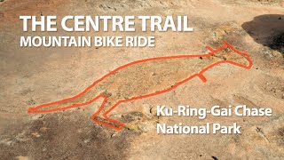
Multi use trail along the ridge line above McCarrs Creek/ Akuna Bay. It can get very rocky after rain with an excess of exposed loose rock and clay. The rock garden at the North Eastern end that used to prove a challenge to climb has been concreted (Aug21) and this is now a really nice and easy trail.

Access Info

Both ends are very obvious, look for National Park signs.

Traditionally Indigenous Territory

Recent Activity on Trail

Past Week
  • 2 rides
  • 26 miles average
6 Months
  • 36 rides
  • 28 miles avg distance
All
  • 258 rides
  • Last: Jun 17, 2026
c1c2c3c4
January
February
March
April
May
June
July
August
September
October
November
December
update trails status or condition

Centre Trail Trail Reports

statusdatedescription
Jan 21, 2024 @ 12:37am
Jan 21, 2024
some water still there from recent rains. good short track i’ll be back
Dec 19, 2023 @ 6:08pm
Dec 19, 2023
May 28, 2023 @ 12:57am
May 28, 2023
Nov 22, 2022 @ 6:52am
Nov 22, 2022
Sep 17, 2022 @ 6:07pm
Sep 17, 2022
Only tiny trickles & puddles
more »
Status:
on Jan 21, 2024
Variable
Avg: 4 (1 votes)
Your vote: 0

view (1,800)
close
3D
Trail Conditions
  • Unknown
  • Snow Groomed
  • Snow Packed
  • Snow Covered
  • Snow Cover Partial
  • Freeze/thaw Cycle
  • Icy
  • Prevalent Mud
  • Wet
  • Variable
  • Ideal
  • Dry
  • Very Dry
Trail Flow (Ridden Direction)
Trailforks scans users ridelogs to determine the most popular direction each trail is ridden. A good flowing trail network will have most trails flowing in a single direction according to their intension.
The colour categories are based on what percentage of riders are riding a trail in its intended direction.
  • > 96%
  • > 90%
  • > 80%
  • > 70%
  • > 50%
  • < 50%
  • bi-directional trail
  • no data
Trail Last Ridden
Trailforks scans ridelogs to determine the last time a trail was ridden.
  • < 2 days
  • < 1 week
  • < 2 weeks
  • < 1 month
  • < 6 months
  • > 6 months
Trail Ridden Direction
The intended direction a trail should be ridden.
  • Downhill Only
  • Downhill Primary
  • Both Directions
  • Uphill Primary
  • Uphill Only
  • One Direction
Contribute Details
Colors indicate trail is missing specified detail.
  • Description
  • Photos
  • Description & Photos
  • Videos
Trail Popularity ?
Trailforks scans ridelogs to determine which trails are ridden the most in the last 9 months. Trails are compared with nearby trails in the same city region with a possible 25 colour shades. Think of this as a heatmap, more rides = more kinetic energy = warmer colors.
  • most popular
  • popular
  • less popular
  • not popular
ATV/ORV/OHV Filter
Max Vehicle Width
inches
US Cell Coverage
Legend
cell carrier legend

Radar Time
Activity Recordings
Trailforks uses anonymized public activity data. ?
Activity Recordings
Trailforks uses anonymized public activity data. ?
Personal Heatmap
Activity Types
all / none
Options
2
Date range month
Winter Trails
Warning A routing network for winter maps does not exist. Selecting trails using the winter trails layer has been disabled.
Missing Trails
Most Popular
Least Popular
Trails are colored based on popularity. The more popular a trail is, the more red. Less popular trails trend towards green.
Jump Magnitude Heatmap
Heatmap of where riders jump on trails. Zoom in to see individual jumps, click circles to view jump details.
BC Backroad Status

Service Road Atlas is a free to use, community-driven service for viewing and creating reports on the numerous back-country service roads around B.C. and Alberta.

map legend
Slope Aspect
Direction the slope faces
Flat N NE E SE S SW W NW
Trails Deemphasized
Trails are shown in grey.
disable
Only show trails with no bike usage.
Enable
Suggested Layers
Based on selected activity type

    Save the current map location and zoom level as your default home location whenever this page is loaded.

    Save
        Directions to centre-trail trailhead (-33.652530, 151.255390)

        Photos

        9 more »
        44 |
        Oct 8, 2021 @ 11:53pm
        Oct 8, 2021
        47 |
        Oct 8, 2021 @ 11:52pm
        Oct 8, 2021
        45 |
        Oct 8, 2021 @ 11:52pm
        Oct 8, 2021
        43 |
        Oct 8, 2021 @ 11:50pm
        Oct 8, 2021

        Videos

        1 more »
        Centre Trail | Mountain Bike ride in...
        9:46 | 359 | Oct 28, 2021 , Sydney

        4 Reviews & Comments


        We hope you've been enjoying Trailforks!

        Create a FREE account to view trail comments and much more.

        • By nandayoTF Pro & contributors
        • #59369 - 2,115 views

        Frequently Asked Questions About Centre Trail

        Where is Centre Trail located?
        Centre Trail is located in Terrey Hills, Sydney, Australia. It is part of the Terrey Hills trail network. The trailhead is located at coordinates -33.65253, 151.25539.
        What is the elevation gain for Centre Trail?
        Centre Trail has 205 ft of elevation gain. The trail has 116 ft of elevation descent. The elevation ranges from 488 ft to 605 ft.
        Is Centre Trail a point to point trail?
        Centre Trail is not a point to point trail. The direction is Both Directions. The trail type is doubletrack.
        How long is Centre Trail?
        Centre Trail is 2.1 miles long. The trail type is doubletrack.

        Hit the Trail

        Open in App

        Get this trail on your phone instantly.
        open trail in app

        Download Trail

        Save to wishlist, Garmin & download.
        save the trail

        Find Related Routes

        Find routes and users activities that include this trail.
        find routes for this trail

        You must enter a description before submitting.