more stats
3,520 ft
Distance
68 ft
Climb
-132 ft
Descent
00:11:18
Avg time
-66 ft
Altitude change
326 ft
Altitude min
393 ft
Altitude max
392 ft
Altitude start
328 ft
Altitude end
-1.9%
Grade
-15.3%
Grade max
16.4%
Grade min
935 ft
Distance climb
1,854 ft
Distance down
728 ft
Distance flat
00:11:18
Avg time

Challenger Details

  • Activities
    • Mountain Bike
    • E-Bike
    • Hike
    • Trail Running
    • Snowshoe
    • Nordic Ski
  • Riding Area
    Vietnam Trail Network
    Milford, Massachusetts
  • Difficulty Rating
  • Voted Difficulty
    Black Diamond (1 vote)
  • Local Popularity
    65 in Mountain Biking [+]
    • 50 in E-Biking
    • 5 in Trail Running
    • 65 in Hiking
    • 5 in Snowshoeing
    • 5 in Nordic Skiing
  • Global Ranking
    #11991 in Mountain Biking [+]
    • #19257 in Trail Running
    • #8135 in Hiking
    • #643 in Snowshoeing
  • Hiking SAC Scale
    T2 Mountain Hiking
  • Trail Type
    Singletrack
  • Bike Type
    AM, XC
  • Direction
    Downhill Primary
    Popular Direction Shown
  • Climb Difficulty
    Blue
  • Physical Rating
    Moderate
  • Trail Visibility
    Sometimes hard to follow
  • Dogs Allowed
    Yes
  • eBike Allowed
  • TTFs on Trail
    Drop, Gap Jump, Log Ride, Rock Face, Skinny

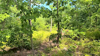
This is a resurrected trail redesigned by the trail designer who brought us The Gig and others. There is a gap jump in the beginning (with a easy B-line) with a fun chute after. Next up is a gnarly rock roller after a bit of a tech climb. Stay right at the roller to bypass it. Next up is a skinny rock roller, easy enough to do, but sketchy enough to make it fun. Not long after we have another fun chute and then climb back up to the top with some techie climbing sections. Another chute brings us to a 4' drop with a 8' rock roller. The fun isn't done, though, follow along the rock ridge, along the swamp, up to another rock ridge and out.

Local Trail Association
Traditionally Indigenous Territory

Recent Activity on Trail

Past Week
  • 13 rides
  • 13.0 km average
6 Months
  • 104 rides
  • 15.3 km avg distance
All
  • 2,384 rides
  • Last: Jun 25, 2026
c1c2c3c4
January
February
March
April
May
June
July
August
September
October
November
December
update trails status or condition

Challenger Trail Reports

Status:
on Apr 10, 2026
Ideal
Avg: 4.07 (8 votes)
Your vote: 0

view (5,183)
close
3D
Trail Conditions
  • Unknown
  • Snow Groomed
  • Snow Packed
  • Snow Covered
  • Snow Cover Partial
  • Freeze/thaw Cycle
  • Icy
  • Prevalent Mud
  • Wet
  • Variable
  • Ideal
  • Dry
  • Very Dry
Trail Flow (Ridden Direction)
Trailforks scans users ridelogs to determine the most popular direction each trail is ridden. A good flowing trail network will have most trails flowing in a single direction according to their intension.
The colour categories are based on what percentage of riders are riding a trail in its intended direction.
  • > 96%
  • > 90%
  • > 80%
  • > 70%
  • > 50%
  • < 50%
  • bi-directional trail
  • no data
Trail Last Ridden
Trailforks scans ridelogs to determine the last time a trail was ridden.
  • < 2 days
  • < 1 week
  • < 2 weeks
  • < 1 month
  • < 6 months
  • > 6 months
Trail Ridden Direction
The intended direction a trail should be ridden.
  • Downhill Only
  • Downhill Primary
  • Both Directions
  • Uphill Primary
  • Uphill Only
  • One Direction
Contribute Details
Colors indicate trail is missing specified detail.
  • Description
  • Photos
  • Description & Photos
  • Videos
Trail Popularity ?
Trailforks scans ridelogs to determine which trails are ridden the most in the last 9 months. Trails are compared with nearby trails in the same city region with a possible 25 colour shades. Think of this as a heatmap, more rides = more kinetic energy = warmer colors.
  • most popular
  • popular
  • less popular
  • not popular
ATV/ORV/OHV Filter
Max Vehicle Width
inches
US Cell Coverage
Legend
cell carrier legend

Radar Time
Activity Recordings
Trailforks uses anonymized public activity data. ?
Activity Recordings
Trailforks uses anonymized public activity data. ?
Personal Heatmap
Activity Types
all / none
Options
2
Date range month
Winter Trails
Warning A routing network for winter maps does not exist. Selecting trails using the winter trails layer has been disabled.
Missing Trails
Most Popular
Least Popular
Trails are colored based on popularity. The more popular a trail is, the more red. Less popular trails trend towards green.
Jump Magnitude Heatmap
Heatmap of where riders jump on trails. Zoom in to see individual jumps, click circles to view jump details.
BC Backroad Status

Service Road Atlas is a free to use, community-driven service for viewing and creating reports on the numerous back-country service roads around B.C. and Alberta.

map legend
Slope Aspect
Direction the slope faces
Flat N NE E SE S SW W NW
Trails Deemphasized
Trails are shown in grey.
disable
Only show trails with no bike usage.
Enable
Suggested Layers
Based on selected activity type

    Save the current map location and zoom level as your default home location whenever this page is loaded.

    Save
        Directions to challenger-258774 trailhead (42.183950, -71.501870)

        Photos

        20 more »
        92 |
        Mar 22, 2009 @ 6:42pm
        Mar 22, 2009
        113 |
        Mar 22, 2009 @ 6:42pm
        Mar 22, 2009
        130 |
        Mar 22, 2009 @ 6:42pm
        Mar 22, 2009
        162 |
        Mar 22, 2009 @ 6:43pm
        Mar 22, 2009

        Videos

        1 more »
        Crash for Friday fails
        0:06 | 1035 | Jul 31, 2020 , Milford

        Routes with this trail

        4.0 12 miles 1,225 ft 19 Loop
        Built this loop for YouTuber BKXC for his visit to Vietnam. Its all of my favorite trails smashed into one...
        13 miles 1,222 ft 36
        A draft of an "Advanced" tour of Vietnam that mixes in some old school and school trails across the whole...
        2 miles 163 ft 5 Point to Point
        The Nam Challenge for July spreads things out a bit and heads north. This challenge has more technical...

        9 Reviews & Comments


        We hope you've been enjoying Trailforks!

        Create a FREE account to view trail comments and much more.

        Frequently Asked Questions About Challenger

        Where is Challenger located?
        Challenger is located in Vietnam Trail Network, Milford, Massachusetts, United States. It is part of the Vietnam Trail Network trail network. The trailhead is located at coordinates 42.18395, -71.50187.
        How hard is Challenger?
        Challenger is rated as Black Diamond difficulty. The physical rating is Moderate. The average grade is 1.9%. The climb difficulty is rated Blue.
        What is the elevation gain for Challenger?
        Challenger has 21 m of elevation gain. The trail has 40 m of elevation descent. The elevation ranges from 100 m to 120 m.
        Is Challenger a point to point trail?
        Challenger is not a point to point trail. The direction is Downhill Primary. The trail type is singletrack.

        Hit the Trail

        Open in App

        Get this trail on your phone instantly.
        open trail in app

        Download Trail

        Save to wishlist, Garmin & download.
        save the trail

        Find Related Routes

        Find routes and users activities that include this trail.
        find routes for this trail

        You must enter a description before submitting.