more stats
5.5 miles
Distance
3,463 ft
Climb
-233 ft
Descent
01:41:40
Avg time
3,230 ft
Altitude change
1,519 ft
Altitude min
4,749 ft
Altitude max
1,519 ft
Altitude start
4,751 ft
Altitude end
11.1%
Grade
-30.2%
Grade max
50%
Grade min
5 miles
Distance climb
2,100 ft
Distance down
144 ft
Distance flat
01:41:40
Avg time

Cheekeye FSR Details

  • Activities
    • Mountain Bike
    • E-Bike
    • Hike
    • Dirtbike/Moto
    • Observed Trials
    • ATV/ORV/OHV
    • Snowmobile
    • Snowshoe
    • Backcountry Ski
  • Riding Area
    Brohm Ridge
    Squamish, British Columbia
  • Difficulty Rating
  • Local Popularity
    25 in Mountain Biking [+]
    • 35 in E-Biking
    • 40 in Hiking
    • 55 in Dirtbiking
    • 85 in ATVing/Offroading
    • 5 in Snowshoeing
    • 5 in Backcountry Skiing
    • 5 in Observed Trials
    • 5 in Snowmobiling
  • Hiking SAC Scale
    T2 Mountain Hiking
  • Trail Type
    Doubletrack
  • Bike Type
    Gravel
  • Direction
    Both Directions
    Popular Direction Shown
  • eBike Allowed
    Yes up to Class 1
  • OSM Way

Rarely discussed runnable gravel road which turns into easier to run trail past reaching the ridge(where two chalet buildings are located) till Brohme Peak(1948m), then gets more scambling type trail which ends at the glacier. Sounds like road portion of maintenance is done locally/privately by people living in Squamish. 2WD cars would be better off parking at the fork of Cat Lake road and Cheekeye FSR and start mtn bike or run or walk. Starting at elev. 340m and finishes at 2040m. Glacier contains numerous visible and likely invisible cracks and not navigatable(highly dangerous) for regular runners/hikers.

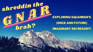
The view from the ridge is probably significantly superior to the other nearby trails like Elphin Lake trail, Whistler, Garibaldi etc. Yet due to the non park status, it is rarely visited and remain unknown so to speak despite easy access even started from the bottom(run generally should take less than 4hrs return trip).

Access Info

Same as Cat Lake: Turns off Sea To Sky Highway past Alice Lake Turn off towards Whistler. .1.3km after turn off there is a fork to go to Cat Lake or Brome Ridge. From here higher Clearance strong tire4WD

Traditionally Indigenous Territory

Recent Activity on Trail

Past Week
  • 0 rides
  •  
6 Months
  • 0 rides
  •  
All
  • 25 rides
  • Last: Apr 4, 2026
c1c2c3c4
January
February
March
April
May
June
July
August
September
October
November
December
update trails status or condition

Cheekeye FSR Trail Reports

statusdatedescription
Nov 1, 2025 @ 2:26pm (America/Vancouver)
Nov 1, 2025
Snow starts at 1250m
Oct 27, 2025 @ 9:05am (America/Vancouver)
Oct 27, 2025
Drove to 1200m yesterday where the snow depth was about 10cm. Skiing and sledding possible from that point
Feb 3, 2025 @ 7:49pm
Feb 3, 2025
reporter
Jul 8, 2023 @ 5:43pm
Jul 8, 2023
reporter
Oct 18, 2022 @ 6:41pm
Oct 18, 2022
curently freshly graded with heavy everyday trafic of logging trucks, which will not stop if sees you, so i suppose u need to use west fsr
more »
Status:
on Nov 1, 2025
Snow Covered
Avg: 2.79 (4 votes)
Your vote: 0

view (211)
close
3D
Trail Conditions
  • Unknown
  • Snow Groomed
  • Snow Packed
  • Snow Covered
  • Snow Cover Partial
  • Freeze/thaw Cycle
  • Icy
  • Prevalent Mud
  • Wet
  • Variable
  • Ideal
  • Dry
  • Very Dry
Trail Flow (Ridden Direction)
Trailforks scans users ridelogs to determine the most popular direction each trail is ridden. A good flowing trail network will have most trails flowing in a single direction according to their intension.
The colour categories are based on what percentage of riders are riding a trail in its intended direction.
  • > 96%
  • > 90%
  • > 80%
  • > 70%
  • > 50%
  • < 50%
  • bi-directional trail
  • no data
Trail Last Ridden
Trailforks scans ridelogs to determine the last time a trail was ridden.
  • < 2 days
  • < 1 week
  • < 2 weeks
  • < 1 month
  • < 6 months
  • > 6 months
Trail Ridden Direction
The intended direction a trail should be ridden.
  • Downhill Only
  • Downhill Primary
  • Both Directions
  • Uphill Primary
  • Uphill Only
  • One Direction
Contribute Details
Colors indicate trail is missing specified detail.
  • Description
  • Photos
  • Description & Photos
  • Videos
Trail Popularity ?
Trailforks scans ridelogs to determine which trails are ridden the most in the last 9 months. Trails are compared with nearby trails in the same city region with a possible 25 colour shades. Think of this as a heatmap, more rides = more kinetic energy = warmer colors.
  • most popular
  • popular
  • less popular
  • not popular
ATV/ORV/OHV Filter
Max Vehicle Width
inches
US Cell Coverage
Legend
cell carrier legend

Radar Time
Activity Recordings
Trailforks uses anonymized public activity data. ?
Activity Recordings
Trailforks uses anonymized public activity data. ?
Personal Heatmap
Activity Types
all / none
Options
2
Date range month
Winter Trails
Warning A routing network for winter maps does not exist. Selecting trails using the winter trails layer has been disabled.
Missing Trails
Most Popular
Least Popular
Trails are colored based on popularity. The more popular a trail is, the more red. Less popular trails trend towards green.
Jump Magnitude Heatmap
Heatmap of where riders jump on trails. Zoom in to see individual jumps, click circles to view jump details.
BC Backroad Status

Service Road Atlas is a free to use, community-driven service for viewing and creating reports on the numerous back-country service roads around B.C. and Alberta.

map legend
Slope Aspect
Direction the slope faces
Flat N NE E SE S SW W NW
Trails Deemphasized
Trails are shown in grey.
disable
Only show trails with no bike usage.
Enable
Suggested Layers
Based on selected activity type

    Save the current map location and zoom level as your default home location whenever this page is loaded.

    Save
        Directions to cheekeye-fsr trailhead (49.804160, -123.101840)

        Photos

        25 more »
        276 |
        Jun 13, 2021 @ 2:01pm
        Jun 13, 2021
        265 |
        Jun 13, 2021 @ 1:33pm
        Jun 13, 2021
        46 |
        Sep 21, 2025 @ 4:54pm
        Sep 21, 2025
        106 |
        Aug 27, 2022 @ 4:43pm
        Aug 27, 2022

        Videos

        1 more »
        Exploring Cheekeye FSR - Squamish Territory -...
        58:21 | 721 | Sep 6, 2022 , Squamish

        Routes with this trail

        63 miles 13,694 ft 24 Out & Back Race
        The Squamish Traverse is an out-and-back race taking place on August 17th, 2024. Part XC marathon, part...

        1 Review & Comments


        We hope you've been enjoying Trailforks!

        Create a FREE account to view trail comments and much more.

        Nearby Trails

        • By canadakaTF Pro Trailforks & contributors
        • #329616 - 3,468 views
        This trails GPS track was originally sourced from OpenStreetMap and will always be available for download in OSM Format.

        Frequently Asked Questions About Cheekeye FSR

        Where is Cheekeye FSR located?
        Cheekeye FSR is located in Brohm Ridge, Squamish, British Columbia, Canada. It is part of the Brohm Ridge trail network. The trailhead is located at coordinates 49.80416, -123.10184.
        What is the elevation gain for Cheekeye FSR?
        Cheekeye FSR has 3,463 ft of elevation gain. The trail has 233 ft of elevation descent. The elevation ranges from 1,519 ft to 4,749 ft.
        Is Cheekeye FSR a point to point trail?
        Cheekeye FSR is not a point to point trail. The direction is Both Directions. The trail type is doubletrack.
        How long is Cheekeye FSR?
        Cheekeye FSR is 5.5 miles long. The trail type is doubletrack.

        Hit the Trail

        Open in App

        Get this trail on your phone instantly.
        open trail in app

        Download Trail

        Save to wishlist, Garmin & download.
        save the trail

        Find Related Routes

        Find routes and users activities that include this trail.
        find routes for this trail

        You must enter a description before submitting.