more stats
3,668 ft
Distance
20 ft
Climb
-208 ft
Descent
00:08:15
Avg time
-189 ft
Altitude change
1,174 ft
Altitude min
1,382 ft
Altitude max
1,363 ft
Altitude start
1,175 ft
Altitude end
-5.1%
Grade
-37.2%
Grade max
7.3%
Grade min
456 ft
Distance climb
2,431 ft
Distance down
781 ft
Distance flat
00:08:15
Avg time

Cobra Details

  • Activities
    • Mountain Bike
    • E-Bike
  • Riding Area
  • Difficulty Rating
  • Local Popularity
    40 in Mountain Biking [+]
    • 50 in E-Biking
  • Global Ranking
    #93234 in Mountain Biking [+]
    • #80181 in E-Biking
  • Trail Type
    Singletrack
  • Bike Type
    AM
  • Direction
    Downhill Only
    Popular Direction Shown
  • Physical Rating
    Hard
  • Trail Visibility
    Always easy to follow
  • Season
    All
  • eBike Allowed
    Yes up to Class 1
  • TTFs on Trail
    Berm, Drop, Rock Garden
  • Ride in Rain
    Yes
  • Land Owner
    South African National Parks

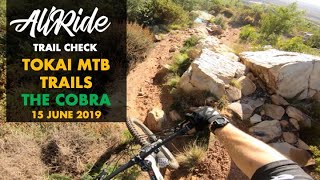
Cobra: The Black Diamond Snake Trail Cobra is by far the most technical of the Snake Trails. Don’t be fooled by the first 150m of flat ex-jeep track after the trail sign, the trail proper is a different animal. You will see the entrance to the descent on your right as you arrive at a small clearing.
Dropping in you are immediately faced with a tricky roll in, and shortly after an awkward short rocky section. A brief moment of respite and then two more rocky rollovers take you into the steepest part of the trail. This has several pedal grabbing projecting rocks to negotiate before you arrive at the first tight left hand switchback. Your speed will increase on the smoother section of trail after this but watch out for a series of rocks as you approach the second switchback, to the right. This is a tight and tricky corner built up with rocks, so watch your braking and let the bike roll. After this the track gets even more interesting with a series of corners and rocky rolls/drop offs. There is an option to roll a boulder section to a drop or stick right and avoid it before the sandy rocks of the last 50m arrive. A loose and rock strewn right-hander leads to an optional rock step down and shortly thereafter the jeep track and the Mamba trailhead. Bring your trail/enduro bike for maximum safety and satisfaction.

TokaiMTB recommends riders attend skills training and use dropper seat posts to maximize the fun and safety.

Access Info

From the Level 4 Jeep Track, head past the DH1 entrance and take the Level 4 to 5 Interconnector Jeep Track which climbs easily via two switchback corners. As you reach level ground take a sharp right up a short steep Jeep Track climb to traverse past the DH0 Trailhead on your right. Several hundred meters further along a smooth track that is slowly turning from Jeep to singletrack. You will see the "Cobra" sign on your left as you proceed and 150 meters further, a clearing where the trail proper starts.

Disclaimer

A TMNP Level 3 Activity Permit is required to enter Tokai. Please consider joining TokaiMTB for R400.00 per annum. We build and manage the trails in Tokai you love to ride.

Trail Supporters
Local Trail Association

Recent Activity on Trail

Past Week
  • 0 rides
  •  
6 Months
  • 25 rides
  • 12 miles avg distance
All
  • 178 rides
  • Last: Jun 13, 2026
c1c2c3c4
January
February
March
April
May
June
July
August
September
October
November
December
update trails status or condition

Cobra Trail Reports

Status:
on Nov 14, 2025
Very Dry
Avg: 4.39 (4 votes)
Your vote: 0

view (2,537)
close
3D
Trail Conditions
  • Unknown
  • Snow Groomed
  • Snow Packed
  • Snow Covered
  • Snow Cover Partial
  • Freeze/thaw Cycle
  • Icy
  • Prevalent Mud
  • Wet
  • Variable
  • Ideal
  • Dry
  • Very Dry
Trail Flow (Ridden Direction)
Trailforks scans users ridelogs to determine the most popular direction each trail is ridden. A good flowing trail network will have most trails flowing in a single direction according to their intension.
The colour categories are based on what percentage of riders are riding a trail in its intended direction.
  • > 96%
  • > 90%
  • > 80%
  • > 70%
  • > 50%
  • < 50%
  • bi-directional trail
  • no data
Trail Last Ridden
Trailforks scans ridelogs to determine the last time a trail was ridden.
  • < 2 days
  • < 1 week
  • < 2 weeks
  • < 1 month
  • < 6 months
  • > 6 months
Trail Ridden Direction
The intended direction a trail should be ridden.
  • Downhill Only
  • Downhill Primary
  • Both Directions
  • Uphill Primary
  • Uphill Only
  • One Direction
Contribute Details
Colors indicate trail is missing specified detail.
  • Description
  • Photos
  • Description & Photos
  • Videos
Trail Popularity ?
Trailforks scans ridelogs to determine which trails are ridden the most in the last 9 months. Trails are compared with nearby trails in the same city region with a possible 25 colour shades. Think of this as a heatmap, more rides = more kinetic energy = warmer colors.
  • most popular
  • popular
  • less popular
  • not popular
ATV/ORV/OHV Filter
Max Vehicle Width
inches
US Cell Coverage
Legend
cell carrier legend

Radar Time
Activity Recordings
Trailforks uses anonymized public activity data. ?
Activity Recordings
Trailforks uses anonymized public activity data. ?
Personal Heatmap
Activity Types
all / none
Options
2
Date range month
Winter Trails
Warning A routing network for winter maps does not exist. Selecting trails using the winter trails layer has been disabled.
Missing Trails
Most Popular
Least Popular
Trails are colored based on popularity. The more popular a trail is, the more red. Less popular trails trend towards green.
Jump Magnitude Heatmap
Heatmap of where riders jump on trails. Zoom in to see individual jumps, click circles to view jump details.
BC Backroad Status

Service Road Atlas is a free to use, community-driven service for viewing and creating reports on the numerous back-country service roads around B.C. and Alberta.

map legend
Slope Aspect
Direction the slope faces
Flat N NE E SE S SW W NW
Trails Deemphasized
Trails are shown in grey.
disable
Only show trails with no bike usage.
Enable
Suggested Layers
Based on selected activity type

    Save the current map location and zoom level as your default home location whenever this page is loaded.

    Save
        Directions to cobra trailhead (-34.046780, 18.396100)

        Photos

        No photos have been added for Cobra yet, add a photo.

        Videos

        1 more »
        TRAIL CHECK // THE COBRA // TOKAI MTB TRAILS...
        4:39 | 553 | Dec 26, 2019 , Tokai

        Routes with this trail

        8 miles 1,970 ft 15
        Route for me and James, we aren't that fit though
        1.0 11 miles 2,807 ft 25 Out & Back
        1st Loop - Cobra, Mamba, Boomslang, Snake Eyes and Rinkhals 2nd Loop - DU0 to DH4 then finish off with 'My...

        Reviews / Comments

        No reviews yet, be the first to write a review or ask a question.
        Use trail reports to comment on trail conditions.


        We hope you've been enjoying Trailforks!

        Create a FREE account to view trail comments and much more.

        • By headshotTF Pro TokaiMTB & contributors
        • #37976 - 2,784 views

        Frequently Asked Questions About Cobra

        Where is Cobra located?
        Cobra is located in Tokai Forest MTB Trails, Tokai, South Africa. It is part of the Tokai Forest MTB Trails trail network. The trailhead is located at coordinates -34.04678, 18.3961.
        How hard is Cobra?
        Cobra is rated as Black Diamond difficulty. The physical rating is Hard. The average grade is 5.1%.
        What is the elevation gain for Cobra?
        Cobra has 20 ft of elevation gain. The trail has 208 ft of elevation descent. The elevation ranges from 1,174 ft to 1,382 ft.
        Is Cobra a point to point trail?
        Yes, Cobra is a point to point trail. The direction is Downhill Only. The trail type is singletrack.

        Hit the Trail

        Open in App

        Get this trail on your phone instantly.
        open trail in app

        Download Trail

        Save to wishlist, Garmin & download.
        save the trail

        Find Related Routes

        Find routes and users activities that include this trail.
        find routes for this trail

        You must enter a description before submitting.