


Open in App
Get this trail on your phone instantly.

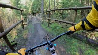
The Cold Creek trail is a section of the greater Tarbell Trail. Cold Creek has a sampling of several types of terrain ranging from carefully crafted berms and rollers to raw rooty and rocky sections. Roughly 5 1/2 miles from top to bottom, it offers some of the most enjoyable and flowy single track in the area. A favorite ride for many in this region.
The Tarbell Trail was named for George Lee Tarbell, who, in the early 1900s, lived alone in a shack accessible only by a path that roughly follows the present day trail. Tarbell surely enjoyed some beautiful views along his trail, of Sturgeon Rock (3,100 feet elevation), Pyramid Rock (3,503 feet), Larch Mountain (3,496 feet), and Silver Star Mountain (4.390 feet). Views stretch from the surrounding valleys to the high Cascades. The Tarbell Trail, like the Three Corner Rock Trail to the east, is among the best Department of Natural Resources (DNR) riding in the state. The trail is mostly hard pack with some rocky and uneven sections. It climbs and descends through second-growth forest with some scattered old growth Douglas fir. It also sports the above-mentioned views, as well as scenic Hidden Falls, to entertain the eyes while exercising the legs and lungs. Some of the best state forest riding in Washington;
http://www.coldcreekmountainbikers.org/maps/
| c1 | c2 | c3 | c4 |
|---|---|---|---|
January | February | March | April |
May | June | July | August |
September | October | November | December |

Service Road Atlas is a free to use, community-driven service for viewing and creating reports on the numerous back-country service roads around B.C. and Alberta.
Save the current map location and zoom level as your default home location whenever this page is loaded.
SaveWe hope you've been enjoying Trailforks!
Create a FREE account to view trail comments and much more.
You must enter a description before submitting.

